The Many Hats of an Archaeologist

An archaeologist working in cultural resource management in British Columbia has to wear a lot of hats (and no, I’m not referring to the stereotypical Indiana Jones hat). It can be exciting to learn many skills, and it allows for considerable variety in day-to-day tasks.

Some of the hats we wear (and we don’t proclaim excellence or expertise in these fields):

The hat of a labourer. In order to find out what is under the ground, archaeologists must dig shovel tests, or excavate evaluative units. Shovel tests are less precise, and often measure 35 cm by 35 cm to depths of between 50 cm to 70 cm, which can be a laborious task. The soil removed must also be screened to find artifacts. Evaluative units may be excavated slowly with a trowel, centimeter by centimeter, or a bit faster while shovel shaving, 5 cm to 10 cm at a time, which combines labour and precision.

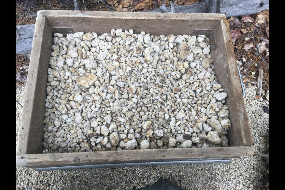
The hat of a geologist. Archaeologists have to describe the stratigraphy in subsurface tests and evaluative units to try and determine what geological layers are present. This can tell an archaeologist what type of soil artifacts come from, and where to possibly expect them in the surrounding area. Layers of soils and rocks may give a timeframe of the when the layer was created, such as glacial till from the glaciers melting or a layer of volcanic ash from a well-known volcanic eruption (see photo 1).

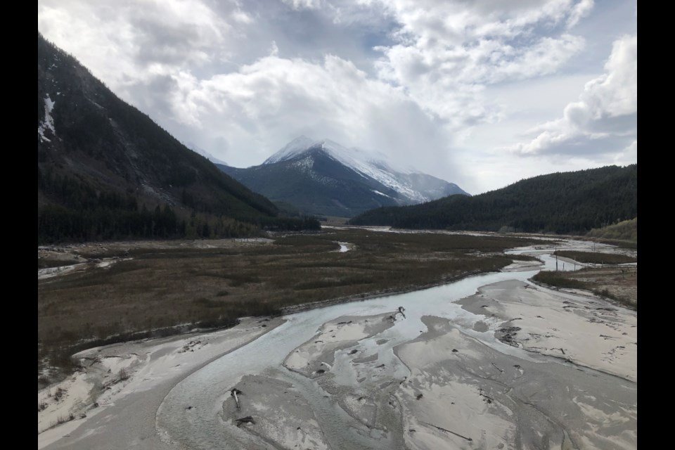
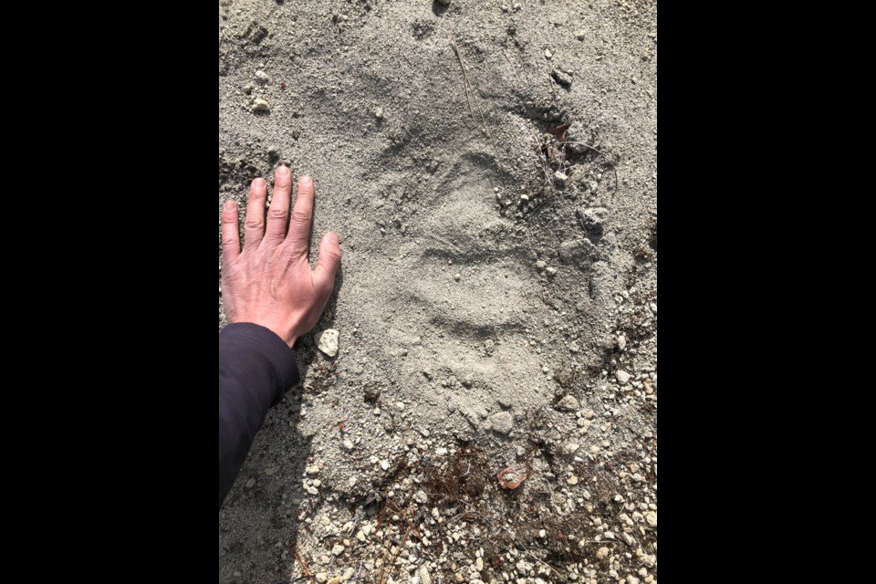
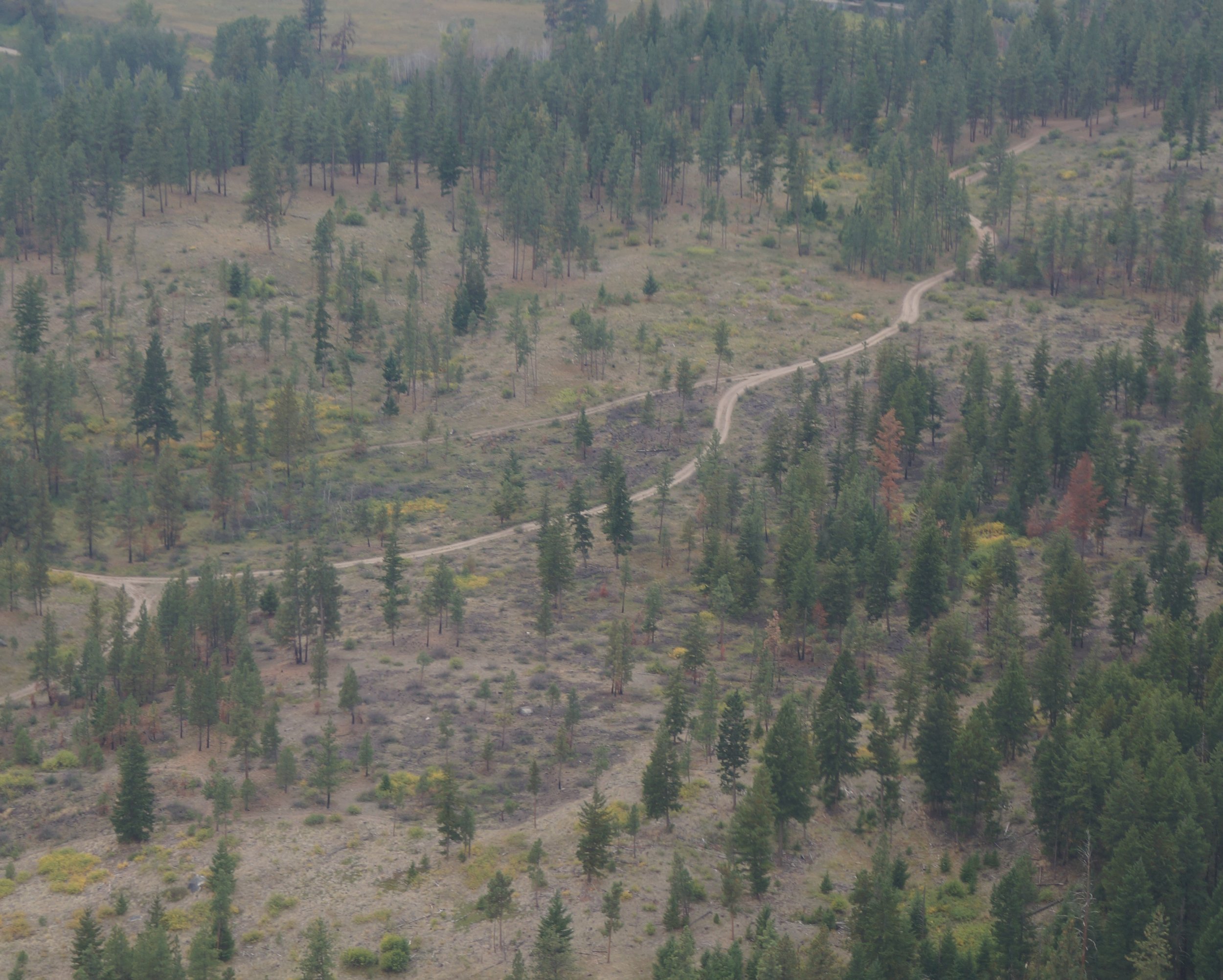
The hat of a cartographer. An archaeologist may need to read a map to find out where they will be working. Although GPS units and other digital navigation alternatives make locating work areas and previously recorded sites easy, it is still important for an archaeologist to know how to read a physical map. This can help identify areas on the landscape with a higher probability for archaeological sites, such as locations near water sources. Archaeologists must also draw maps while in the field, of places where they have completed shovel testing, as well as site maps, when archaeological material is encountered. They use a compass and measuring chain to illustrate a scaled down map, which includes shovel tests, evaluative units, trees, boulders, landform features, water sources, and a number of other helpful identifiers (see photo 2). The maps must also be legible for other archaeologists to read and decipher.

The hat of a leader. An archaeology crew can include anywhere from a couple to a dozen or more individuals. The field director or field supervisor is in charge of the safety and coordination of the crew. They must plan routes to and from the site, communicate with project managers or clients, ensure a safe work environment for all crew members, and track productivity to stay on target with timelines. They must also listen to input from the rest of the crew, and uphold the standards expected of professional archaeologists in BC.

There are many more hats an archaeologist can wear in the span of their career, and each individual has their own assortment of skills. Cultural resource management can allow for changing work areas, a variety of tasks, new crew members, and never-ending learning experiences. People are always discovering new things, and our understanding of history is likely to continue to evolve. That takes many hats, and I’m always looking forward to finding out which one I will wear next!


Narrative Conflict in Archaeology

Archaeologists love nothing more than a good story. After all, in the end, we are just storytellers trying to base our narratives on evidence. The following are two competing tales about our ancestors:


Once upon a time, ignorant primitive hunter-gatherers huddled in the shadows of the towering walls of ice covering the world. Unbeknownst to them, a technologically advanced civilization thrived to the south, a civilization with buildings, ships, writing, and technological achievements surpassing what we have today. Approximately twelve thousand years ago, a mighty catastrophe obliterated this civilization leaving no trace. The few stunned survivors left their shattered home and scattered to the four corners of the world. They brought the light of civilization to the primitive peoples they encountered, teaching them agriculture, writing, metallurgy, and monumental architecture.


Once upon a time, small scale hunter-gatherer societies lived in groups across the world in a wide variety of environments. They were superbly adapted to their varied surroundings, each with unique languages, tools, clothing, and cultural practices. Approximately twelve thousand years ago, their world began to change as the climate warmed and the ice retreated. Populations shifted and grew, and new technologies and lifeways developed in response. Agriculture, metallurgy, writing, and monumental architecture developed in different ways, at different times and different places across the world, as people continued to adapt to their changing circumstances.


One of these stories diminishes the intelligence and abilities of our ancestors through vague hunches, baseless assumptions, idle musings, and selective cherry-picking of evidence. The other story is perhaps less glamorous but references a staggeringly large body of evidence including DNA, linguistics, geology, paleoenvironmental research, traditional knowledge, and archaeology. All of these lines of evidence mutually support each other and help us create robust narratives of our collective prehistory.


The problem comes when we watch TV shows presenting these views. How do we sift through and judge their merits when we are not a specialist in the field? Even without specialist knowledge, one can still make an educated guess about the quality of a TV show based on the presence of the following red flags.


I always become a bit suspicious when a show seems to be more about the journey of the narrator and less about digging into the details supporting their thesis. Unfortunately, some legitimate archeology shows fall into this trap as well. When I start seeing lots of footage of the narrator driving in exotic places in a 4x4 with a soaring soundtrack of stirring music, backed up with very little discussion about the details of how the evidence is gathered and analyzed, I start to wonder how much fluff is being used to pad out the show.


Are the innovations and achievements of our ancestors diminished? This is one of the most insidious mindsets and is one that was also widespread in past archaeological thinking as well, until it began to conflict with the growing body of evidence. For instance, it is natural for some to look at a big structure like a pyramid and wonder how our ancestors could have ever created it without modern technology. This unimaginative thinking starts with the premise that they were not sufficiently advanced to be able to innovate on their own and must have learned anything of significance from another, more advanced source.


Does presenter use small gaps in our current understanding as proof to support their competing theory? There are many gaps in our theories of how our ancestors lived and over time, research is conducted, and those gaps tend to be filled in. Just because one narrative cannot explain absolutely everything does not automatically mean that the competing argument is true, especially when that story selectively ignores the mass of collected evidence.


How does the presenter handle opposing ideas? Are they linked to specific theories, researchers, and articles, or are they characterized in vague ways? Providing specific information makes it easier for a non-specialist to search for and find out things for themselves. Conversely, vague conspiratorial statements like “mainstream archaeologists don’t want you to know…” are much harder for a non-specialist to fact check. It is extremely difficult to track down Professor Mainstream Archaeology to inquire about her theories! Anyone who knows archaeologists would find the idea of a worldwide cabal of archaeologists conspiring to suppress information laughable. As a group we cannot even agree on what constitutes a good beer, let alone cooperate sufficiently to conceal and suppress competing theories.


Where is the evidence? Is the show attempting to present a narrative based on the sum of known evidence, or is it ignoring the inconvenient data and selectively picking only the information that supports the story? Often the cited evidence was not carefully collected and does not stand up to even a brief examination. As an archaeologist, I expect that if someone is pushing a narrative and citing archaeological data to support it, then that information will have been collected with the same care and standards that I am required to adhere to.


In the end, archaeologists love nothing more than a great story, and I would be enthralled to find out that Atlantis was a real place where seafaring travellers came from, spreading the light of civilization across the globe. Unfortunately, as an archaeologist, I am burdened with the inconvenient idea that our narratives must be linked to the sum of the evidence. Alas, no amount of wishing can make it otherwise.

The dog days of pre-contact BC

Many years ago, early in my (Matt Begg’s) career as a professional archaeologist, I was sitting around a campfire with a couple of colleagues, one of whom was an accomplished faunal analyst (someone who analyzes bones, or fragments of bones, found at archaeological sites).

I asked my colleague about dogs, specifically, what did the average village dog in the Southern Interior of British Columbia look like?

He pointed at my medium-sized, mixed-breed brown/black/tan/white dog and said, “Probably a lot like him.”

Many of us have heard about some of the specialized dog breeds in pre-contact B.C., such as the Salish hair dog, but we don’t hear much about the average, run-of-the-mill village dog that was living alongside, or with, the pre-contact inhabitants of our region.

I’ve always had somewhat mixed-breed dogs — the good-to-a-free home or sprung-out-of-the-pound variety. They’ve always been medium-sized and somewhere between one breed or another.

Is this what the village dog looked like? Were they anything like the Sadies, Fidos and Bellas we know and love today?

Domestic dogs have been identified in archaeological sites around the world. Research looking at dog remains excavated from pithouse village sites along the middle Fraser River, near Lillooet, indicates their presence alongside people during the last 2,000 years at least, though we can assume for much, much longer.

At the Keatley Creek site, for example, the remains of at least 15 domestic dogs were uncovered during academic investigations (Crellin and Heffner 2000:162).

In a recent publication, the function of dogs in mid-Fraser village sites are hypothesized under four categories: hunting aids, sources of labour, indicators of wealth or free roaming.

The archaeological evidence is compared to ethnographic descriptions and some broad conclusions can be made.

Free-roaming village dogs were likely ubiquitous in pre-contact villages, serving as refuse cleaners (think of any food you drop on the floor or disposal of waste products), warnings of nearby dangers (I have a dog that warns me about approaching snowplows) and, likely, as companions.

Ethnographies in the middle Fraser describe dogs as forms of wealth, providing dog hide clothing, dog skin quivers and sources of meat. The use of dogs as labourers is not well documented in the archaeological record, but at least one set of dog remains found at the Keatley Creek village site suggests it may have served to pack goods, such as hauling fish up from the river (Prentiss et al. 2021, Crellin and Heffner 2000).

Although there is still some uncertainty surrounding what those free-roaming village dogs would have looked like, the excavated remains of Canis familiaris in middle Fraser village sites show a distinction between domesticated village dogs and wild canines (wolves and coyotes).

Notably, village dogs are described as being smaller than wolves, but more robust than coyotes, with shorter muzzles than their wild relatives.

We can’t know for sure what these dogs looked like, but we suspect their genes continue to be passed down through modern dogs.

Whenever I’m at a dog park, I overhear conversations about dog breeds — the particular modern breeds that fit into narrow categories or suggestions about the various breeds that went into creating the mutts to which I am drawn.

Whenever I watch my dog clean up after a campfire or warn me about nearby wild animals (or snowplows), I wonder if she might be, at least partially, a descendent of the village dogs of the past.

Alysha Edwards is a St’at’imc archaeologist currently at graduate school at the University of Montana and Matt Begg is a Kamloops-based archaeologist. Interested in more? Go online to republicofarchaeology.ca.

To dig or not to dig

Field archaeology is often synonymous with digging, with the common public perception of archaeologists painstakingly exposing buried artifacts in the ground with brushes and picks.

Although a large part of an archaeologist’s work, especially in the southern interior of B.C., consists of various digging activities (shovel testing, hand excavation and sifting sediments), this is not universally the case on every project.

There are many circumstances in which archaeologists try to avoid or limit digging in the ground to search for buried artifacts while still completing the necessary work.

This is because the act of digging in the ground is such a destructive endeavour in itself.

Digging through buried archaeological deposits irreparably impacts, and essentially destroys, archaeological sites.

The act of excavating through an archaeological site is most commonly undertaken in concert with development activities that are slated to disturb the ground surface, such as highway construction, pipeline installation or other infrastructure projects.

In these cases, the proposed development will disturb a specific area of ground and archaeologists assess (usually through digging) whether the development activities will impact buried archaeological sites.

If an archaeological site is planned to be destroyed or irreversibly altered by the impending development, then the site is excavated in advance by archaeology crews to gather as much data as possible about the site’s occupants before the opportunity is lost forever.

There is a rich and deep history of sites dating to 11,000 years or older in this area, with much more to learn about how people were living millennia ago.

On the other hand, if proposed developments are only in the early planning stages, then archaeology crews take the path of least destruction while looking for ancient sites.

This usually involves systematic pedestrian surveys through proposed project areas, with crews searching for evidence of archaeological sites visible on the ground surface.

Many archaeological sites can be identified through this technique, such as scatters of stone artifacts on the ground, the remains of pithouses, hunting blinds, trails or culturally modified trees.

The preference is always to observe and record, then leave the archaeological site in place.

Artifacts are always left where they are found unless under threat of development.

In 2022, I was involved in a research project in Secwepemcúlecw (Secwépemc lands).

With no imminent development guiding the field work, we were able to instead select survey areas based on terrain features on the landscape in order to gain a more regional perspective of land use.

We identified more than a dozen new archaeological sites through surface observation only — with no digging needed.

These sites consisted of lengthy trail corridors and stone tool artifact scatters identified in remote, high-elevation environments. In these instances, we would document the site, record the location and types of artifacts present, take photographs and leave the site undisturbed.

These archaeological sites are thousands of years old and unnecessary collection of artifacts or unnecessary digging through the site sediments to search for additional artifacts would only destroy this non-renewable resource.

When in doubt, the default recommendation for archaeologists and the general public alike is to always leave an archaeological site where it is found.

Phoebe Murphy is a Kamloops-based archeologist. Interested in more? Go online to republicofarchaeology.ca.

Indigenous-created winter gear

As I’m sure many a Kamloopsian did, I enjoyed several days up at Sun Peaks over the holiday break, taking advantage of the “warmer” weather and good cross country ski conditions.  I also bought some new gear, partly based on friend’s recommendations as well as some general observations about what other people on the hill were wearing. 

It got me thinking about the origins of some of this gear. Dig It readers might be surprised to know much of the winter snow gear we use, and a few of the activities we take part in, are owed to Indigenous Arctic peoples’ adaptation to their environment.

A good friend has been eyeing a new pair of snow-glasses for a week or so at a local ski gear shop, coveting their fancy technical lenses and stylish frames.  They are indeed lovely, and while a bit of a technological leap from the first snow goggles used by Indigenous people for hundreds of years, they fulfill an identical role. The earliest technological solution was a pair of goggles created from a thin (1-2”) strip of a natural material with two small slits cut horizontally over the eyes.  These ‘natural materials’ generally consisted of wood, bone, antler, leather, or whale baleen, among other things. 

According to researchers at Parks Canada, these snow goggles have been in use for at least 800 years and were utilized to protect the wearer from both snow blindness as well as the prolonged UV rays that can be especially harmful during the long days of Arctic summer sunshine.

We also crossed paths with many an outdoor enthusiast getting in their exercise on a pair of snowshoes. Metal and plastic have replaced wood and rawhide, but modern snowshoes often still reflect the size and shape of the original design, created to spread out the user’s weight and facilitate travel across deep snow.  Snowshoes have a millennia-long history and have long been used in Europe and central Asia, with the practice brought into the Canadian Arctic by Inuit peoples.  The oldest known pair of snowshoes dates to almost 6000 years ago, and were found in the Italian alps in 2003, now housed in the South Tyrol Museum of Archaeology in Italy.

While the oldest snowshoes may have originated in Europe, most snowshoe designs seen today have come from Indigenous peoples living in the Great Lakes area in eastern Canada.  Likely the most familiar style is the Ojibwa (Cree) style, with pointed toes and long tails, but several other styles have also arisen, including Alaskan, Beavertail, and Bear Paw, all adapted for terrain and snow conditions.

Some ski hill users chose to have a less ‘exercisey’ day for themselves, and instead took advantage of comfortable sleds and let the dogs do the work; dogsled teams are a regular sighting at the hill. Modern dog sledding is generally associated with tourism, sport, or competition, such as the Iditarod, but its origins lie in the Arctic with Indigenous use of dogs for transporting people and supplies or hunting.  There is poor agreement in the literature as to when and where this practice started, but it most likely started in northern North America and spread to Siberia, or vice versa, 2000+ years ago. 

The first dog sled teams had fewer dogs than we generally see now, and one or two dogs were originally used to pull small sleds while the ‘musher’ (a word with French origins and based on an English interpretation) often broke trail with snowshoes. As dogs were selectively bred for specific traits, the larger packs we see now were utilized for pulling larger loads and/or multiple people. As with snowshoes, there are regional variations in style and size of sleds, also adapted to the local environment and conditions.

So, as we take part in our beloved traditional Canadian winter activities, we can tip our toques to Indigenous peoples for the invention and perfecting of much of the gear we use.


Timeless cooking: Soup season on the Interior Plateau

It’s soup season in the interior! As winter grinds on and we hunker down inside, many of us will step up our consumption of nourishing, communal and comforting meals of soups and stews. This week’s column salutes the warm, timeless and so-very-human tradition of broth with an archaeological tour of this culinary staple.

Soup, when you think about it, is a game-changing invention for humanity: water-based meals allow for the cooking of otherwise undigestible raw foods like grains, the extraction of essential calories, minerals and nutrients from bones, and the varied use of dried meats, fish, and plants. They provide easy nourishment to the very young and very old, and to sick and disabled people who otherwise have difficulty with solid foods. And they’re comfort in a bowl (or an animal skin).

As much as a spit-roasted animal is a quintessential image of early human cuisine, it’s very likely that soup is as old as cooking itself. While discarded animal bones, shells, seeds, and other chunky dietary remains are easy to identify in the archaeological record, evidence for compound foods is comparatively rare. This is both because fragmentary organics preserve poorly over time, and because identifying complex mixes and preparations is a real challenge for the science of food residue analysis, which rely on trace elements left behind on cooking pots, implements, or features such as ovens and hearths.

Archaeological signatures of soup- and stew-making often come from what we call “indirect evidence”—clues left in archaeological sites that suggest behaviours or products we can no longer see.  These include boiling stones, and the fire-cracked rock that is left of them, greasy pit features, chemically-transformed foods (grains), food packaging (barks), and ceramic or metal cooking vessels.

Boiling bones to create a nutritious broth was very likely the first widespread approach to soup. Archaeologists have inferred broth-making from stone-age site assemblages in which the ends of long bones were notably missing—the parts containing abundant collagen, an important source of protein in pre-industrial diets.

The first soups were made long before metal or clay cooking pots. Immersion heating using “boiling stones” heated in fires then deposited in water have been used for cooking worldwide. These stones can be dropped in water-tight baskets or vessels made of wood, gourd, or gut to boil or steam foods. Before this even, skin-lined pits dug in the ground made serviceable containers, into which food and hot rocks were dropped. Intriguingly, archaeologists and survivalists have found that materials considered too flammable for direct heat, like bark, animal skin, and even plastic can be used to boil water over open flame without disintegrating.

Archaeologists infer that “wet-cooking” using boiling water was used by humans during the Middle Paleolithic, an enormous span of time from 300,000 to 30,000 years ago. Evidence from Belgium and Iraq suggest that boiling stones were likely used by Neanderthals to cook grains 36,000 years ago.

Soup likely became more serious eats once vessels that could more reliably resist high temperatures and moisture were developed, and which allowed for preparation of greater volumes of food. Fragments of clay pots found at Xianren Cave in China dating to around 20,000 years ago are believed to be among the oldest known ceramic cooking vessels, which became more widespread after about 10,000 years ago. Another Chinese site in the ancient capital of Xian revealed a 2,400 year-old lidded bronze cooking vessel, which was found sealed—with soup still inside!

Vessels like these also allow archaeologists to identify carbonized remains, and protein and lipid residue analyses can extract and identify chemical signatures of the specific plants and animals cooked. From a single clay vessel found in Southern Ontario, scientists found traces of a 1,300 year-old stew made of pickerel, bass, sturgeon, deer, and seasoned with walnuts and purslane.

Here on the Interior Plateau, soups and stews have long been an Indigenous dietary staple, where dehydration was a primary method of processing foods for storage. Dried meats, fish, and berries stored in cache pits bring flavour, variety, and nutrition to mid-winter diets. Roots, bulbs and tubers that were roasted, dried, and ground in season were added to thicken soups and provide valuable carbohydrates and vitamins.

Making and sharing soups is part of the continuity of human experience. Since time out of mind, families have gathered around hearths and ovens, pits and pots, to prepare and enjoy the liquid nourishment of this communal meal. From bone broth to hearty stews, from special occasion treats to whatever’s-in-the-cellar specials, soup has always sustained us. Here’s to good food made with love.

Microblade was a prehistoric toolbox

There are many different ways to turn a rock into a useable tool. The most commonly recognized rock tool, referred to as a lithic tool, is an arrowhead style projectile point. This lithic technology can take a considerable amount of effort, and a large rock, to create. There are many lithic tools made for quick use, which involve much less preparation, time, and effort. These are referred to as expedient tools, and one of these tools is the microblade.

In Photo 1, you can see the largest artifact in the top left - this is a microblade core. The remaining 13 artifacts are different sizes of microblades – some broken and some whole. Microblades are removed from the microblade core with a length at least 2.5 times longer than they are wide. They have parallel edges, and on one side you can see the places where previous microblades or flakes were removed, called scars. The cores exhibit long, narrow microblade scars and often are shaped like a cone. Photo 2 gives a good visual of the 4 sides of a microblade, as well as the typical ‘cone-shape’ of a microblade core.

According to research, microblades were first used in northeast Asia. The technology was brought over to North America by way of Beringia, the Bering land straight, to modern day Alaska. Dating back to 11,600 BP, evidence from Swan Point, Alaska indicates some of the first people to enter North America brough the microblade technology with them. This hypothesis is based on similarities in the methods that the microblade core is made into the individual microblades, called ‘core reduction strategy.’

After making its way into the northern end of North America, the microblade lithic technology continued to expand to the south, where it has been observed in a wide time span of archaeological contexts, covering the entire prehistoric period in British Columbia. These observations are made when microblades are found with materials or technologies which can be connected to a specific range of years.

One study looked at a number of microblade sites and their locations, and it was noted that microblades were more frequently found in higher concentrations in temporary, upland campsites. This led to their conclusion that microblade technology made for a toolkit that was flexible, versatile, and easy to adapt while moving frequently with unpredictable tool needs. It was also transportable, and much lighter than the larger rocks required to make bigger tools or arrowheads.

A looming question on microblades that could still use more research is what they were used for. A number of theories currently exist, and the ones shared here are by no means an exhaustive list. Microblades have been found as hafted tools, meaning they were attached to a handle made of antler, bone, or wood. At a site in Washington State where a collection of hafted microblades were recovered, both side hafted and end hafted knives were identified (Photo 3). This means that the blade was attached to the end of a handle, making it more of an engraving style tool, as well as to the side of a handle, making it into a cutting style tool.

Microblades have many attributes which make them useful in a variety of tasks. They have been observed all over British Columbia, including around the Kamloops area, and continue to be discovered as archaeological excavations continue. I was involved in an excavation this fall within an hour’s drive of Kamloops, where the crews found X3 of microblades.  Analysis is currently underway, and we are excited to see how they fit into the archaeological record, and how they compare to what is already known about this fascinating technology.

Reconciliation in a time of transformation

On Sept. 30, people wore orange shirts to honour survivors, individuals, family and community members who have endured the intergenerational impacts of residential schools.

For some, this is a time to learn about First Nations culture and listen to survivors talk about truth and reconciliation. In archaeology, one aspect of reconciliation that needs to be addressed is the Heritage Conservation Act (HCA).

The HCA is provincial legislation intended to encourage the protection and conservation of cultural heritage in British Columbia.

Currently, there are more than 60,000 protected heritage sites in the provincial registry. More than 90 per cent of these sites are of First Nations origin. For several years, there have been formal and informal discussions with First Nations, heritage professionals and academics about the effectiveness of the HCA. These discussions may soon result in changes to the HCA through the collaborative work being completed under the Heritage Conservation Act Transformation Project.

The HCA Transformation Project has been launched to reform the HCA and ensure provincial heritage legislation is consistent with the United Nations Declaration on the Rights of Indigenous Peoples (UNDRIP).

In 2021, the federal UNDRIP Act was announced. It “provides a road map for the Government of Canada and Indigenous peoples to work together to implement the Declaration based on lasting reconciliation, healing and cooperative relations”.

On a provincial level, British Columbia passed The Declaration on the Rights of Indigenous Peoples Act (Declaration Act) in 2019. The Declaration Act establishes the UN Declaration as the province’s framework for reconciliation. Specifically, the Declaration Act requires that all measures must be taken to make laws in B.C. consistent with UNDRIP, specifically to “work with First Nations to reform the Heritage Conservation Act to align with the UN Declaration, including shared decision-making and the protection of First Nations cultural, spiritual, and heritage sites, and objects.”

In an effort to implement the Declaration Act, a provincial action plan was established and the regulation of cultural heritage resources in B.C. through the HCA was identified as an immediate priority for change to achieve consistency between provincial laws and the UN Declaration.

Phase 1 of the HCA Transformation Project has begun with a series of virtual meetings with First Nations, modern treaty nations and key stakeholders to identify priorities for change to the Act. Phase 2 will consider how the standards of the UN Declaration may be reflected in changed laws, policies and practices. Phase 3 will result in the drafting of legislative, policy and program reforms.

The phases of the HCA Transformation Project are expected to be completed by the spring of 2024.

The Project has just begun, but the work will hopefully inform priority areas of change and see an alignment of the HCA with the UN Declaration.

• For more information on the Heritage Conservation Act Transformation Project, go online to tinyurl.com/mvc3k6uc.

• For more information on the B.C. Declaration Act, go online to tinyurl.com/24ffjmfm.

• For more information on the BC Declaration Act Action Plan, go online to tinyurl.com/ywcvrwm2.

Nadine Gray is a Kamloops-based archaeologist working in the unceded territories of St’át’imc.

Ashes to ashes through the centuries

In our column in May, we discussed prehistoric use of the upper Bridge River by St’át’imc peoples and the volcanic eruption of Mount Meager that covered the valley in blankets of Bridge River Ash approximately 2,400 years ago.

As described in the last column, scatters of stone artifacts are abundant along the Downton Reservoir in the upper Bridge River Valley. However, the sites are out of context, making it difficult to distinguish between sites used before and after the Mount Meager eruption. While habitation sites (such as the Bridge River village) are absent in the middle and upper Bridge River Valley archaeological record, diagnostic tools and lithic scatters provide indicators on how and when this resource rich landscape was used and occupied.

A short distance downstream from the Downton Reservoir is the Carpenter Reservoir, stretching from near the town of Goldbridge to approximately 47 kilometres downstream to the Terzaghi Dam. Similar to the Downton Reservoir, Carpenter Reservoir is covered by Bridge River volcanic ash, though the ash deposits are not as thick as the deposits observed farther upstream.

Archaeological surveys over the last few years by St’át’imc Government Services (SGS) have found frequent scatters of stone artifacts along both banks of the reservoir. Volcanic ash layers can be useful for archaeologists, as archaeological sites occurring below ash layers can be confidently determined to be older than the eruption, while those above the ash layer are more recent. The changing environment of reservoirs make this impossible, as the ash tends to move up and down in the water column and collect on low-lying lands at high pool.

Unlike sites we described at the Downton Reservoir, several archaeological sites found during surveys of the Carpenter Reservoir included temporally diagnostic artifacts. The method of relative dating stone tools has been discussed in previous Dig It columns, but as a refresher, based on stylistic attributes, certain tools and points can be associated with specific dates as “horizon markers” by comparing them to other projectile points found in dateable contexts (like systematic investigations with secure carbon dates).

So far, dateable artifacts found along the Carpenter Reservoir can be assigned to time periods between 3,500 and 200 years before present.

At one archaeological site that is densely packed with stone artifacts, projectile points from the Shuswap Horizon (3,500-2,400), the Plateau Horizon (2,400-1,200) and the Kamloops Horizon (1,200-200) were found scattered on the surface amidst drifts of volcanic ash. At another site a bit further downstream in the reservoir, six diagnostic projectile points were identified that span the same time periods, and a third site includes points from 3,500-1,200 years before present.

Projectile point styles don’t change overnight, and while we can’t be certain of how long after the Mount Meager eruption it took for people to return to the middle Bridge River, it’s clear that particular locations were well used before and after the eruption. Due to the exposed nature of the reservoir, secure carbon-dating samples would be difficult to find. Future investigations will hopefully discover archaeological sites in undisturbed contexts outside of the exposed reservoir, where we can determine depths of artifacts relative to the volcanic ash (buried below the ash means older, whereas above the ash means more recent) or collect secure dating samples.

Archaeological sites can represent a single-use occupation, or repeated and continual use of a landscape over time. Based on the artifacts found in the upper and middle Bridge River Valley, it’s clear this landscape was subject to continual use by St’át’imc for millennia.

As we encounter our own modern catastrophic climate events, it’s useful to remember that humans have survived past devastating events and thrived, but they did so out of necessity, whereas we have choices.

Alysha Edwards is a St’át’imc archaeologist and graduate student at the University of Montana. Matt Begg is an archaeologist based in Kamloops.

Unexpected results at Big Bar Slide

The spotlight in archaeology naturally tends to shine on the field archaeologists.

However, archaeologists often lean heavily on other specialists to both provide analysis and interpret their research and help us tell the story of the sites we work on.

The preliminary findings we have received to date for the Big Bar project have been quite interesting.

They mostly seem to support the general story of use in the Big Bar area that has been unfolding as we work through the project. There are some surprises though.

What follows touches very briefly on some of these research efforts.

Though historical research is not technically “analysis,” it helps set the stage for what we are seeing during fieldwork. We engaged a researcher who has delved into the BC Archives, searching for old maps, surveyor’s notes, historical photos and historical accounts.

She has uncovered a trove of information from the settler era at Big Bar reaching back to the 1850s.

There were several findings that we will be following up in more detail in our final report that paint a rich picture of activity in the area into modern times.

A trading post on the west side of the Fraser River north of Big Bar Ferry was established in the 1850s near the location of the home of a current landowner.

A severe smallpox outbreak in the First Nations community at Big Bar was also recorded at this time, describing burials north of Big Bar, in locations that were also reported to the field crew.

Two trails on the north and south sides of French Bar Creek, north of Big Bar, were shown on maps extending west into the mountains, then connecting north to Taseko Lakes in the Chilcotin and south to Bridge River.

Portions of these trails are still visible today. The majority of the animal remains analyzed by the faunal experts in Victoria came from the excavations at the “fin” overlooking Big Bar slide.

The analyst uses a comparative collection of known bones and shellfish to help determine which species are present at a site.

Deer, mountain goat and salmon were the most abundant types encountered, with very little in the way of small mammals or birds.

The type of salmon bones recovered were skewed to the skull and abdomen, with almost no tail bones present.

This is consistent with the salmon being processed at this location but being eaten elsewhere.

Interestingly, marine shellfish fragments including horse clam, California mussel and possibly dentalium, were observed, implying trade with the coast.

Tools were also examined for animal protein and plant residue. Unfortunately, not much was recovered, though there were “hits” on grouse, deer and sheep (mountain goat).

Four artifacts had conifer wood fragments, along with microscopic use wear consistent with cutting, scraping and wedging.

A selection of flakes and debris debitage resulting from the manufacture of stone tools was examined by a local specialist.

Interestingly, almost a quarter of the fragments observed resulted from bipolar percussion, a technique where the rock is placed on an anvil and then struck with a hammer.

This technique is often used to break up challenging rocks like rounded river cobbles and smaller pieces such as pebbles or old worn tools.

The examination of the assemblage also suggests that the artifacts made here tended to be more general use expedient tools suitable for fishing and food processing, as opposed to more specialized tools.

What is left to do?

We have not yet received results back from the X-Ray fluorescence (XRF) analysis that is used to help determine the sources of raw material from stone tools.

The results of the debitage analysis suggested that locally sourced river cobbles were being used to make expedient tools, as well as modify worn out specialized tools brought in from other locations; we are hoping that the XRF work will help with this interpretation.

Sediment samples are also being examined to look for plant remains such as pollen to help discern what times of the year the area was occupied.

Reaching out to other specialists helps extend our abilities to tell the story of an archaeological site.

Often this work tends to support and amplify what we have already learned through our fieldwork.

Sometime, when we are very lucky, this analysis brings up unexpected results that challenge our thinking and extend our understanding of how people used to live in the past.

Clinton Coates is an archaeologist in the Kamloops area.

Next Generation Shouldn’t Nap on Knapping

The Arrowstone Hills have been used as a source of stone for manufacturing tools by the Secwépemc and Nlaka’pamux for more than 12,000 years.

The hills are located northeast of the Cache Creek and north of the Thompson River, between the Bonaparte and Deadman rivers.

The Secwépemc have an oral history about the transformer, Tlli7sa, and his brothers, who in a fight with Grizzly Bear sisters, shook loose the shards of stone from their spiky fur. Those shards were cast around Arrowstone Hills for subsequent generations to find.

 Volcanism in this area occurred approximately 56 to 47 million years ago and resulted in the formation of volcanic deposits rich in silicious fragments of a rock type known as dacite.

Arrowstone Creek, a major confluence of Cache Creek (the waterway), subsequently dissected through one of these volcanic deposits, which resulted in pebbles, cobbles and small boulders of dacite being spread over the landscape.

Known dacite exposures cover an area measuring approximately 100 square kilometers and could extend even further.

The quarry sites within the Arrowstone Hills are unique in that arduous methods of stone removal were not required. Unlike many other prehistoric quarry sites, the material was found on the ground surface or just below it.

One of the quarry sites has an astonishing 115 pits where the dacite rocks were mined from the ground.

 Instead of hauling large rocks off the mountain, stone tool technicians would knapp (chip) pieces off at the quarry site, leaving behind what are referred to as reduction flakes. They would also make rough tool shapes called blanks or preforms, which they could later knapp into more specialized tools or use for trade.

At the quarry sites, the ground is covered with thousands of these pieces, in some places as thick as two metres. The Arrowstone Hills material is very good for knapping stone tools. This made the material extremely valuable and, as a result, it was traded extensively.

 Archaeologists can learn about trade routes by tracing this material. First, the material must be “fingerprinted,” which can be done by analyzing the mineral and geochemical composition of the rocks at these quarry sites. Figuring out where the stone tools that we find originate allows for a much broader understanding of cultural exchanges.

Historically, the source materials of obsidian tools have been easier to identify and have been a focus of previous archaeological research, but now, silicate toolstone datasets are growing.

This is due to the greater availability and portability of equipment used in geochemical analyses and modern ways of sharing knowledge, such as the internet and open source software.

 Recently, nine projectile points recovered from the YaçkEtEl site, a Coast Salish-Sts’ailes site on the Harrison River, located approximately 200 kilometers away, were geochemically analyzed and attributed to Arrowstone Hills.

As more of the stone tool material is correctly identified and geochemically analyzed, and as more source locations are “fingerprinted,” this number is going to grow and reveal more information about ancient interaction spheres and trade. 

I was fortunate to visit Arrowstone Hills recently with Bert William, a member of Bonaparte First Nation and archaeologist with SNRC. Bert and his brother, JR William, discovered several of the quarry sites while surveying the landscape before it burned in the 2017 Elephant Hill fire. Bert is also a skilled knapper.

Although the stone tools Bert knapps are no longer used for hunting and processing, it speaks to the culture local Indigenous people are still sourcing dacite at Arrowstone Hills and keeping this tradition alive.

Sadly, Bert said he does not see a lot of interest from younger generations in carrying out this tradition. It is a skill that takes countless hours of practise to perfect.

Maybe as more archaeologists study the “fingerprints” of these materials, this will help foster a greater interest in knapping stone tools. As an archaeologist, learning to knapp provides valuable knowledge in understanding the manufacturing of stone tools and how sites are formed.

Bert has become one of my greatest mentors and I am grateful to learn knapping skills from him.

Katie Sperry is a Kamloops-based archeologist.

Perusing projectile points of war

Whenever I see a projectile point, I am always impressed with the level of detail and time that went in to turning a plain rock into a useable tool. While working in the Big Bar locality on the Fraser River, a considerable number of multi notched, or serrated, projectile points were recovered, leaving me even more amazed by the meticulous work put into these tools. Why did the makers begin taking the extra time and effort to put serrations on the projectile point, after thousands of years without? (Warning – this contains some unpleasant details).

Projectile points in the Canadian Plateau of British Columbia are assigned to archaeological time units using specific size and shape characteristics. The age ranges are determined through carbon 14 analysis of datable materials found in association with the same point styles in other archaeological sites.

The most recent archaeological unit is the Kamloops Horizon, which dates from 1200 to 200 years before present. The characteristic projectile points from this Horizon are typically small (1.5 to 3 cm long), thin, and triangular in shape. Larger points became more frequent towards the recent end of the time period. The points have 2 small opposing U shaped notches above the base, and are predominantly produced from fine grained volcanic rock such as basalt and dacite. Photograph 1 shows a typical Kamloops Horizon point. The multi notched variation of the Kamloops Horizon point has 2 or more deep, narrow, U shaped notches along one blade edge. This style has been found in the Mid-Fraser and Thompson drainages in sites dating from 600 to 200 years before present. Photograph 2 shows an assortment of complete and fragmented multi notched Kamloops Horizon points collected from a notable site in the Big Bar area.

Although more in depth research is still needed, it has been theorized that multi notched projectile points may have been designed for use in serious interpersonal conflicts. The extra notches would result in greater damage during arrow penetration, and would also cause more damage when removed. The notches on a thin projectile point make it more prone to breaking, either on impact or extraction, which would leave the tip of the point in the wound. This may promote infection or require invasive removal, resulting in further physical damage.

Secwepemc oral histories, along with ethnographic record, reference inter-regional conflict and tensions between nations, and that the Fraser River and Plateau was an area with significant conflict and overlapping territories. Hunting and fishing grounds could have been the subject of social conflict, and sections along the Fraser River still have assigned fishing rights today. Multi notched projectile points were utilized just prior to the arrival of settlers, and the introduction of colonial weapons may have resulted in a shift from stone tools for conflict. As addressed in a previous Dig It article, a metal projectile point was also recovered in this area, which may be correlated with the timeline of the arrival of settlers and the introduction of new arrow material with the potential to cause greater injuries.

To have made the shift from tools manufactured for means of subsistence through hunting and gathering to a weapon of warfare is part of a shift of lifestyle and inter-regional group dynamics. What kinds of shifts in society took place for this to occur, and what caused certain groups to aim to make war on others? Oral histories and ethnographic accounts are our best way to gain understanding of the societal interactions, and the archaeological record will hopefully help instigate and continue those conversations and research.

Trying to find the point of this

In my 30-plus years in archaeology in B.C., I had never knowingly come across a metal projectile point until working on the Big Bar Slide project.

Until then, I had never really thought much about it and assumed, when I thought about it at all, that I was just working in the wrong spots.

At Big Bar, we have been working at a site on a prominent bedrock “fin” overlooking the steep-sided narrow canyon just downstream from the slide location.

At this site, we found lots of crushed and burned deer bone, fish bone and many stone artifacts, including scrapers, spall tools, knives, utilized flakes and projectile points, with styles dating from 200 to 2,400 years before present.

All of this made complete sense.

Then we found the iron projectile point. We were, of course, very excited and were looking forward to nerding out in the typical archaeologist’s deep dive into the literature to find out as much as we could about these artifacts.

After all, everyone knows these were made in large number, both by blacksmiths and First Nations craftsmen and in factories for the fur trade.

Of course, there would be numerous articles and mentions in site forms for us to research.

Early this spring, one of the archaeologists working on the Big Bar Project started researching metal projectile points and found — nothing. We were all a bit taken aback and started asking around.

It ends up that “everyone knows that …” means that no one actually knows very much at all. In the end, we had to enlist the help of the BC Archaeology Branch to search through the site records, interview venerable archaeologists with a deep background in B.C. archaeology and reach out to friends and associates in Alberta to find anything at all. It is hard to know why this is the case.

It may be that there were just fewer of these artifact types traded into the province before people transitioned to firearms, so not many survived.

One would also expect that iron points might tend to be on or near the surface in archaeological sites and thus be more prone to rusting away to nothing than the same artifacts in the drier Prairies.

Or perhaps the “Pre-1846 AD” bias in B.C. archaeology could have meant that archaeologists did not recognize or choose to record these artifacts.

So, what we do know?

As far as we can tell, there is essentially nothing we could find in the B.C. literature about metal projectile points, with only a handful of sites in the province recording them.

Looking farther afield to Alberta and down into the United States, this artifact style becomes more abundant, both in sites and in the ethnographic literature.

There are mentions of both locally manufactured points, often cut from scrap metal like barrel hoops or wagon wheels with a cold chisel and hammer, as well as ones that are factory made for trade.

One reference mentions the explorer David Thompson trading several hundred metal points to the Interior Salish in 1809 and 1810. In general, metal points tend to be longer and wider than the stone points from the same time frame. Often the locally made points are reported as being more triangular and often asymmetrical.

The commercial ones tend to be more symmetrical, often with leaf-shaped blades, and sometimes had a manufacturers’ stamp or mark on them.

One other interesting tidbit of information was that the point bases were often described as having serrations, presumably to help keep the points firmly attached to the arrow shaft.

Points used for warfare often were described as having smooth-sided bases that were loosely attached to the arrow so that they would slip off the shaft when the arrow was pulled out.

So, what did we have here?

The point we found at Big Bar is consistent in size with other reported metal points and is noticeably larger than the smaller Kamloops points with which it is associated.

It is symmetrical, leaf-shaped and has a smooth, parallel-sided base for attaching to an arrow shaft.

We were not able to discern a manufacturing mark or stamp, but this could be because we did not heavily clean the artifact out of concern for damaging it.

The shape and symmetry suggest the point is probably more likely a commercial item made for trade, rather than locally made.

We can never know the final intentions of the owner, but the smooth-sided base suggests it could have been intended for use in warfare.

One of the fun things about archaeology is coming across finds that test one’s assumptions about the past.

Finding this point at Big Bar will help us tell a more complete story of this site and its surroundings.

Clinton Coates and Abby Wilson are archaeologists in the Kamloops area.

The Garbage Project

As all archaeologists will attest, archaeology (studying human culture through material remains) often means we are digging through the garbage of the ancient past.

Fifty years ago, William Rathje and his students began asking questions: What could we learn about ourselves if we studied the garbage of the recent past?

And how can we truly understand ancient garbage if we don’t truly recognize how humans deal with waste in general?

Spurred on by his students’ questions and enthusiasm, Rathje in 1973 began the groundbreaking University of Arizona study known as The Garbage Project.

The first part of the study had students and volunteers collect census and survey data of households in Tucson.

The garbage from those areas was then rerouted to a lab to be weighed, sorted, recorded and analyzed.

What they discovered when they analyzed the results was that there were serious differences between what the respondents said they did with their trash as opposed to what they actually did with their garbage.

Participants’ survey responses stated they were very rational with their consuming and disposing of refuse; however, the analysis of the actual trash showed very different, very irrational behaviours.

Middle income homes typically wasted more than richer or poorer ones.

People reported that they ate significantly healthier than they actually did, drank less alcohol than they actually did (by 40 to 60 per cent) and recycled more than they actually did.

During periods of economic stress, households tended to buy more perishable goods to get the cheaper, bulk pricing.

However, much of this extra food spoiled before it was eaten and was ultimately thrown away.

For example, during a beef shortage in the spring of 1973, the project documented the highest rate of edible beef waste they had noted throughout the survey.

By analyzing the data, they found consumers had responded to the much-publicized shortage by purchasing more beef when it was available, but in typically cheaper and unfamiliar cuts.

Lack of experience with how to store and prepare these cuts were large factors in what caused the waste of beef and contributed to the continuing shortages.

The Garbage Project expanded throughout different cities in North America and continued to ask new research questions.

A study of three Metro Toronto landfills in 1991 revealed curbside recycling had saved 20 per cent of those landfill spaces since the program began in 1982. Rathje also focused on what was happening with environmental factors in the landfills.

It was a common assumption that items in landfills would degrade fairly quickly.

It quickly became apparent this was not the case. Biodegradable items, such as 50-year-old newspapers, hot dogs and several types of vegetables were found and looked like they had been just thrown out the day before. More than 900 students and volunteers worked on The Garbage Project over the years.

Rathje created an entirely new subdiscipline of archaeology now known as “garbology.”

The discipline has prompted change in many fields, including hazardous waste disposal (from hospital waste to nuclear waste), recycling, nutrition, diet and food loss, biodegradation and methane generation.

Perhaps one of the most important principles garbology has proven is that the greater the technological achievement, the greater the amount of waste we generate.

However, it has also established that we are capable of breaking this link through consumer awareness and education, as well as reduction in packaging materials used by industrial suppliers.

Archaeology has proven that we can learn a lot about ourselves through what we discarded in the distant and not so distant past — and that by studying it, we can make positive changes to improve the future.

Buffy Johnson is a Kamloops-based archaeologist.

A river of ash nets historic catch

Approximately 2,400 years ago, Mount Meager, in the Southern Interior of British Columbia, erupted.


The eruption launched a plume of ash that was deposited on lands up to 530 kilometres to the east, in southern Alberta.

Directly downwind of the eruption is the Bridge River, from which the massive deposits of ash get its name — Bridge River ash.

More recently, the landscape of the upper Bridge River is one that has been modified by modern dams, impounding the Bridge River in two reservoirs.

During the last five years, St’át’imc Government Services has conducted archaeological survey work in the upper Bridge River, looking for archaeological sites both above and below the deep layer of ash deposited by this eruption.

The landscape we’ve encountered is both breathtakingly beautiful and a reminder of the destruction that occurs with a massive volcanic
eruption.

When Mount Meager erupted, it left a thick layer of ash in the Bridge River valley, likely killing much of the forests and animals in its path.

The river is full of volcanic tephra, both in a talcum-like powder form and popcorn- to fist-sized chunks of pumice. Eroded hillsides show rivers
of ash.

Reservoir archaeology can be fascinating.

When you remove all the normal impediments to finding archaeological sites, like forest littermats, soils and surface sediments, artifacts can be found  on the surface.

Due to the land exposure in reservoirs, we don’t necessarily need to dig to find buried artifacts, which can be time-consuming and provide only a narrow glimpse into what is present beneath the surface.

The sites are out of context and disturbed, but we tend to find more than we would if we depended on the usual subsurface testing.

However, when the landscape is covered in volcanic ash and silts are drained from a massive glacier, things get a bit trickier.

Subsurface testing adjacent to the Bridge River in forested settings has shown that up to a metre of ash is present beneath the forest floor.

When we’ve excavated shovel tests in these contexts, we’re digging to the depth of our shovels and scooping out bucket-fulls of ash.

Again, you have to picture what it would have been like to be in this river valley when the eruption occurred — scary and, most likely, deadly.

Despite the thick deposits of ash, we are finding abundant archaeology.

Due to the modified landscape and the thick blankets of ash, we aren’t certain if any of the archaeological sites we have identified pre-date the

Mount Meager eruption, but it is clear the upper Bridge River was (and still is) well used by St’át’imc peoples.

Archaeological sites composed of stone artifacts and tools are present on alluvial fans and slopes bounding the Bridge River and we can assume this has always been true.

We’re hopeful to find dateable artifacts and to develop the means to test below the thick layer of ash more effectively, but it seems certain that St’át’imc peoples utilized the resources in this river valley.

Since the volcanic eruption, the Bridge River valley has rebounded with lush, high elevation forests and abundant wildlife.

Footprints in the ash show a thriving grizzly and black bear populations, as well as wolves, deer and moose.

Fish are present in the river and eagles are perched above the river looking for these fish.

While this river valley faced a natural disaster and modern impacts from dam construction, it’s clear from the archaeology in the upper Bridge

River valley that St’át’imc peoples were adaptable to changing environmental conditions and have much to teach during our continuing climate changes.

Alysha Edwards is a St’át’imc archaeologist and graduate student at the University of Montana. Matt Begg is an archaeologist based
in Kamloops.

The Need for Good Smoke

Spring is a time of awakening from the colder winter months and time when new growth of plants begins. Some plant growth is a result of the lifecycle of the plant, but some plants need fire to stimulate their growth. This is achieved through the use of cultural burning for land management. Cultural burning has been practiced worldwide by indigenous cultures for generations. If we look after the land, it will look after us.

As grasses and shrubs in the bottom valleys slowly emerge from dormancy, there is a window of time where brown, cured grasses can be burned in a careful and controlled manner by experienced individuals prior to green up to ‘clean up’ areas and improve habitat. Fire Keepers, an english term that has been adopted recently by First Nations in Canada and tribal nations across both North and South America, are working to educate the public about the importance of traditional ecological fire knowledge and how it benefits all of us. Fire Keepers look at local weather conditions, such as winds, humidity, terrain to plan and design burns. These cool burns (approximately <500°F) are based in ceremony and are controlled, low intensity, slow burning of select areas of land that are planned in the spring and fall. In many First Nation Communities, it was the grandmothers who determined where burns were to take place. As family matriarchs they knew areas that needed to be managed or areas of food harvest. This knowledge centres on the respect and care for the land and acknowledges the intimate relationship between plants, people, smoke, soil and controlled burns.  

Syilx Fire Keeper and retired Fire Warden, Walter Archachan, who has worked in the Merritt Fire Zone for over 50 years says, “Our lands need a good smudge.”  The smudge is coming from the smoke, from good smoke. Good smoke is light coloured, it can be white which indicates that material is off-gassing moisture and water vapor, meaning the fire is just starting to consume material.  White smoke can also indicate light and flashy fuels such as grass or twigs. Grey smoke on the land indicates a slow burning fire with larger shrubs and logs burning. Scientific data is also reminding us that plants, trees and animals benefit from good smoke as well.

The benefits from controlled cultural burns are vast. Cultural burns enhance plant growth for hunting and basket materials, cycle nutrients back into the soil (calcium, potassium and magnesium to name a few), reduce massive fuel buildup, improve tree resiliency, and reduce pest infestations. Burns also improve ground bird nesting habitats as birds lay their eggs in black burnt areas to speed up egg incubation. We also see an improvement in ungulate (deer, moose, elk, sheep and caribou) and bear habitat as well.  Increases in berry and mushroom productivity supports habitat areas for their food requirements. Cultural burns also retain water in the forest canopy, soils and wetlands helping prevent catastrophic wildfires. 

Currently, Salish Fire Keepers Society members are working with interior communities, such as the City of Merritt, to communicate the implementation of this land-based practice. The BC Wildfire Service Merritt Fire Zone and the Lillooet Fire Zone have a long collaborative history of working with Fire Keepers and supporting community cultural burning activities.

During the spring and fall when you see smoke, consider that it might be good smoke.  

Nadine Gray is a Kamloops based archaeologist and sessional instructor at TRU. 

Jennifer Morrison is a Professional Agrologist and sessional instructor at NVIT


Photo 2: Spring 2021 Aerial view of cultural burn area on the Coldwater Reserve. Photo: Jennifer Morrison