Phoebe Murphy

To dig or not to dig

Field archaeology is often synonymous with digging, with the common public perception of archaeologists painstakingly exposing buried artifacts in the ground with brushes and picks.

Although a large part of an archaeologist’s work, especially in the southern interior of B.C., consists of various digging activities (shovel testing, hand excavation and sifting sediments), this is not universally the case on every project.

There are many circumstances in which archaeologists try to avoid or limit digging in the ground to search for buried artifacts while still completing the necessary work.

This is because the act of digging in the ground is such a destructive endeavour in itself.

Digging through buried archaeological deposits irreparably impacts, and essentially destroys, archaeological sites.

The act of excavating through an archaeological site is most commonly undertaken in concert with development activities that are slated to disturb the ground surface, such as highway construction, pipeline installation or other infrastructure projects.

In these cases, the proposed development will disturb a specific area of ground and archaeologists assess (usually through digging) whether the development activities will impact buried archaeological sites.

If an archaeological site is planned to be destroyed or irreversibly altered by the impending development, then the site is excavated in advance by archaeology crews to gather as much data as possible about the site’s occupants before the opportunity is lost forever.

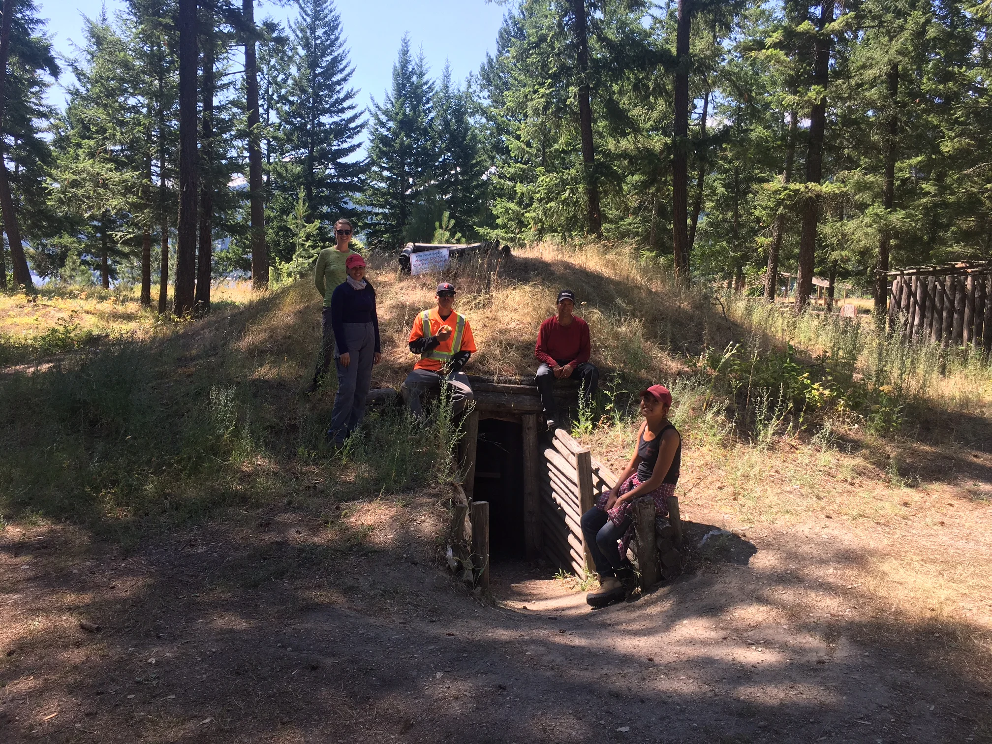
There is a rich and deep history of sites dating to 11,000 years or older in this area, with much more to learn about how people were living millennia ago.

On the other hand, if proposed developments are only in the early planning stages, then archaeology crews take the path of least destruction while looking for ancient sites.

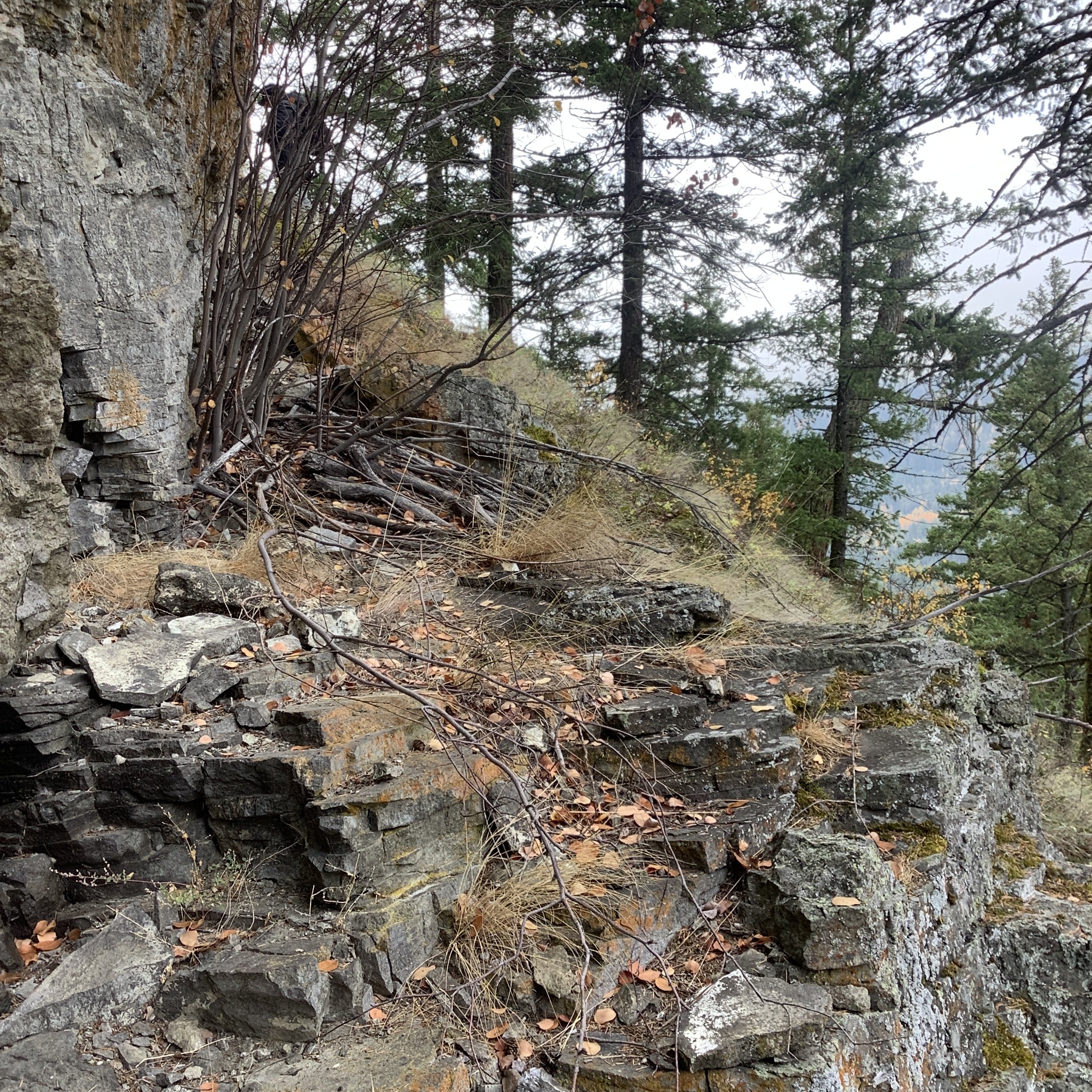
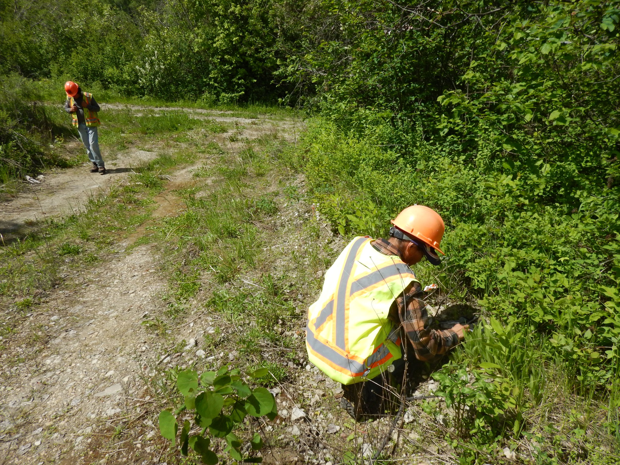
This usually involves systematic pedestrian surveys through proposed project areas, with crews searching for evidence of archaeological sites visible on the ground surface.

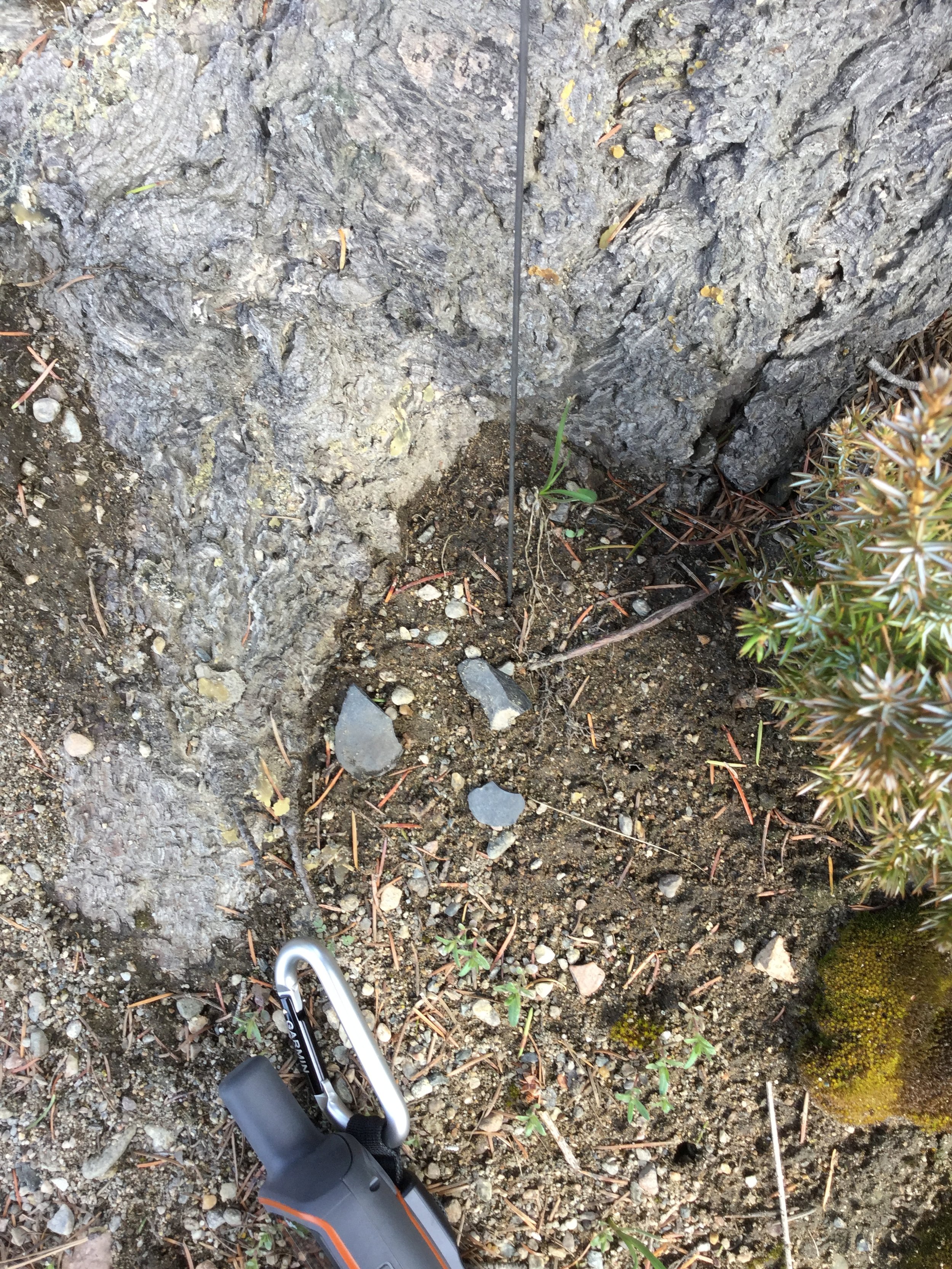
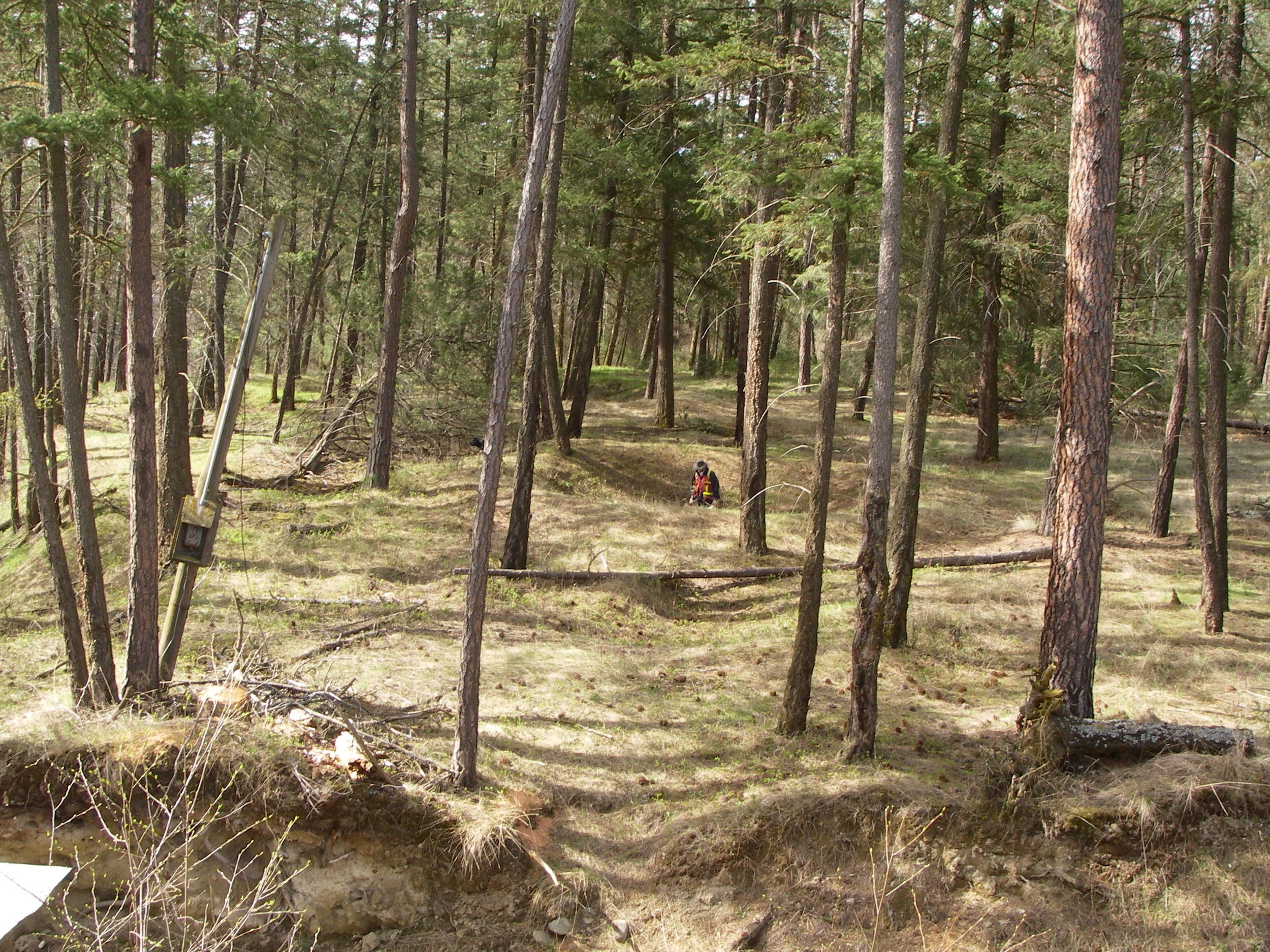
Many archaeological sites can be identified through this technique, such as scatters of stone artifacts on the ground, the remains of pithouses, hunting blinds, trails or culturally modified trees.

The preference is always to observe and record, then leave the archaeological site in place.

Artifacts are always left where they are found unless under threat of development.

In 2022, I was involved in a research project in Secwepemcúlecw (Secwépemc lands).

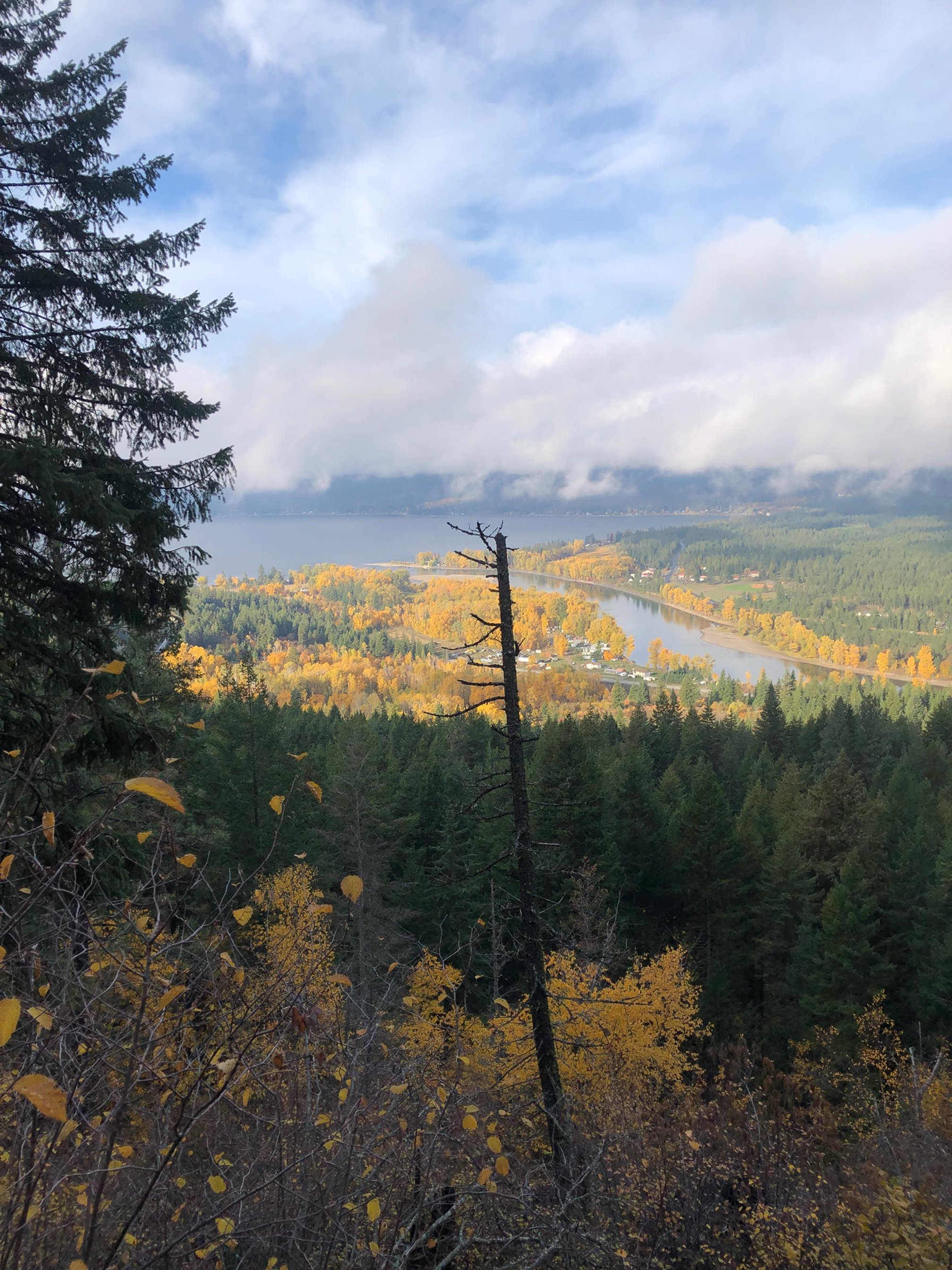
With no imminent development guiding the field work, we were able to instead select survey areas based on terrain features on the landscape in order to gain a more regional perspective of land use.

We identified more than a dozen new archaeological sites through surface observation only — with no digging needed.

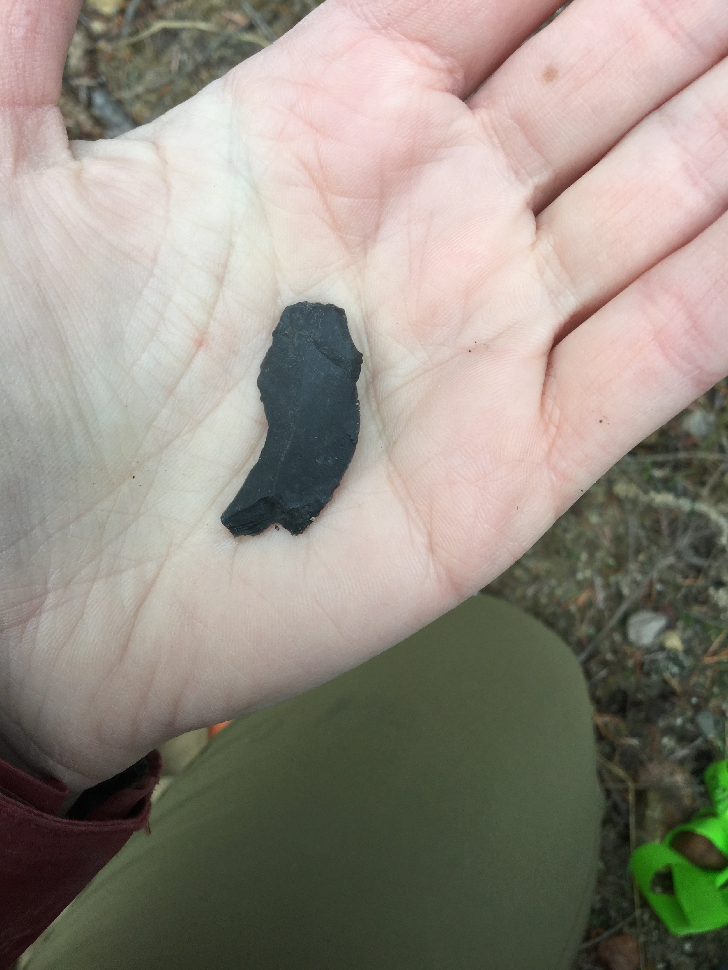
These sites consisted of lengthy trail corridors and stone tool artifact scatters identified in remote, high-elevation environments. In these instances, we would document the site, record the location and types of artifacts present, take photographs and leave the site undisturbed.

These archaeological sites are thousands of years old and unnecessary collection of artifacts or unnecessary digging through the site sediments to search for additional artifacts would only destroy this non-renewable resource.

When in doubt, the default recommendation for archaeologists and the general public alike is to always leave an archaeological site where it is found.

Phoebe Murphy is a Kamloops-based archeologist. Interested in more? Go online to republicofarchaeology.ca.

Interpreting the past and the archaeology of children

Archaeology as a discipline is a social science – it is focussed on the study of past human groups through the analysis of the material remains people have left behind. It is important to remember that each uncovered archaeological site provides a direct and tangible human connection to the past. Even if the archaeological site is comprised of one single stone tool, that item was shaped, used (perhaps many times over), and then ultimately discarded or lost by a person living thousands of years ago.

It isn’t uncommon in archaeological reports and literature for the authors to focus almost exclusively on the material remains people left behind with a quantitative lens. Items uncovered in archaeological sites are described, measured, and compared. During this process, the items themselves inadvertently become the focal point of the interpretation of the past while the people that manufactured and used those items become a secondary consideration.

It is important for archaeologists working within archaeological sites and documenting the past to keep interpretations focussed on the people. One challenging, but growing, aspect of archaeological research is the discussion of children in archaeological sites. We know, of course, that children were present at most archaeological sites in BC as Indigenous populations have been inhabiting this region for well over 10,000 years and children are necessary for population growth and longevity. But detecting and documenting the presence of children at archaeological sites is not an easy feat.

Present-day Indigenous knowledge keepers and ethnographic sources from the late 1800s and early 1900s can provide insights and details pertaining specifically to children to help provide a more robust interpretation of the past. For instance, in the southern interior a useful resource is the reports produced by James Teit, a Scottish ethnographer that lived in the Spences Bridge area for almost four decades, that document many details about Secwépemc and Nlaka’pamux groups. His detailed writing and drawings provide context about day-to-day life and overarching beliefs and cultural practices.    

James Teit’s anthologies provide details about the care of children, children’s activities, children’s games, and children’s participation in daily life. Many of the obvious items directly related to children do not survive in archaeological sites due their perishable nature, such as infant cradles or carriers made of birch bark or coiled basketry and buckskin. What can be learned from Indigenous knowledge keepers in communities and from ethnographic sources is the types of activities children were involved in. There are numerous examples of young children assisting with certain tasks, such as preparing food, picking berries, or fishing, and through these processes gaining important life skills.

Just like the present day, a lot of children’s games and early play revolved around building a required skillset through mimicking the behaviour of adults with child-size items. For instance, the use of miniature bow and arrow sets, baskets, and digging sticks so that children could play, and ultimately learn, invaluable techniques and strategies from their parents and relatives.

As archaeologists we know children were present at archaeological sites and it is important to acknowledge their presence, think about the transfer of knowledge between generations, and ensure the smallest members of the group aren’t forgotten in the interpretation of the past.

Archaeology of the intangible

Archaeology is a discipline focused on the material remains left behind by people in the past. Except on rare occasions, such as waterlogged or permafrost conditions, the majority of organic items used in the past do not preserve. Typically, all that is left after thousands of years in the ground are stone, bone, or shell artifacts. As a result, these items have become the source of much archaeological research and attention.

Apart from portable items manufactured by people, archaeology also focusses on unmovable features created or modified intentionally by humans, such as the remains of semi-subterranean pithouses, fire pits, hunting blinds, fish weirs, rock paintings, or bark-stripped trees. All of these various site types are relatively easy to comprehend and understand – these are physical items that can be easily documented, measured, photographed, and described.

As archaeologists we are trained to analyze the material remains left behind by past people, but just focusing on the few physical items that happen to preserve in the earth after millennia is missing a large part of the picture. Not all significant places on the landscape have a tangible component that can be quantified and classified. The material remains we find scattered across the province and registered as archaeology sites with the BC Archaeology Branch need to be considered and understood within the whole landscape.

Non-Indigenous British Columbians have a very short history in this province, five or six generations at the very most. Nevertheless, we can all collectively understand the importance of place in this beautiful province. Many can relate to special mountain tops, hiking trails, or lake views that are significant to you and your family due to shared experiences and memories at these locations. These places contribute to a sense of place and self. We often react strongly when these places are destroyed through developments because those locations were significant and meaningful to us personally.

This is a challenging aspect of the past for archaeologists to capture – the important places on the landscape to Indigenous communities that don’t necessarily contain material evidence that they were visited or used in the past. There might not be obvious traces left behind from past visitors, yet these locations are an integral part of the past and present cultural landscape and were and are important to Indigenous communities today. These places may be associated with origin stories, significant past events, ceremonial activities, or spiritual places. With the focus on physical remains in archaeology, capturing these intangible places and understanding their significance is not an easy feat. Nevertheless, excluding these locations and sites from research projects limits the understanding and interpretation of the past.

The Heritage Conservation Act is the legislation that protects archaeology sites in BC. Although the emphasis is weighted on the tangible (i.e., physical remains left behind by people in the past) significant places can be afforded protection. The system isn’t perfect and getting protection for a place is much more challenging than the automatic protection provided to artifacts. The most promising avenue is for Indigenous-led research and archaeology projects to document these locations on the landscape and advocate for not only their significance, but their right to be preserved and protected.

There is a shift toward this movement globally and within Canada. For instance, earlier this year the Muteshekau Shipu (Magpie River) in Quebec was granted legal personhood. This new legal status, the first of its kind in Canada to be provided to a natural entity, was granted by the local Indigenous communities and will ensure the river is protected for future generations. Protecting significant, and at times intangible, places on the landscape enriches the interpretation of the past while preserving these irreplaceable locations for the future.

Animals as unlikely archaeologists

Archaeology interest stories regularly appear in the news around the world when a captivating or unusual find is unearthed. Just recently, an article appeared in The Guardian titled “Welsh rabbits serve up prehistoric finds on tiny Skokholm Island” (published online March 25, 2021). While digging a burrow, a family of rabbits inadvertently dug up prehistoric artifacts on a tiny island outside of Wales. The artifacts included a lithic (stone) artifact that is approximately 9,000 years old as well as a shard of a bronze age burial urn approximately 3,750 years old.

This type of story makes for a fascinating read and often piques the public’s interest in archaeology. Because the items that were unearthed by the rabbits in this particular circumstance were of a certain style that could be attributed to date ranges almost 5,000 years apart, it highlights the use and occupation of this tiny island spanning millennia.

This type of fortuitous archaeological site discovery is not uncommon, even in our backyard in Kamloops and surrounding area. Rabbits, reptiles, rodents, and other small mammals often burrow through archaeological sites and occasionally artifacts are identified at the entrances to animal burrows or dens or within rodent mounds.

Finding these items during an archaeological survey can be incredibly helpful. Most archaeology projects are related to proposed developments and involve multiple stages of work. Typically, the first stage is a pedestrian survey of the entire proposed development by an archaeological team. This first stage may not be conducted under a Heritage Conservation Act permit, which means that the archaeologists cannot dig shovel tests and screen the soil to search for buried artifacts (the typical way archaeological sites are discovered).

Instead, the archaeological team surveys the terrain on foot and identifies areas to shovel test in the future once a Heritage Conservation Act permit is obtained. While surveying the proposed development, the archaeological team carefully examines the ground to search for artifacts that may be visible on the surface or eroding out of subsurface exposures. Small mammal burrows and rodent mounds are carefully inspected as these areas of recently overturned soils can potentially expose artifacts or buried cultural features, such as the remains of cooking hearths.

Additional subsurface exposures are also examined, whenever present, during archaeology surveys such as tree throws, stream banks, road cut banks, and wildlife trail beds. The discovery of artifacts on the ground surface or in subsurface exposures during the early stages of a proposed development can facilitate project planning by identifying archaeological sites early on in the process. Natural subsurface exposures allow archaeologists a view under the ground surface without actually digging into it with a shovel.

Archaeologists cannot collect artifacts without a Heritage Conservation Act permit in hand and so if artifacts are discovered in an animal burrow, the artifacts are recorded with a GPS unit, photographed, and described, but ultimately left in place.

There are archaeological sites exceeding 10,000 years of age in this region that are yet to be discovered. Rabbits, marmots, moles and the like can be helpful assistants in unearthing archaeological finds and providing us a glimpse beneath the ground surface and into the past.

What's in a flake?

When one thinks of an archaeological site, images are often conjured of the remains of large winter pit house villages, ancient burial locations, or caches of impressive stone, bone, and shell artifacts. Although plenty of those types of sites are found throughout the southern interior, one of the most common archaeological sites that archaeologists encounter are called lithic scatter sites. Lithic scatters refer to archaeological sites consisting of stone tools or the waste flakes removed during stone tool production found on the surface or buried in the ground.  

Sometimes lithic scatter archaeological sites consist of formed tools, such as spearpoints or arrowheads, but more often than not, they are comprised entirely of the waste flakes or by-products of stone tool manufacture. Archaeologists call these types of artifacts flakes, debitage, or stone chips.

The manufacture of one arrowhead can produce hundreds or even thousands of waste flakes of various shapes and sizes as the person fashioning the tool reduces a natural nodule of stone into a thin and stylized tool. In some cases, archaeologists find hundreds of waste flakes in a small area that if pieced back together would show the whole process of tool manufacture from a raw nodule of stone to a finely crafted tool. Typically larger flakes are chipped off the nodule first and then smaller and smaller flakes are removed as the tool is shaped into its final form.

Archaeologists do not always have the luxury of finding hundreds of lithic flakes from an archaeological site to recreate stone tool manufacture and past activities. In fact, many lithic sites in the southern interior and elsewhere in BC consist of isolated finds comprised of one single stone artifact. What can be learned from this simple yet ubiquitous site type?

The short answer is that we can actually infer quite a bit from the discovery of an isolated artifact even if that artifact consists of a single waste flake removed during tool manufacture. First of all, the location of the find can provide information about past land use. If an artifact is found on a high mountain pass or in an isolated valley, it highlights the fact that people were living throughout the landscape in various ecosystems for many thousands of years. The discovery of a stone artifact provides direct physical evidence of past occupation.

Additionally, the type of stone material can provide insights into trade and travel as certain material types, such as obsidian (volcanic glass), are traceable to their source. Obsidian is often found many hundreds of kilometres away from its source providing evidence of extensive past trade networks. Other material types, such as basalts/dacites and cherts, have known quarry sites in the southern interior and finding an artifact manufactured of a particular stone material can indicate where the item originated.

Finding only one waste flake can also provide information about the type of tool that was being made or resharpened based on the attributes of the flake discovered. Moreover, characteristics of the individual flakes themselves can indicate how they were removed from the original nodule of stone. A variety of tools were used during stone tool manufacture to shape and sharpen stone tools, such as hammerstones and antler tine percussors. It is sometimes possible to determine the method that the flake was removed from the larger nodule and the material (i.e., stone or antler) that was used to remove the flake. 

Although not the flashiest archaeological site type, lithic scatter sites consisting of one single stone flake are incredibly common. These sites can help paint a picture of life in the past through revealing details about past land use, travel, trade, and method of stone tool manufacture thereby providing an intrinsic link to the past.

The rich history beneath the surface of BC Parks

Most of BC’s provincial parks reopened for overnight camping on June 1. If you’ve been lucky enough to secure a reservation in one of the province’s 340 campgrounds, perhaps take some time during your stay to consider the importance of these protected places and the depth of history contained in many of these locations.

There is considerable overlap between the location of known archaeological sites and provincial parks. From an archaeological perspective, it is not at all surprising that archaeological sites abound within provincial parks.

BC was a leader in western Canada in protecting land through the establishment of provincial parks. The first provincial park in BC, Strathcona Provincial Park on Vancouver Island, was established in 1911. Over the ensuing decades, more and more areas across the province were designated as provincial parks and afforded protection. Fast forward to the present day and according to BC Parks, over 14% of the province (amounting to 13.5 million hectares) is located within the BC parks system. The parks system includes campsites, hiking trails, boat launches, and day-use areas.

For millennia before European settlers arrived in what is now called British Columbia, indigenous people were living throughout the various ecosystems in the province. Present-day coveted campsites near rivers and lakeshores were also optimal habitation locations in the past with plenty of fishing, hunting, and plant species available for procurement. 

Provincial parks are often situated near major water courses and within important environs, such as the Lac du Bois grasslands near Kamloops. The location of provincial parks near to lakes, rivers, and creeks often corresponds with the presence of archaeological sites. In fact, shoreline surveys by foot and boat of the major water systems within the southern interior commissioned by the Heritage Conservation Branch (now called the Archaeology Branch) in the 1970s recorded hundreds of archaeological sites along the banks of lakes and rivers.

The shoreline surveys were undertaken before many of the provincial parks in the southern interior were established and served to provide an inventory of the diversity and distribution of archaeological sites. The archaeological sites identified during these surveys included rock art, burials, surface scatters of stone and bone artifacts, and round-, oval-, and rectangular-shaped depressions in the ground representing the remains of house pits, storage pits, and earth ovens.

Some of the archaeological sites identified during the shoreline surveys were eventually protected from development through the establishment of provincial parks. Provincial parks are an ideal way to preserve archaeological sites through the designation of green spaces and the ability to limit or avoid destruction of these sites compared to areas outside park boundaries.

Not all provincial parks containing archaeological sites acknowledge the archaeological and cultural history of the area. A local example of a provincial park incorporating archaeological features is Monck Park on Nicola Lake where large house pits are left undisturbed in a green space and marked with informational signage. Additionally, along the Adams River the 2018 name change from Roderick Haig-Brown Park to Tsútswecw Park, meaning “many rivers” in Secwepemc, is another local example of a BC Park acknowledging and incorporating local indigenous cultural heritage.  

If you find yourself in a provincial park this summer following the guidelines by the BC government to stay local in 2020, take time to consider the vast history of the province long before Europeans arrived. Many campsites contain a rich and varied history just beneath the surface.

Reflecting on the lengthy history of the Kamloops area

With the start of a new decade, it seems timely to reflect on the long history of human occupation and the archaeological record in British Columbia. The longevity of the archaeological record in the southern interior, including Kamloops, and the province of British Columbia as a whole is extensive. The earliest recorded sites in the province confirming human occupation date to over 14,000 years ago. To put that in perspective, the oldest sites in the province were occupied over 9,000 years before the pyramids in Egypt and Stonehenge were constructed.

Archaeological sites are defined as the physical remains left behind by people from the past. There are over 50,000 archaeological sites currently recorded in British Columbia. That number grows almost daily as development continues throughout the province and previously unidentified archaeological sites are discovered as a result. Archaeologists are required to update the provincial heritage register maintained by the Archaeology Branch once a new archaeological site is discovered or an existing site is expanded.

Archaeological site types in the Kamloops area are diverse and plentiful. Common site types include subterranean house pits, burials, rock shelters, hunting blinds, cache pits for food storage, earth ovens, culturally modified trees, cultural trails, fish weirs, rock art, and scatters of stone and bone artifacts.

The oldest recorded sites currently identified in British Columbia are found along the west coast. While much of the province was covered in thick glacial ice until around 10,000 years ago, the coastline and associated islands and inlets were ice free first thereby creating habitable environments. In the Kamloops area the oldest sites date to around 10,000 years old coinciding with the glacial ice retreat. As more research continues throughout the province it is inevitable that additional archaeological sites will be identified and the dates of the earliest human occupation will be further refined.

When comparing dates of 10,000 or more years of Indigenous occupation to settler history in this area, the time difference is stark. The first European to set foot in the Kamloops area arrived in 1811. Settler history spans just over 200 years in the Kamloops area, while Indigenous groups have been living here for millennia.

As an archaeologist working in the southern interior, it is often exciting and humbling to discover and hold an artifact that was manufactured thousands of years prior. The Kamloops area has a rich history that spans thousands of years before the most recent 200 years of settler occupation in the region. As the year 2020 was rung in across the world, it’s a fitting time to consider and appreciate the long and diverse history of the Kamloops region prior to the arrival of the first Europeans.

Consider joining the Archaeological Society of British Columbia

There are a surprising number of resident archeologists in Kamloops.

Local archeologists can be found working at First Nations organizations, acting as independent consultants, teaching archeology at Thompson Rivers University or working for engineering or archeology consulting companies.

This time of year also finds an influx of archeologists to the area as field programs in the B.C. Interior ramp up for the summer season.

Earlier this year, several of the local archeologists (many of whom are contributors to the Dig It column), formed a Kamloops chapter of the Archaeological Society of British Columbia (ASBC).

The ASBC was founded in 1966 with the aim of bringing together archeology professionals, researchers and enthusiasts to share knowledge and promote the preservation of archeology sites and heritage in the province.

Archeology is considered a non-renewable resource as there are a finite number of archeological sites in the province that, once destroyed, are irreplaceable.

The ASBC has always maintained that educating the general public about the value of B.C.’s archeological heritage is one of the most effective means of preserving the threatened resource.

The goals of the society are twofold: to encourage the protection of archeological resources in the province and to provide lectures and publications about archeology to educate British Columbians.

The society publishes a quarterly journal about archeology called The Midden (uvic.ca/midden). Consulting archeologists, First Nations organizations, archeology students and avocational archeologists contribute to the journal as a platform for sharing new ideas, interesting finds and research results.

The Midden provides a way to record and share the growing body of knowledge about B.C.’s dynamic past.

The ASBC membership is comprised of a variety of professionals, students and archeology enthusiasts. The primary chapter of the ASBC is based in Victoria, but there are members from across B.C., other Canadian provinces and the United States.

Membership is not restricted to practicing archeologists. Anybody with a general interest in B.C. archeology and history is welcomed and encouraged to join.

The Kamloops chapter is growing. If you are interested in learning more about the ASBC or joining as a local member, go online to asbc.ca.

The Kamloops chapter of the ASBC has several events planned, so stay tuned for more details.

You’ll find several members at the Kamloops Regional Farmers’ Market this Saturday.

Tk’emlúps te Secwepemc has generously loaned the society a sample of artifacts for educational purposes.

The market runs from 8:30 a.m. to 12:30 p.m. in the 200-block of St. Paul Street in downtown Kamloops.

Come find us this weekend to learn more about local artifacts and share stories about Kamloops archeology and prehistory.

Phoebe Murphy is a Kamloops-based archeologist.

Archaeology of ancient living spaces

Winter pithouses, often clustered along river and lake shores, were commonplace within the B.C. Interior for millennia.

Pithouses were constructed from thousands of years ago to as recently as the 1900s and built by digging a foundation in the ground before building

a wooden structural frame. The wooden frame was then covered with hides, bark, sod, piled sediment and tree boughs.

After the houses were abandoned, the roof would eventually collapse inward, leaving a distinctive oval-, circular- or rectangular-shaped depression in the ground. Developments within the last 50 years have adversely impacted, if not completely destroyed, many pithouses within the B.C. Interior.

Nevertheless, occasionally the undisturbed remains of winter pithouses are encountered by archeologists. In these instances, archeologists are sometimes afforded the opportunity to excavate a portion or all of a pithouse.

Ideally, the pithouses that remain throughout the province would be recorded and mapped, but not dug, as digging archeological sites essentially destroys the integrity of the sites.

Archeological sites are considered an important link to the past and site preservation is typically the preference.

However, if development is encroaching on the pithouse or if First Nations communities would like to learn more about a particular site, sometimes a pithouse will be excavated.

Similar to when people move houses in the present day, the majority of possessions within the pithouse were packed up and taken with the occupants when they moved into summer tents at the end of winter.

In some cases, tools and other seasonal items were stored within the pithouse until the following year.

Inevitably, a few items were inadvertently left behind. The forgotten or lost artifacts can help paint a vibrant picture of the past inhabitants of the house.

Much can be learned from excavating the remains of an abandoned house and archeologists approach this type of research with a well-organized plan and in consultation with local First Nations communities.

There are many ways to approach excavating a pithouse and it depends on the time available and the goals of the excavation.

If it is not feasible or possible to excavate the house in its entirety, it is common to excavate a trench across the centre of the house or to excavate half of the house.

In these scenarios, archeologists lay out a grid across all or a portion of the house in one-metre squares and then excavate each one-metre by one-metre unit in carefully measured increments.

The digging is precise and detailed and often completed with small hand tools and trowels.

A particular focus is placed on noting changes in the sediment layers. Artifacts are collected and recorded based on the location of the find from within each one-meter by one-meter unit.

Archeologists are looking for evidence of structural elements of the house to help explain how the house was constructed and organized.

As crews delve deeper into digging inside the pithouse, it can be determined how many times the house was occupied and rebuilt, how the interior of the house was organized (e.g., hearth locations, sleeping areas, entrance ways), how many people likely occupied the house and what types of activities were taking place and so forth.

Collected samples can highlight what type of foods were eaten by the occupants, what types of plant and animal resources were used and how long ago the house was inhabited.

Finding personal items that were left behind can be particularly revealing; for instance, uncovering a drilled shell pendant or a bone whistle tucked beneath a sleeping area.

Archeology provides a view into the past and excavating a family’s home from thousands of years ago provides a personal connection to past residents of the Southern Interior.

Phoebe Murphy is a Kamloops-based archeologist.

Evidence of Skilled Carpenters in the Archaeological Record

Archaeologists are often only left with the non-perishable remains from past groups to learn details about their former lifeways. This typically involves stone artifacts and occasional charred bone fragments from long ago meals. While stones and bones comprise the bulk of artifacts discovered by archaeologists in the interior of BC, in reality these items only represent a tiny fraction of the materials utilized in the past. 

Soil conditions typically do not favour the preservation of organic materials in archaeological sites. After hundreds or even thousands of years buried in the ground, items constructed of plant or animal materials have long decomposed. There are circumstances where the conditions are ideal to preserve organic items, such as within glacial ice (as discussed in the previous Dig It column), but these situations are location-specific and incredibly rare.

It’s easy to focus on what is in front of us as archaeologists and forget about the diverse and complex array of items used in the past that were manufactured from wood and other organic materials that we rarely encounter. Luckily, certain artifacts that do survive in archaeological sites can provide clues about the types of perishable items manufactured and used. I recently experienced this while analyzing artifacts collected from an archaeological site excavated during the summer. While all of the recovered artifacts were manufactured from stone, the vast woodworking technology of the past was illuminated through the presence of certain types of artifacts.

Woodworking on a large scale was inferred through the presence of stone adze fragments and stone wedges. Adzes were used to cut down trees while stone wedges were used to split wood for various purposes. Finding these items within an archaeological site suggests that trees were felled and processed in the general area, perhaps for use as structural timbers for the abandoned pit houses located nearby.

Other wood processing tools were also present within the archaeological site, including a distinctive, slightly curved, stone scraping tool. This specially designed tool was used to strip the leaves, small branches, and bark from the stems of shrubs to form wooden shafts. These wooden shafts were important components of various tools such as digging sticks, spears, and arrows.

Oral history from Indigenous elders, community knowledge-holders, and ethnographic documents completes the picture by providing invaluable details about which types of plants were preferred for making wooden shafts. Saskatoon, yew, rocky mountain juniper, ocean spray, and hawthorn are a few of the local species selected because of both the natural straightness of the branches and strength of the wood. Many of these plants were observed growing within or near to the archaeological site under examination and most are ubiquitous throughout the southern interior.

These are just a few examples of specific woodworking tools found in archaeological sites and many more woodwork tools existed in the past. It’s not surprising that a variety of tools were designed for this purpose. Essentially every aspect of daily life had a component constructed from wood, ranging from timbers for housing, hunting and fishing technology, transportation, plant harvesting equipment, basketry, and so on. The use of wood was endless and past groups tailored a specific and expansive set of tools to work with this medium.

Although the wooden items of the past have often long decomposed, an archaeological site comprised entirely of stone artifacts can still provide information about past woodworking and help to fill in the details about daily life in the southern interior thousands of years ago.


Recording history one shovel test at a time

For archaeologists in the southern interior, the summer months commonly involve spending long days digging shovel test after shovel test. Shovel tests are used as a technique to discover archaeology sites buried in the ground and involve archaeology crews manually digging square holes measuring 35 cm a side and 70 cm deep. All of the dirt removed from the test is sifted through a mesh screen to catch any artifacts that may be buried in the ground in that location. More often than not, shovel tests are dug and no artifacts are found within the sifted dirt. Archaeologists call these negative shovel tests.

shovel test.JPG

Occasionally shovel tests are placed in just the right location and we find artifacts in the tests. When this happens, it feels like everyone’s hard work stomping on shovels and carefully sifting through the dirt is rewarded. Finding even one artifact, which in the southern interior typically consists of stone tools or the stone chips associated with making stone tools, constitutes an archaeological site. Archaeological sites are afforded automatic protection under the Heritage Conservation Act.

As soon as an artifact is found, there are specific tasks that must take place so that the newly identified archaeology site is adequately tested and recorded. Since the details and location of each archaeological site are unique, archaeologists must determine how many shovel tests are required to appropriately test the site in order to comply with archaeological permits issued by the Provincial Archaeology Branch or First Nations organizations (or both). This typically involves digging shovel tests at specified intervals, usually every 2 to 5 meters away from the test containing artifacts, until there are two or three negative shovel tests in a row in every direction. Depending on how many shovel tests contain artifacts, this process can add dozens of additional shovel tests for archaeology crews to excavate. The idea is to find the extent of the buried artifact scatter and determine the outside boundaries of the site.

Once the testing is complete, a site map is drawn to depict the location of all of the shovel tests in relation to nearby landmarks, like creeks or roads.  The subtle details in the topography surrounding the site are also drawn, such as landform margins, changes in slope, and bedrock exposures. There are all sorts of global positioning technologies to assist with site mapping, but archaeologists commonly just use graph paper, a compass, and measuring tape to create an accurate and to-scale map.  

archaeologist drawing an archaeology site map.jpg

These completed site maps are then provided to the Archaeology Branch so that the location of the newly identified site is added to the central database called the Provincial Heritage Register. This means that any archaeologist working in the area in the future will have access to the map, which will help inform them about the type of terrain where one would expect to find an archaeological site and provide insights into how the landscape was used thousands of years ago.

site map example.JPG

Finding new archaeological sites and uncovering artifacts that haven’t been touched for thousands of years since they were disposed of or lost is partly what makes archaeological field work so exciting. Documenting archaeological sites through accurate site mapping and recording ensures that information about each archaeological site in the province is preserved.

What do archaeologists do in the winter?

As an archaeologist, I often get asked about what I do in the winter. I would like to say my winters consist of spending weeks on tropical sandy beaches to even out the glove tan from the summer, but the winter is often a busy time of year. Snow and frozen ground generally stop archaeological field work for the year (not always, but I won’t get into that here). Although the winter season offers relief from long hours of digging shovel tests and sifting dirt, there are specific tasks that archaeologists must complete in the winter months prior to the start of the next field season.

During the winter months archaeologists are kept busy writing reports and summarizing the data collected during the field season in order to present project results and recommendations to local communities and clients. Providing summary reports is also a requirement to fulfill archaeological permit obligations to the Provincial Government and First Nations.

Additionally, specific forms must be filled out to document the location and provide information about any new archaeological sites discovered. These forms and associated mapping information are kept in a database regulated and maintained by the BC Archaeology Branch. There are well over 45,000 archaeological sites currently recorded in BC and this number continues to rise annually. It’s important that archaeologists document and report the locations of newly discovered archaeological sites in a timely fashion so that the database is current and accurate.

Depending on the type of project undertaken in the summer, archaeologists are often left with many stone artifacts and faunal (animal) remains to inventory and analyse over the winter. The stone and bone artifacts are classified and studied prior to submitting the items to an approved museum (another archaeological permit requirement). Commonly, the debris from stone tool manufacture makes up the bulk of the artifacts recovered during a field program. Formed tools, such as spear points or arrowheads, are found more rarely. Although classifying hundreds or even thousands of small stone chips may sound like a mind-numbing task, we can learn a lot from the waste left behind from making tools.

There are many different ways to categorize lithic artifacts but typically the size of the item, the stone material type (is the artifact made of chert, basalt, or obsidian, for example), and certain characteristics present on the stone chip itself are used as basic ways to sort the artifacts. Previous installments of Dig It have explained what can be learned from analysing stone tools and stone chips (https://www.kamloopsthisweek.com/dig-analyzing-stories-past/; https://www.kamloopsthisweek.com/dig-stoned-souls/).

When archaeologists get to work collectively to catalogue the artifacts it can really enhance the process and make it much more enjoyable. I was recently cataloguing a few thousand stone artifacts with the field crew from a large project we had all worked on together in the summer.  As we were constantly opening bags and looking at different artifacts, the task never felt monotonous as there was always something new to look at and examine. Opening the dirty ziplock bags housing our finds from the summer caused us to fondly reminisce over the past field season. The information gathered through classifying the artifacts allowed us to really delve into what types of archaeological sites we were dealing with, the antiquity of the sites, and what types of activities occurred there.

Although the winter season comes with specific and time-sensitive tasks for archaeologists to complete, come spring you might see some of the local archaeologists eagerly awaiting the snow to melt to start the process all over again.

Blazing ancient trails from our past

The sprawling trail networks surrounding Kamloops allow us access to grasslands, mountain peaks, waterfalls, rock bluffs, and hoodoos whether by hiking, biking, or snowshoeing. As someone who regularly uses the recreational trail systems around Kamloops, one of the areas I find particularly interesting in archaeology is the location of ancient trail networks.

As part of the pre-field planning before undertaking an archaeological assessment, archaeologists complete a thorough review of past archaeological work conducted in the local area. This includes identifying the location of previously documented archaeological sites and any cultural heritage information provided by the local First Nations communities. This can include the location of ancient foot trails.

Unfortunately, many ancient trails are not documented. Historic maps produced by the Hudson’s Bay Company, early mining prospectors, and ethnographers can be a useful source to help identify ancient trail locations and routes. Early explorers often spent considerable effort drawing maps of the local area and the trails depicted on the maps were almost always originally established by local First Nations communities.

Besides travelling by boat through lake and river systems, travel by foot (and later horses) was the primary means to move around the landscape in the past. Trails networks were used extensively to access resource gathering locations, such as fishing, fur trapping, or berry picking areas, to interact and trade with neighbouring groups, to access important sacred and ceremonial sites, and general day to day travel throughout a region. Travel corridors generally followed a logical route over the most favourable terrain for foot travel through varying landscapes ranging from open grasslands in valley bottoms to steep mountain passes. These trail networks covered distances of thousands of kilometers.

In many cases, trees along the trails were marked in various ways in order to assist travellers with wayfinding. Blazed trees marked with axes or intentionally bent trees are sometimes found at intervals along trails in order to mark the route. The bent trees are referred to as trail marker trees with the bend in the tree indicating the direction of travel along a path or at a trail junction. Sometimes when the trail bed is overgrown from disuse and difficult to see, archaeology field crews can locate the path of a trail by following trail marker trees.

For an archaeologist, finding a segment of an ancient trail is an exciting process. If archaeology sites are found along the trail, such as stone artifacts, it further highlights the antiquity of the use of the trails. This summer, less than a hundred meters away from a major highway, the archaeology team I was working with came across a portion of a trail in a thickly shrubbed area. Once we cleared some of the brush out of the way and followed the trail, it became evident that it was an overgrown pack trail. The trail was about one metre wide and contained a well-defined and level trail bed that was cut into the side slope of the hillside. The trail followed a fairly linear path skirting above the steepest portions of the landscape. We were able to follow the trail for a few hundred meters until it was lost at the junction with the current highway. Presumably parts of the pack trail followed the same path as the current highway. We were able to locate a second portion of the same trail several hundred meters away. In total we recorded over half a kilometer of the pack trail during our study and found numerous stone artifacts in the surrounding area suggesting the trail was used many hundreds of years ago.

Unfortunately, development activities have impacted many ancient trail systems. Over the past two centuries, trails have been modified from foot paths to pack animal trails to wagon roads and eventually present-day paved highway and road systems. Although the look of the trails has changed over time, the purpose has remained unchanged – to transport people efficiently and safely across a vast province, including areas of high elevation and rugged terrain. The next time you drive through one of the many high mountain passes surrounding Kamloops, take a moment to consider the fact that for millennia people continually travelled and navigated similar routes by foot.


Blazed tree.JPG

Exploring Cultural Depressions

Stone tools and other portable items left behind by people from the past make up a significant portion of archaeological research, as the last three installments of this column have done an excellent job of highlighting. The physical remains of past human activities are the focus of archaeological studies, which also include non-portable items. Archaeologists refer to the non-portable components of archaeological sites, such as hearths, trails, or structural remains, as “features”. 

Walking along the lake and river shores in the interior we sometimes come across small and large depressions in the ground. These depressions provide evidence of past human occupation and archaeologists call these distinctive features “cultural depressions”. The function of a cultural depression is determined in part through the size and shape of the depression as well as the results of any archaeological testing. Common types of cultural depressions include the remains of past housing structures, storage facilities, or cooking locations.  

Dig It Image 3.jpg

The larger depressions, ranging in size from 5 to 15 m or more in diameter, are typically the remains of housepits. These were semi-subterranean houses that were constructed by digging a pit and piling excavated sediments around the perimeter to form a rim. A timber frame was then assembled over the excavated pit and covered with a combination of woven mats, dry grasses, pine needles, bark, animal skins, and sod. This style of house was often occupied in the late fall through the winter and snow would accumulate on the surface adding extra insulation during the cold winter months.

Entrances to the housepits commonly consisted of a timber framed side entrance or an opening in the top centre of the house that acted as both a chimney and an entrance/exit using a ladder. Inside there would be sleeping platforms and benches around the perimeter and a hearth in the centre to provide warmth, light, and a place to cook. Several different styles of housepits have been recorded in BC’s interior representing regional differences and changes through time. Housepits were often used and re-used for multiple years. They would be abandoned in the summer in favour of more portable housing styles, such as tents, and then cleaned out and reoccupied the following autumn.

Smaller diameter depressions (1 to 3 m) are often the remains of earth ovens or storage pits. Earth ovens or roasting pits were used to cook various food items and often contain large quantities of cooking stones and burned rock. Storage or cache pits consisted of an excavated pit lined with woven mats, dried grasses, or tree boughs. Food items, for instance dried salmon or prepared roots, were then placed in the pits and reburied for consumption later in the winter. Storage pits were often located within or just outside housepit locations so that stored food could be accessed throughout the winter.

What typically remains of abandoned housepits in the present day is a sunken pit with a well-defined rim around the perimeter that formed when the house structure collapsed. These depressions may be easily identified in open grassland terrain, but in more forested areas cultural depressions might only be located when someone fortuitously stumbles into the feature.

Cultural depression sites measuring several hectares in size and containing hundreds of housepits, earth ovens, and/or storage pits have been recorded in the southern interior. Locally, you can visit reconstructed winter houses (or kekulis) at the Secwepemc Museum and Heritage Park in Kamloops and Quaaout Lodge in Squilax. Visiting the reconstructed houses is a great experience and well worth the trip. If you come across a depression during a hike and want to report its location or wish to learn more about cultural depressions, please contact a local archaeologist.

Dig It Image 1.JPG