What's in a flake?

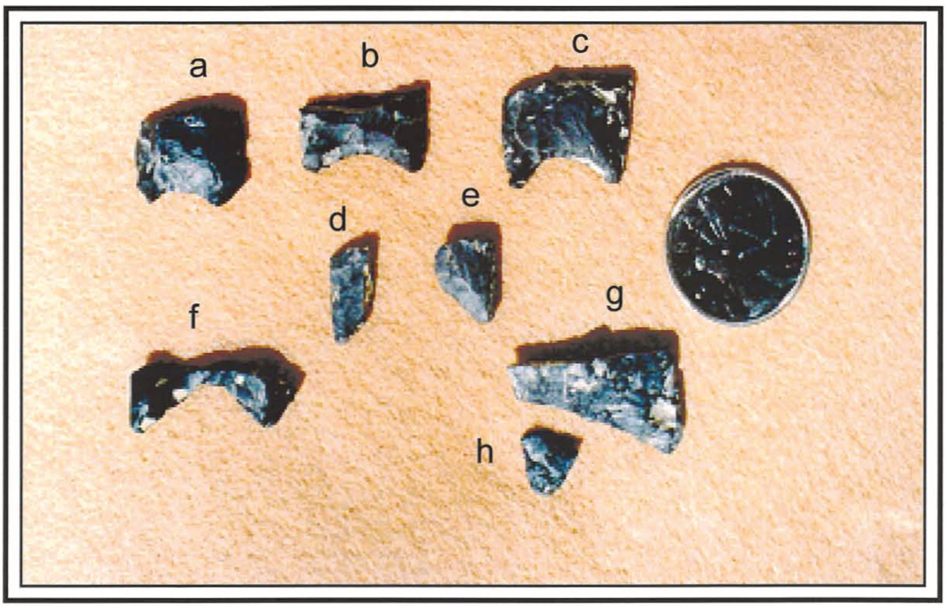
When one thinks of an archaeological site, images are often conjured of the remains of large winter pit house villages, ancient burial locations, or caches of impressive stone, bone, and shell artifacts. Although plenty of those types of sites are found throughout the southern interior, one of the most common archaeological sites that archaeologists encounter are called lithic scatter sites. Lithic scatters refer to archaeological sites consisting of stone tools or the waste flakes removed during stone tool production found on the surface or buried in the ground.  

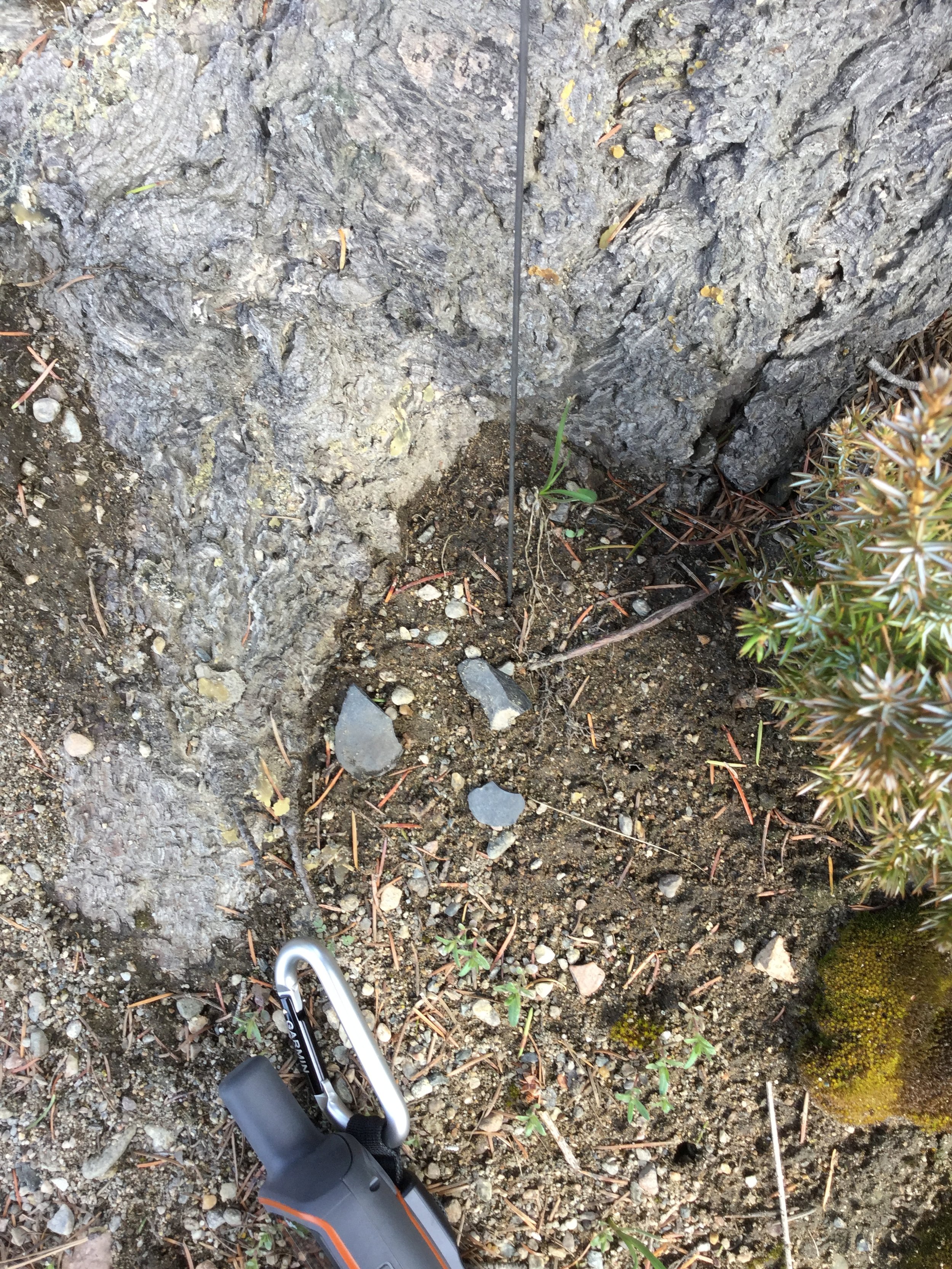
Sometimes lithic scatter archaeological sites consist of formed tools, such as spearpoints or arrowheads, but more often than not, they are comprised entirely of the waste flakes or by-products of stone tool manufacture. Archaeologists call these types of artifacts flakes, debitage, or stone chips.

The manufacture of one arrowhead can produce hundreds or even thousands of waste flakes of various shapes and sizes as the person fashioning the tool reduces a natural nodule of stone into a thin and stylized tool. In some cases, archaeologists find hundreds of waste flakes in a small area that if pieced back together would show the whole process of tool manufacture from a raw nodule of stone to a finely crafted tool. Typically larger flakes are chipped off the nodule first and then smaller and smaller flakes are removed as the tool is shaped into its final form.
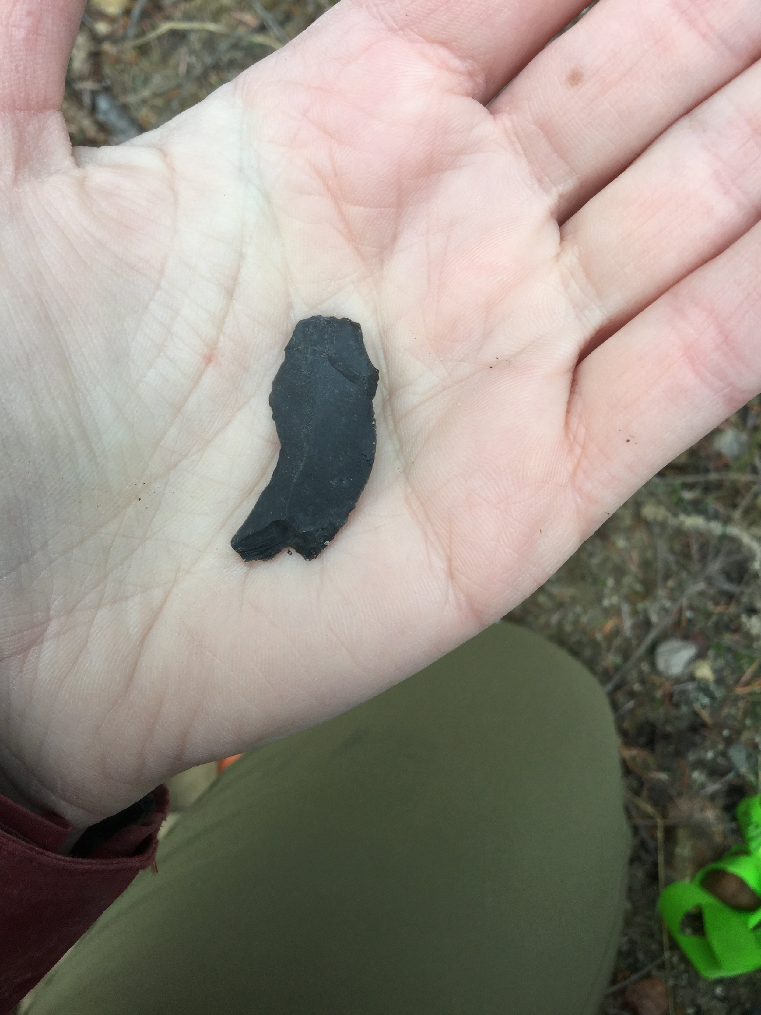
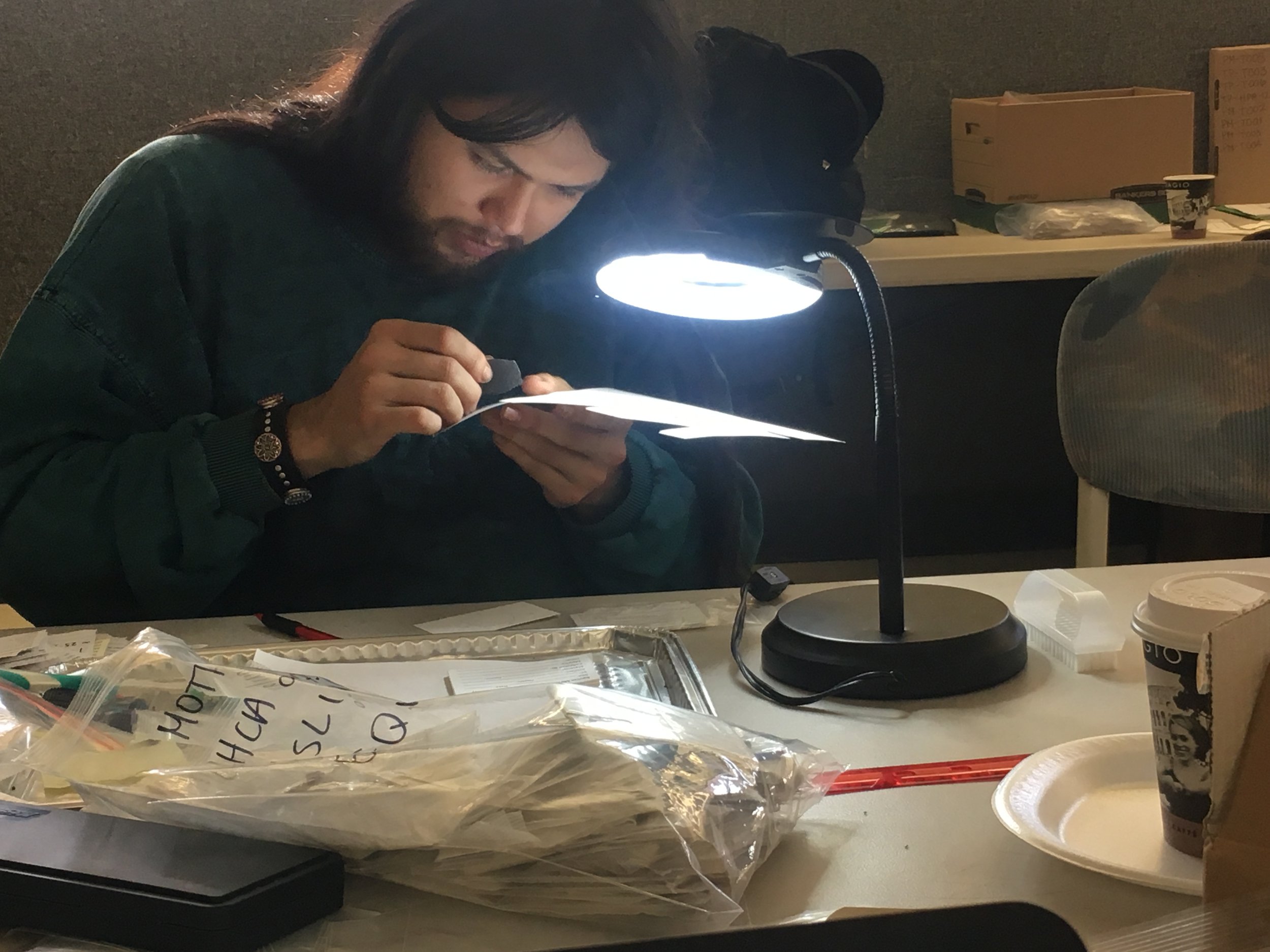
Archaeologists do not always have the luxury of finding hundreds of lithic flakes from an archaeological site to recreate stone tool manufacture and past activities. In fact, many lithic sites in the southern interior and elsewhere in BC consist of isolated finds comprised of one single stone artifact. What can be learned from this simple yet ubiquitous site type?

The short answer is that we can actually infer quite a bit from the discovery of an isolated artifact even if that artifact consists of a single waste flake removed during tool manufacture. First of all, the location of the find can provide information about past land use. If an artifact is found on a high mountain pass or in an isolated valley, it highlights the fact that people were living throughout the landscape in various ecosystems for many thousands of years. The discovery of a stone artifact provides direct physical evidence of past occupation.

Additionally, the type of stone material can provide insights into trade and travel as certain material types, such as obsidian (volcanic glass), are traceable to their source. Obsidian is often found many hundreds of kilometres away from its source providing evidence of extensive past trade networks. Other material types, such as basalts/dacites and cherts, have known quarry sites in the southern interior and finding an artifact manufactured of a particular stone material can indicate where the item originated.

Finding only one waste flake can also provide information about the type of tool that was being made or resharpened based on the attributes of the flake discovered. Moreover, characteristics of the individual flakes themselves can indicate how they were removed from the original nodule of stone. A variety of tools were used during stone tool manufacture to shape and sharpen stone tools, such as hammerstones and antler tine percussors. It is sometimes possible to determine the method that the flake was removed from the larger nodule and the material (i.e., stone or antler) that was used to remove the flake. 

Although not the flashiest archaeological site type, lithic scatter sites consisting of one single stone flake are incredibly common. These sites can help paint a picture of life in the past through revealing details about past land use, travel, trade, and method of stone tool manufacture thereby providing an intrinsic link to the past.

What archaeologists do and don’t do

I was having a conversation with a co-worker this week about comments and questions we receive from the public when they find out we are archaeologists.  We always try to provide clarification, generate interest in archaeology, and educate people about the aims of cultural resource management.

However, one comment that is often difficult to address is “the archaeologist shut down my project”.  I’ve heard this statement a number of times and thought it might be a useful exercise to walk through the assessment and decision-making process to create awareness of what archaeologists do and what they don’t when it comes to a developer completing a project. 

A local or provincial government agency review of a developer’s proposed project may trigger the need to undertake an archaeological assessment.  The archaeologist conducts an assessment to determine if documented or yet-to-be identified archaeological sites may be altered by the proposed project and provide guidance to the developer, per guidelines associated with the Heritage Conservation Act

When archaeologists are engaged to conduct an assessment, we provide the client with an initial, well-scoped work plan and budget based on a number of variables.  We make efforts to discuss these variables with the client because no two projects are the same. We need to know the type and dimensions of the proposed impacts, which can vary greatly (e.g., residential construction versus pipeline construction). Understanding the project location allows us to determine the logistics required for the assessment and which First Nations will be involved as part of the crew or in permitting.  It also allows us to research the setting and generate expectations of the archaeological site types we may encounter.   

Now, it is important to remember that much of what archaeologists look for is not immediately visible.  While some sites have a surface expression, such as pit house depressions, many of the sites are buried and we need to conduct subsurface testing to find them. That means we may not know if sites are present or how big they are when we provide the initial work plan to the client.  We take efforts to make this clear and indicate that, if the fieldwork results exceed the expectations in the initial workplan, we must generate a revised workplan/budget that has to be approved by the client before proceeding further. Just like when a mechanic finds something unexpected on your vehicle when you take it in for a brake job and must get your approval to repair it, the scope and cost of archaeological assessments are subject to modification based on what we encounter during fieldwork.

Further, the archaeologist works with the client to develop strategies to address the presence of archaeological sites in the proposed project area once the assessment is complete.  This includes looking for options to avoid or reduce impacts to sites through design modifications. If the client does not wish to modify the design, then a determination is made of how much of the site will be impacted and the amount of archaeological work that would be necessary to address it.  The archaeologists will provide input to the client on the regulatory requirements, work scope, and general schedule and cost implications associated with the options.  Ultimately, it is the client who decides if the options presented are viable based on their schedule or budget, public and stakeholder concerns, and/or other regulatory requirements.  

Throughout this process, the archaeologist does not tell a developer they cannot proceed with a project.   However, a developer may decide their project is not viable to pursue based on those various constraints.

Context — Putting it all together

There have been several Dig It articles discussing aspects of the importance of context in archaeology, including the general location of sites and the stratigraphic layers that make up sites.

I am going to use a site from northeast British Columbia as an example of how having the location, artifact assemblage, and the vertical and horizontal contexts to help interpret the story of a site, and how losing that context makes it very difficult to tell what happened there.

Imagine a development took place where all the sediment within an archaeological site was dug up and put in a big pile without archaeological work being completed first. After the fact, an archaeology team came in and screened the sediment pile. Over 700 artifacts were found, mostly debitage (the flakes resulting from stone tool production), a small number of unifaces (sharpened like a chisel) and bifaces (sharpened like a knife), 5 complete and 3 partial projectile point bases, and 5 sandstone cobbles, some with wear markings. From this, we know that the site is located, on a gentle east facing slope next to water, the artifacts suggest this is probably a hunting site, and, based on the shape of the projectile point bases, at least part of the site might be well over 6000 years old.

We can’t say how the artifacts are related to each other in time and space. Did they all come from one layer, perhaps suggesting a single occupation?  Were they in several layers, suggesting people had repeatedly visited this site? Similarly, were they in one small dense cluster, or were they spread throughout the dug-up site area? Were there any features such as a campfire hearth? We will never know!

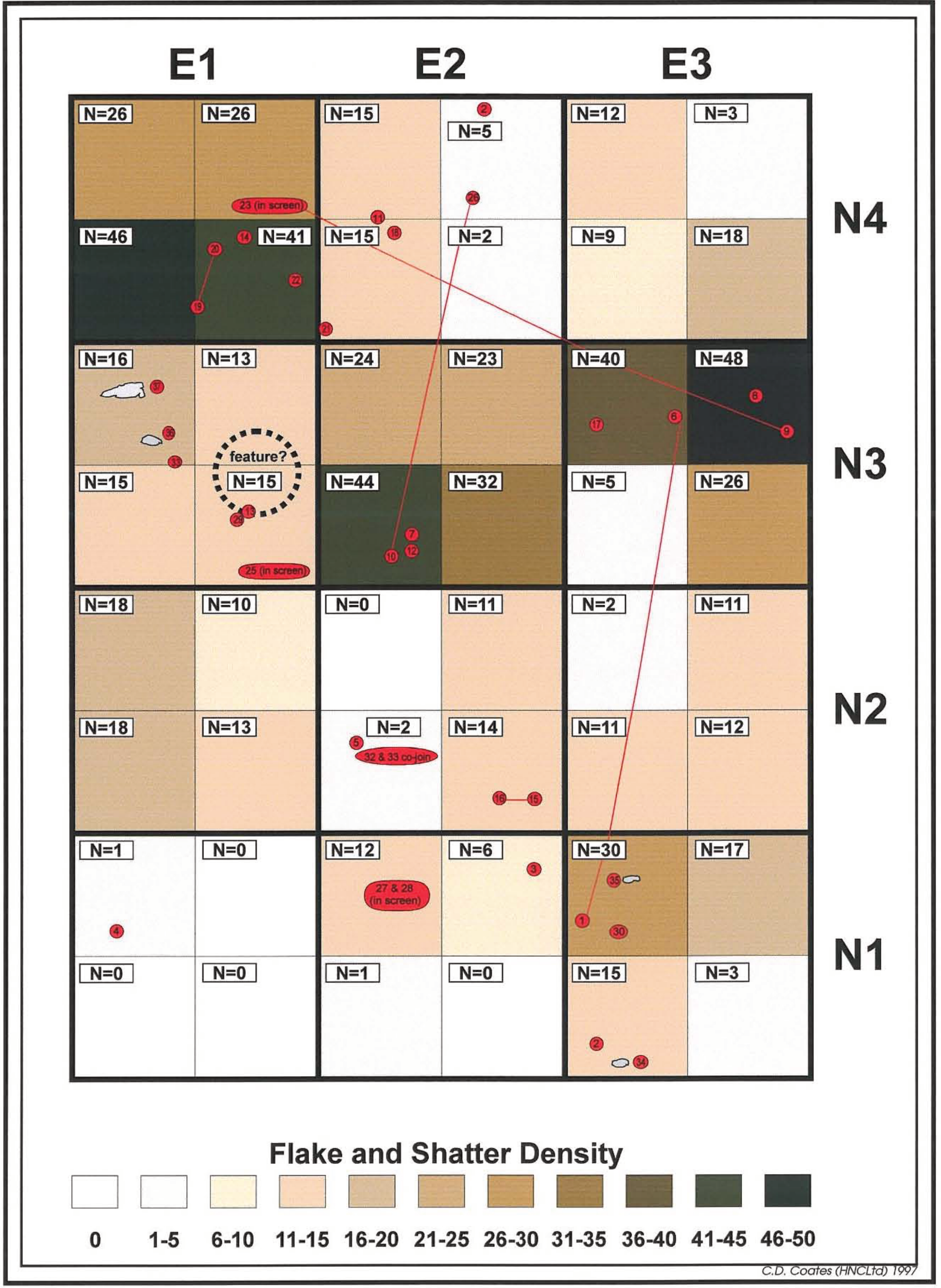
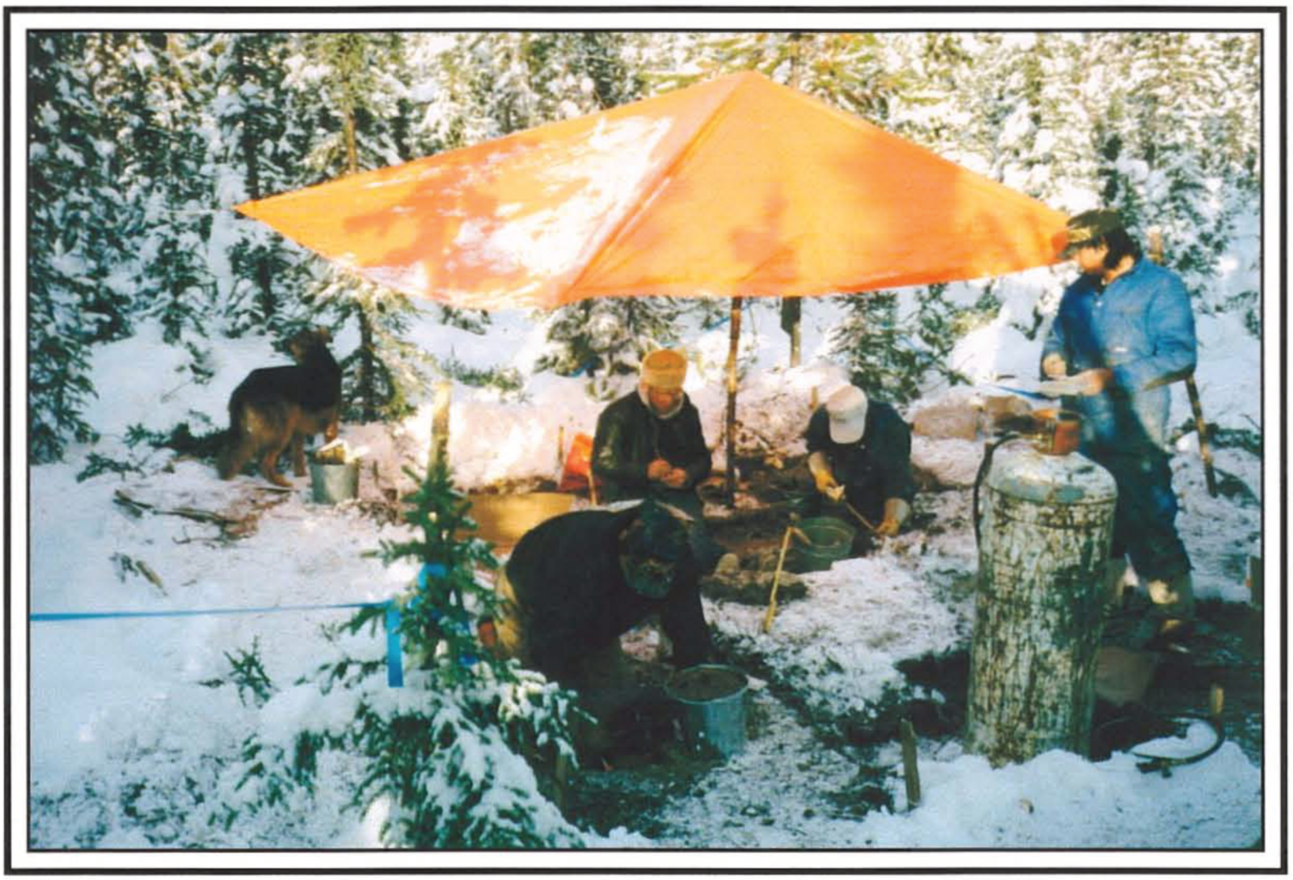
Instead, let us say that an archaeology team was able to conduct a controlled excavation in advance of the construction work. In this example, a 4 m x 3 m grid was excavated over the site. Following the excavation, the amount of debitage from the quadrants of each unit was calculated and placed on the site map, along with the location of other artifacts.

Several things became apparent:

- The vast majority of the artifacts were recovered from a single, shallow layer;

- A possible hearth was noted in the northwest part of the excavation block, with the sandstone cobbles found in proximity;

- There are three patches of relatively dense artifacts to the north and east of the hearth;

- Several artifact fragments from a few meters apart were found to “refit” back together into partial artifacts;

- Almost all of the debitage flakes are under 2 cm in size, with over half being under 10 cm; and

- Other than the cobbles, no complete artifacts were found.

With this information, we can now start to create a more complete picture of the site. The dense clustering of debitage near the hearth, the relatively thin layer where most of the artifacts were found, and the refit artifacts from across the site, suggest that it may have been created during a single short occupation instead of multiple visits over many years.

The small size and frequency of debitage is consistent with the last stages of tool making and maintenance. The wear marks on the sandstone cobbles could be the result of platform grinding to increase the reliability of the flaking process.

Putting it all together, we can now tell a more complete story about the site. A small group of hunters from at least 6000 years ago came to the location to camp for a short time and rejuvenate their hunting equipment. The broken point bases attached to the spear thrower shafts were being cut off and replaced with newly made points, and they were possibly processing the meat and/or hides.

So as you can see from the two examples discussed here, much context is lost when an archaeological site is disturbed before investigations take place, and that data is lost forever.  Which is why it’s always so important to ‘call before you dig’!

Exploring the archaeology of us

When imagining archaeological research, most people conjure mental images that come right out of National Geographic magazine:  archaeologists painstakingly excavating artifacts left behind by some ancient and exotic culture.  But archaeology is not so much a cohesive field of study focused on any one culture or time as it is a series of concepts and tools that allow for reasonable inferences to be made about human behaviour based on physical remains.  As such, archaeology is not limited to the study of ancient cultures, or even to the past. 

Consider the evolving archaeological study of modern garbage.  While archaeologists have always studied refuse, the formal archaeological study of recent trash—the messy, smelly, partly-decayed mountains of household garbage and food waste that we all contribute to via our trash collection and landfill systems—is relatively new.  Professor William Rathje of the University of Arizona, who pioneered the archaeology of garbage in the 1970s and 1980s, coined the term ‘garbology’ for this subfield of archaeology.

Rathje’s work began with the study of garbage left for pick-up in curbside garbage cans in Tucson, Arizona.  Rathje and his students sorted, classified and quantified what the residents of Tucson were discarding.  The best-known results of this study pertain to alcohol consumption:  the analysis of household garbage indicated that the residents of Tucson consumed substantially more alcohol than they were willing to admit to in questionnaires or in-person interviews.  This work also investigated the degree to which people waste food, and showed, counterintuitively, that in difficult economic times, people tend to waste more food.  Rathje inferred that when money is tight, people tend to purchase certain foods—particularly meat—in larger quantities when they find it on sale, only to fail to consume it all before its best-before date, thereby resulting in an increase in wasted food. 

After this promising start, Rathje and his team turned their attention to garbage dumps themselves.  They investigated more than a dozen of them across North America.  They excavated deep test holes into garbage dumps, just as one might excavate test units into any archaeological site. 

The archaeological investigation of garbage dumps allowed for the quantification of what kinds of trash predominate in landfills.  Survey data showed that Americans commonly believed garbage dumps to be dominated by fast food refuse, Styrofoam packaging, and disposable diapers.  Instead, the garbologists found that these items constitute a small fraction of the total volume of refuse in landfills—typically less than five percent.  Instead, landfills were found to be dominated by plastic and paper garbage and industrial and construction debris, which accounted for more than three quarters of all garbage.

These studies also revealed problems with how landfills are designed and operated.  Garbage at landfills was typically crushed and compacted and then buried.  The garbologists discovered that, as  a result, items that were assumed to degrade in landfills—food waste and paper products in particular—were not degrading as anticipated.  Decades old newspapers were still quite readable.  Food waste was often surprisingly  intact and recognizable, despite the intervening decades since it was discarded. 

These two sets of observations about landfills yielded insights that have affected public policy and planning around how we manage the wastes we produce.  Recycling programs have significantly reduced the amount of paper and plastic entering landfills.  And modern landfills are designed to ensure that organic wastes do biodegrade, and that the resulting gasses are properly and safely vented. 

Most archaeological studies fail to affect public attitudes and perceptions or to inform public policy—in that regard the work of the garbologists is an unqualified success.  The work of Professor Rathje and his colleagues has been well-covered in the mainstream press, including articles in magazines like Time, the Atlantic, and yes, even National Geographic.  Rathje’s excellent 2001 book “Rubbish: The Archaeology of Garbage”, is available in bookstores.

A network of trails through time

Trails form a network across our landscape. We use roads and sidewalks to make our way around town, and trails in the forest and grasslands to hike, bike, and run with our furry friends. These paths are built with different levels of permanency – levelled, paved roads and built-up sidewalks will last centuries if we suddenly ceased to exist (which I hope we don’t), while paths through the forest or grasslands will grow over and disappear, if not used and maintained. Many such pathways crisscrossed the province in the past, ranging from major trade networks to smaller footpaths.

Archaeologists find evidence of these trails, or the trails themselves, during our field surveys. As with our modern pathways, some trails are clearly present on the landscape, still. There are grease trails in northwest and central BC (used to trade ooligan grease from the coast to the interior) that run like highways for hundreds of kilometers through the forest. You can easily walk these trails and see hundreds of culturally modified trees (CMTs) along the way, including arborglyphs (writing on trees) with names and dates of passage. These trails are etched into the landscape from centuries of use.

Other, smaller trails are often suggested on the landscape by the presence of archaeological sites or landscape features along their routes. In BC, one of the most common features you’ll find along trails are CMTs. Trees were used for a variety of purposes in BC, but one of the most common type of CMTs in the interior are cambium-stripped pine trees. Cambium, or the inner bark, is an energy-rich food source. Archaeologists often conduct large-area surveys for forestry or similar industries, and once results are mapped, it’s sometimes obvious where trails were once located. Photo 1 shows CMT sites recorded during a forestry survey. The red “blobs” mark the site locations, clearly showing a trail heading north from a lake (a modern reservoir, in this example) and coming to an intersection. No trail is present on the ground surface, but the presence of CMTs in this pattern indicate a once busy pathway.

Photo 1. Red polygons showing CMT sites and an obvious trail location.

Photo 2. CMTs found in a linear pattern

Archaeologists often find other types of archaeological sites that line up in a nice, linear patterns across the landscape. Photo 3 shows a series of recorded archaeological sites located along a creek, high up in southern interior mountains. These sites include scatters of lithic artifacts, such as debitage and projectile points, as well as cache pits that were used to store food. I recorded a few of the sites shown in this photo, many years ago, and upon returning to the office after fieldwork, a colleague showed me a map drawn by R.C. Mayne in 1859, which describes a well-used pack trail at this location. A trail is present, still, on the creek bank, and the presence of dateable artifacts at these sites demonstrates it has been used continuously for at least 5,000 years.

Photo 3. Red polygons showing location of archaeological sites along a creek bank.

Many of the trails that covered the BC landscape underly our highways, city streets, and backroads. We build roads over level lands, through mountain passes, and up and down river valleys. We travel the same routes that people have travelled since time immemorial through the interior, out to the coast, and between villages. We have an ever increasing need to travel places faster, and easier, but we need to acknowledge our heavy footprint on the land and the heritage of Indigenous peoples to achieve that goal. As always, be interested in the past use of the landscape, but leave artifacts where you see them and leave a feather-light footprint.

What's missing from the archaeological record

Archaeology sites provide an array of information about the tools, crafts, materials and resources that people utilized. We know that not all aspects of the past remain and as a result, archaeology sites are not a complete picture of the past, they are a result of what has preserved in a specific environment. For example, organic or once living remains survive well only if they are protected. Organics may be protected by hot and dry, airless or waterlogged conditions, very cold or frozen environments, or if contained in volcanic ash.  Organics include animal, human and plant remains such as bark, wood, and animal hides and objects made of these remains like clothing and footwear, baskets, baby cradles, bows and music instruments. Some of these objects have preserved and provided new information for archaeologists, our understanding of the past and often lead to asking questions about how, why and when an object was discarded or left in a location. In some cases, ancestral remains and personal objects have been recovered from peat, bog or glacial environments.

In 1999, a group of hunters in Champagne and Aishihik Territory within Tatshenshini-Alsek Park on the British Columbia and Yukon Border, found the naturally mummified body of a young male exposed in the melting glacier. Kwäday Dän Tsʼìnchi, meaning long ago person found, had objects that were radiocarbon dated to between 300 and 550 years old. Among the items recovered were several organic items that are not typical recovered in Canada. The glacial environment protected the organic items from decay. These included a robe made from 95 pelts of local arctic ground squirrel, more commonly called gopher, sewn together with sinew (animal tendon or ligament used as thread), a woven spruce root hat, a small pouch made of beaver fur containing lichen, mosses and leaves, and a small copper bead wrapped with sinew. He was also travelling with walking poles, a curved, hooked stick possibly used for setting snares to catch marmots, a carved and painted stick of unknown purpose, an iron-bladed knife with matching gopher skin sheath, and an atlatl (spear thrower) and dart.

 Photo Caption: Kwäday Dän Ts'ìnchi’s spruce hat and knife (left), the copper bead he wore (right) and a sketch drawn by late 19th century traveler of Shäwshe (Neskataheen/Dalton Post) of Chief Ick Ars wearing a robe and hat similar to those found with the remains.  Source: Champagne & Aishihik First Nations http://cafn.ca/wp-content/uploads/2015/04/Kwaday_Dan_Tsinchi_Newsletter_March_2009.pdf

The use of gopher skins for clothing, robes, bags and blankets had been important in the past, but the discovery of Kwäday Dän Tsʼìnchi’s clothing was a reminder of an aspect of the intangible heritage of the Champagne and Aishihik people. Intangible heritage are the traditions and living expressions inherited from ancestors and passed on to descendants. When new clothing styles are introduced the teaching and passing of the skills involved in making clothing and pouches from animal skins is sometimes left in the past. From archaeology we can study the finished object, the robe, but the skills and techniques, remain intangible. Through continual practice or revitalization of skills, intangible heritage can be protected and preserved over time.   

So the next time a family member or friend show you a new skill, craft, or share a recipe, remember that is a part of your intangible history.


Nadine Gray is a Kamloops based archaeologist and instructor at TRU.

Why diversity matters in archaeology

Go to any gathering of archaeologists in this province, and you will look upon a sea of white faces. Visit archaeological sites, and you will overwhelmingly see white people in charge. Deal with the Archaeology Branch in Victoria and you will learn that the staff that manages an 15,000 year old archaeological record that is 99% Indigenous lacks representation from those communities.

Archaeology, like many fields, has a diversity problem.

But why is it a problem? Don’t archaeologists, and other scientists, apply their knowledge and methods in unbiased ways? Doesn’t the evidence speak for itself? Aren’t training and education sufficient?

To begin answering these questions, let’s consider the history of history-making.

Much of early archaeology was indisputably racist: antiquarians dedicated to identifying the vast spectrum of non-European peoples, then organizing them into hierarchies from more to less sophisticated, with European (and later North American) white cultures at the top.

A common approach to this involved measuring skulls. The idea was to identify features associated with more intelligent, moral, “advanced” peoples, and with less intelligent, immoral, “barbaric” peoples. Called phrenology, this now-debunked race science was practiced widely on Black and Indigenous people, living and dead.

In British Columbia, early archaeology was consumed with the idea of confirming the primitive nature of Indigenous peoples using this method, which led to horrific exhumation of burial grounds by the men considered the founders of BC archaeology.

In 1899, Harlan I. Smith wrote to Franz Boas on how this was done: “By taking skeletons out on our backs we got them out without Indians realizing the bulk & so free from objections. But when the Indian return from fishing it will not be pleasant to be here”. These stolen ancestors remain in museums, the property of “science”, and this history of grave-robbing remains a stain on our field.

The practice of skull-measuring was carried out on the living too. Some of the most enduring images we have of renowned Tk’emlups Chief Louis Clexlixqen, for example, came from just such efforts: race-science masquerading as portraiture.

Throughout the Americas, much of 19th and early 20th century archaeology concerned itself with explaining how some of the most astounding architectural achievements of precolonial societies could not have been created by ancestors of living Indigenous people, who were “too primitive” to have built mounds, engineered canals, or created monumental art.

Non-Indigenous archaeologists interpreting ancient Indigenous culture have necessarily done so through the lens of Euro-centric biases. The result has often been to reduce millennia of sustainable technologies to insignificant “stone age” cultures.

So why does it matter now? Because much of the fundamental knowledge that North Americans and Europeans have on Indigenous and other cultures still rests on the racist stereotypes that archaeology has generated. Our research has helped rationalize dispossessing Indigenous peoples of their land, marginalizing Chinese people as worthy of only labour, segregating Black people as less-than-human.

For example, the very basis of Canadian “Indian policy” rests on stereotypes that archaeology and anthropology helped create. The Indian Residential School system was an answer to the belief that Indigenous cultures and peoples were inferior and in need of fixing. The Indian reserve system was used to remove people from lands on the grounds that they were unused wilderness, a lie backed up by archaeologists’ refusal to consider any evidence that didn’t line up with European expectations.

So back to the question of diversity: would having more archaeologists of colour change how archaeology is done? Of course. Archaeology is the people who do it, after all.

The questions that researchers ask determine the products of science. As the history of archaeology shows, scientists motivated by demonstrating the supremacy of white people produce racist results. Scientists of colour, with real connections to communities they study, will necessarily ask—and answer—these questions differently, creating a field that’s more accountable to all communities.

It’s beyond time to open the gates and hear from a diversity of voices on the past.

IMAGE: Digging at Marpole midden (cesnam) 1888, City of Vancouver Archives.

Labourers and archaeologists excavating deposits and collecting skulls for comparison at c̓əsnaʔəm. Known to Musqueam people as a major ancestral village site, archaeologists referred to the area as the Great Fraser or Marpole Midden, an archaeological term for garbage dump.


Examining the archaeology of free time

The modern world has brought much in the way of time-saving technology; for example, many people in more affluent societies have machines to do the laundry, wash the dishes and even vacuum the floors.

The concept that modern life is more convenient has led many people to believe that life in the distant past was nasty, brutish and short.

Contrary to popular belief, ancient people had more free time than most people have today.

Anthropologists have studied societies in sub-Saharan Africa that still practise a gathering and hunting economy and found that such societies typically spend about 20 per cent of their time at work, acquiring and processing food, travelling, making and mending clothing and household goods and completing domestic activities.

Throughout much of the history of the B.C. Southern Interior, people practised a gathering, fishing and hunting economy.

The archaeological record has left evidence of how these people spent their free time.

In the Fraser Canyon area, examples of ornate ground stone bowls with anthropomorphic (human-shaped) and zoomorphic (animal-shaped) figures integrated into the bowl have been recovered.

It likely took the makers of these items hundreds of hours to make.

While these stone bowls are exceedingly rare in the archaeological record, they offer an excellent example of artistic expression facilitated by abundant time not spent on survival.

Chasm, north of Clinton. - Ramsay McKee

Throughout the Southern Interior of B.C. (and throughout most regions of the world), rock painting (pictographs) and images ground or carved into stone (petroglyphs) can be found, often in difficult to reach places.

While interpreting these images is best done in collaboration with Indigenous people who can put the images into a cultural and ecological context, the time and effort required to make these images is significant.

Grinding images into stone by hand could take hundreds or thousands of hours.

Procuring, preparing and painting images took less time, but still required plenty of hours and effort.

Oftentimes the locations of these sites are difficult to access and that required intense effort over several days or weeks to complete the images. The choice of where to place these images took time and contemplation.

Many places that are considered “points of interest” or scenic places to visit today contain evidence that ancient people also visited these locales.

Spectacular waterfalls, caves, scenic viewpoints and rare geological features are often places where archaeological sites are more likely to be found.

These places often do not offer much in the way of good hunting or plant gathering, yet still contain evidence of human presence.

While it is possible that these places were of spiritual significance, they may have also been visited just because they are worth the trip.

Many people, and even some archaeologists, believe life in the distant past was a struggle for survival that took up most of people’s time.

This often dominates archaeologists’ understanding and study of past lifeways.

The archaeological record of the Southern Interior demonstrates that people in the past had plenty of free time — and they used that time to pursue artistic, spiritual, recreational and leisure pursuits.

Some food for thought about past crops

When most people think of how indigenous people lived prior to European contact and colonization, it is as hunter-gatherers.  That people were more nomadic and travelled around seasonally taking advantage of the naturally available foods and medicines.  Maybe that it probably involved skill but also a bit of luck, happening upon food sources as they travelled.

This isn’t wrong, indigenous people living in what is now Canada certainly were hunter-gatherers following a seasonal round throughout their respective territories, but the archaeological record, oral histories, and traditional use studies tell us that their resource-collection behaviour was a lot more complicated than that. There is substantial evidence indicating people understood how to best modify the landscape to create environments that increased their ‘crop’.

For example, swaths of land were regularly burned to stimulate growth of berry patches, while preventing invasion of other shrub species and conifers.  This practice had further, beneficial outcomes; it facilitated both hunting and travelling by clearing underbrush and increasing visibility and decreased the risk of larger scale fires which could be catastrophic to the landscape and food sources.  This practice was in use for thousands of years but has been disallowed due to fire suppression by government’s forest services, including in British Columbia.

Camas have a root about the size of a small onion, are abundantly available in the wild throughout much of BC, and when baked are a high-fructose, calorie-rich food source.  These were harvested and baked all throughout the pacific northwest. Evidence that camas bulbs were collected from the wild, transplanted to garden plots near villages, and were hoed, weeded, and periodically replenished with bulbs collected from the wild. These plots were then covered with seaweed and burned off in the fall, to replenish nutrients in the soil.

Arrow-leaf balsamroot, the beautiful yellow sunflower-esque plant is seen in abundance on sunny slopes around Kamloops throughout spring and early summer.  This root vegetable was an important source of carbohydrates for indigenous people in the BC interior.  The taproots can be dried, roasted, or steamed and eaten. The seeds were pounded for use as a flour, and the roots can be steamed or eaten raw.  While not subject to more intensive agricultural practices, these were managed by not harvesting the “mother” roots which could be decades old.  These well-established parent plants were left alone, to ensure a continued source of balsamroot for future harvests.

A little further from home, indigenous groups from Manitoba and Ontario have long practiced the collection and cultivation of wild rice species that thrive in the shallow waters of the great basin.  This rice is not a species related to the Asian rice varieties we are most familiar with but is a naturally occurring grass seed with a chewy outer sheath and tender inner grain.  Indigenous people gathered and prepared this wild rice in the late summer through early fall, shaking or beating the ears of the hollow stems into their canoes to catch the grains as they paddled through the shallows. There is limited evidence to suggest that indigenous people needed to manage, move, or re-seed wild rice, but there is evidence that it was used as a ‘cash-crop’, both in trade with other indigenous groups, and eventually with European settlers who used the grain to sustain themselves as they travelled cross-country.

If this  summary of how indigenous people traditionally managed their food sources has interested readers, please refer to local publications by Simpcw elder Mona Jules and academic and ethnographic researchers Nancy Turner, Sandra Peacock, and Marianne Ignace.

The rich history beneath the surface of BC Parks

Most of BC’s provincial parks reopened for overnight camping on June 1. If you’ve been lucky enough to secure a reservation in one of the province’s 340 campgrounds, perhaps take some time during your stay to consider the importance of these protected places and the depth of history contained in many of these locations.

There is considerable overlap between the location of known archaeological sites and provincial parks. From an archaeological perspective, it is not at all surprising that archaeological sites abound within provincial parks.

BC was a leader in western Canada in protecting land through the establishment of provincial parks. The first provincial park in BC, Strathcona Provincial Park on Vancouver Island, was established in 1911. Over the ensuing decades, more and more areas across the province were designated as provincial parks and afforded protection. Fast forward to the present day and according to BC Parks, over 14% of the province (amounting to 13.5 million hectares) is located within the BC parks system. The parks system includes campsites, hiking trails, boat launches, and day-use areas.

For millennia before European settlers arrived in what is now called British Columbia, indigenous people were living throughout the various ecosystems in the province. Present-day coveted campsites near rivers and lakeshores were also optimal habitation locations in the past with plenty of fishing, hunting, and plant species available for procurement. 

Provincial parks are often situated near major water courses and within important environs, such as the Lac du Bois grasslands near Kamloops. The location of provincial parks near to lakes, rivers, and creeks often corresponds with the presence of archaeological sites. In fact, shoreline surveys by foot and boat of the major water systems within the southern interior commissioned by the Heritage Conservation Branch (now called the Archaeology Branch) in the 1970s recorded hundreds of archaeological sites along the banks of lakes and rivers.

The shoreline surveys were undertaken before many of the provincial parks in the southern interior were established and served to provide an inventory of the diversity and distribution of archaeological sites. The archaeological sites identified during these surveys included rock art, burials, surface scatters of stone and bone artifacts, and round-, oval-, and rectangular-shaped depressions in the ground representing the remains of house pits, storage pits, and earth ovens.

Some of the archaeological sites identified during the shoreline surveys were eventually protected from development through the establishment of provincial parks. Provincial parks are an ideal way to preserve archaeological sites through the designation of green spaces and the ability to limit or avoid destruction of these sites compared to areas outside park boundaries.

Not all provincial parks containing archaeological sites acknowledge the archaeological and cultural history of the area. A local example of a provincial park incorporating archaeological features is Monck Park on Nicola Lake where large house pits are left undisturbed in a green space and marked with informational signage. Additionally, along the Adams River the 2018 name change from Roderick Haig-Brown Park to Tsútswecw Park, meaning “many rivers” in Secwepemc, is another local example of a BC Park acknowledging and incorporating local indigenous cultural heritage.  

If you find yourself in a provincial park this summer following the guidelines by the BC government to stay local in 2020, take time to consider the vast history of the province long before Europeans arrived. Many campsites contain a rich and varied history just beneath the surface.

It’s bring your kid to work day — the COVID-19 pandemic archeology edition

It’s May 26th. I’ve been home with my kids for 74 days.

It’s been 57 days since emergency remote learning started.

That’s 57 days of learning how to use google classroom and zoom meetings.

It’s 57 days of still having to do my job, but from home.

And 57 days of figuring out how to be a teacher and a mother and an archaeologist all at once. It’s been a ride.

Like so many parents right now, our two-archaeologist household is struggling to balance the need to keep working under these circumstances with the need to keep kids on track, to try to build a little structure and feeling of normalcy into each day, and to keep everyone safe while doing so.

Like so many parents, self-doubt (“I’m not a teacher!”) and frustration (“I don’t have time for this!) had to be actively shoved aside to make room for a new normal, like it or not.

For me, that began by admitting I wasn’t going to replace my kids’ dynamic and capable teachers, and looking for different opportunities: what can I teach my 10 and 12 year old that they weren’t getting at school? How can I use what’s around me to do it? And the answer, no surprise, has been archaeology.

I’m incredibly lucky to have access to the rich archaeological landscape that’s all around us, but remains invisible to most people. So we’ve visited mountain sides and riverbanks, forests and lakeshores, even downtown streets, to show and tell about the layers of Secwepemc history laid down before British Columbia was even an idea.

Since April, I’ve shown my kids salmon fishing infrastructure that fed Secwepemc families for more than a thousand years, campsites that marked stopping places for generations of hunters journeying up the mountain, and the gentle dips and swells of ancient pithomes built before Christianity was even a thing.

On beaches and knolls, my kids have helped me find, and record, “new” archaeological sites that will contribute to our collective knowledge of pre-colonial life here.

In town and beyond, we’ve read about and visited the places where the fur trade here was born, where pack trains run by Secwepemc, Nlaka’pamux and st’at’imc merchants brought tens of thousands of pounds of dried salmon to market to sustain the traders, miners and farmers of early BC.

But it’s not been one glorious long fieldtrip—they’ve also stood in the mud and the rain waiting for field meetings to end, spent hours in the car just getting to place they didn’t want to go anyway (AND has no wifi), and waited patiently, endlessly, outside my office door for calls to end.

But we’re doing our best. Like all the parents making due with what we have, and making things work however we can, our best is all we can do.

For me, finding a teaching niche during this stretch of home learning has made me more convinced than ever that the special knowledge I have because of my job shouldn’t be that special. Doing and learning from archaeology is a privilege, yes, and it only matters if we can share it.

It’s not enough to teach my own kids—how can we teach other kids this too? Archaeology and Indigenous histories have immense value in our kids’ education, in their view of this place, its history, and our place in it.

Now, in the time of COVID, we’re seeing more opportunities to do this than ever: digital solutions that let us visit remote locations and showcase unique materials and that can bring living experts into our classrooms with a click of the mouse. It’s the perfect time to bring the past to life in the classroom.

The future of pandemic archeology

Archaeology is not just about the stones, and the bones, the features on the landscape, and the really cool things found along the way that allow us to interpret past human behaviours. It is also very much about the current cultural context within which we are working. For a professional consulting archaeologist in B.C. where the cultural context is almost exclusively indigenous, everyday we are working with or for First Nation communities across the province. Perhaps some of my favourite and influential moments in the field have come while sharing information with elders and knowledge keepers at an excavation or a study area, presenting the our findings and exchanging thoughts and ideas about cultural activities or events that  may have taken place at a location during a particular time in the past. These exchanges are often the most rewarding in terms of learning about a particular site or study area, but also about the broader cultural context within which I am working.

With the current pandemic unfolding before us and nearly two months of strict social distancing requirements in place, there has been perhaps too much time available to consider the history of past pandemics. Canadians have experienced only one pandemic, the Spanish Flu of 1919 that killed countless millions across the globe. First Nations, on the other hand have had the misfortune to experience many more. Perhaps the most devastating being the Smallpox epidemics  that wiped out entire villages and nearly entire cultures across B.C. The impacts of smallpox still resonate with First Nation communities today. For example, on more than one occasion when touring an elder around an excavation site, I would offer an arrowhead or some other interesting artifact for them to see and the elders would refuse to touch it or even come close for fear that the object may still be carrying disease such as Smallpox. The threat of contracting the Smallpox virus that killed so many of their ancestors was still real for these elders and that surprised me at the time. Regardless of whether this belief was scientifically sound (it is! Just extremely unlikely in southern B.C.), the fact that a very serious and horrible epidemic that swept across First Nation communities 200 years prior continues to impact and influence people’s behaviour is very significant.

From an archaeological perspective, this moment in our collective history will leave a distinct and obvious footprint on the planet. Future archaeologists will be able to pinpoint the exact moment in time when COVID-19 changed our culture based on discrete layers in landfills with increased occurrences of latex gloves, facemasks, and other PPE necessary to protect workers and use this evidence to place their excavations in space and time much like we do today. Material remains aside, the question remains, to what degree will this crisis impact the behaviours of the current and future generations? While the impacts of COVID-19 are not currently on the same scale as past epidemics and we are not likely to experience the overwhelming population loss that led to significant changes in First Nation communities, it represents a once in a hundred year event that requires our full attention and coordination to tackle for the good of all.

Archaeology Safety during Pandemic Times

One of the pre-field tasks required before beginning fieldwork for the season, is to develop a safety plan. These safety plans are not really exciting to write about generally, but it’s worth while mentioning at this time.

Conducting cultural resource management archaeology during pandemic times did not exist during the last global pandemic – the 1918 Spanish flu.

The 1918 influenza pandemic is the most recent worldwide illness that we have to compare to, and it ran its course for a few years. Practicing good hygiene, quarantine, using disinfectants and cancelling public gatherings also took place during this time. For the business of archaeology, this would be the first time that we actually have to think about these things – it’s not going to be business as usual.

In Canada, cultural resource management archaeology wasn’t practiced until the 1970s and didn’t really get going in earnest until the 1980s.

One of our pre-field tasks before we prepare for the field, is developing a safety plan for the crew. Two main reasons for this would be to keep crew safe and for liability purposes. Some of the projects that we take on are often a distance away from cell coverage and are conducted in different climates. They sometimes involve working around dangerous equipment that has consequences for injuries and, on very few occasions, have been life threatening. 

Safety plans are revised yearly and throughout the year on every project to document new hazards and develop controls for these hazards. This year, we added our Covid-19 (biohazard) to our safety plan and we have included a safety monitor to our projects. The safety monitor will help keep us compliant.  

Although we may conduct shovel testing five metres apart there are other habits that we will have to try to break. For instance, crew often call the archaeologist over to have a look at an artifact or feature, which would not comply with the 6.5 foot distance we have to maintain. Therefore, one of those controls are to collect the artifact and analyze it later, back at the lab. Another issue, is driving crew members in trucks. Normally, we can usually fit four crew members in with a driver. That will change, with a driver and one crew member – and both required to wear face masks, with the window cracked open for ventilation. But the logistics are that we have to add more vehicles to our projects. It’s a domino effect impacting all types of businesses in this era of physical distancing.

Additionally, our safety plans include that if a person does not feel safe at work, they can refuse work. This also applies to the Covid-19 issue. We have added new tools to our toolkit, which include disinfectant sprays, wipes and hand sanitizers (if we can find them), face masks, paper towels, safety glasses, gloves and face shields and non-contact thermometers. Everyone will need to use their own equipment that is labelled, disinfect the equipment daily, keep common surfaces clean, to ensure that everyone is safe.

This is the new norm now. And as our health experts have said, “this is the time to be kind, be calm and be safe.” We need to take care of everyone so that we can get back to business. Stay safe.

Stumbling upon an archeological site — what’s next?

So you found an archaeological site... now what do you do?

Enjoy the fact that your eagle eye has helped you find an archaeological site. Often archaeologists will work for days on end without finding a site. Look around, think about what you have found, consider the terrain and environmental context, and try to get a feel for why the site might be where it is.

Preserve the site and leave it as you found it. Will your walking over it cause disturbance? Is there anything happening, such as dirt bike trails, impending housing developments, or river erosion?

Now the big choice. You can simply walk away with your memories... or you could choose to engage in some citizen science, record the site, and submit the information to so that it can included in the archaeological record. The rest of this article focuses on a ‘how to’ for recording, using an imaginary archaeological site and an artifact collected elsewhere from an actual site.

Great! So, you have decided to record the site. Now what do you do? I will walk through the recording  process with my smart phone using free, easily available software. There are many options, but for this article, I used Google Maps, Topo Maps Canada and the camera on my phone.

We are going to focus on the three fundamentals of site recording. What kind of site is it? Where is it located? How can someone else relocate it?

I first took three screen shots using Topo Maps Canada and Google Earth. Photos 1 and 2 give the general “where is it located” context.  Photo 3 is zoomed in more to show the immediate area around the site.

Photo 4 is a screen shot from the point location in the Top Maps Canada app, and gives the precise latitude and longitude of the site (the red flag on Photo 1).

Photo 5 shows the location of the site. You can see that I have marked the precise location of the artifact with an arrow. For brevity I only included one image, but when you are doing this, feel free to take as many as needed to effectively show the context of the site.

Photo 6 shows the artifact in context where it as found. It is important to put a commonplace item in the image to provide a sense of scale.

Remember to leave the site as you found it. Assemble the photographs into an email, along with the name of who recorded the site, the date it was recorded, a short description of what was found, and a short description of where it is located.

Finally, send the email to archsiteform@gov.bc.ca. If you feel that the site may be under threat of imminent disturbance, please indicate that in the email header, and also cc it to archaeology@gov.bc.ca.

Congratulations, you have taken in important step on the road to citizen archaeology!

The patience and focus of an archaeologist

When I meet new people, they are usually surprised to learn that I am an archaeologist.  This surprise typically turns into curiosity—one of the questions I’m commonly asked, is “OK, so what do you actually do?”

Most archaeologists in BC, and indeed all of the contributors to this column, work in the cultural resource management industry.  Cultural resource management—usually shortened to ‘CRM’—is the work conducted by archaeologists and others to navigate the complex and often confusing array of legislation, rules, and bureaucracy that protect archaeological sites, while working to find ways to facilitate the developments proposed by our clients.  Our clients may be anyone whose work has the potential to damage or destroy BC’s archaeological heritage, but we most commonly work in the forestry, mining, transportation and energy sectors.  Hundreds of British Columbians are employed in CRM, and many more people work in CRM across Canada. 

The Archaeology Branch works to oversee archaeological research in BC, and to enforce the Heritage Conservation Act. CRM archaeologists are guided by the rules, regulations and policies established by the Archeology Branch.  Indeed, we cannot conduct most kinds of archaeological work without a permit from the Archaeology Branch.

The Branch also works with proponents to ensure their developments don’t violate the Act, by working with developers, CRM archaeologists and First Nations to develop a plan to mitigate damage to archaeological sites when conflicts between development and archaeological resources cannot be avoided. In these circumstances, developers require a special permit from the Branch called a Site Alteration Permit.

As the name implies, Site Alteration Permits allow a specific development to proceed in a manner that alters the archaeological site or sites in conflict with it.  These permits absolve developers of the consequences of illegal site destruction but include a variety of conditions relating to how the development can proceed.  Typically, these permits require two related things:  modified construction techniques, and archaeological monitoring.

Archaeological monitoring involves carefully and systematically watching construction excavations so that work can be paused when archaeological materials are encountered.  It usually involves screening or raking through the displaced sediments to look for artifacts.  And if significant discoveries are made, work is paused while the archaeology crew dig excavation units by hand to collect related data, artifacts and samples.

We do a LOT of archaeological monitoring. Because we work in proximity to heavy machinery like excavator, backhoes and graders, this work requires full PPE.  Its often very dusty and very hot.  And when you`re not finding much, it can be repetitive and boring.  But every now and then we discover something significant, or unanticipated, and then it’s all worth while.  We jump into high gear, excavating units, collecting artifacts and samples, and work hard to gather good data while not subjecting our projects to undue delays.

Many projects around Kamloops have included CRM archaeologists monitoring construction.  These include upgrades to Highway 1 east of town, and the Victoria Street West improvement project in our downtown.  The Victoria Street West project made the news when the archaeological monitors working there discovered prehistoric human remains during construction excavations last summer.  Because the project included archaeological monitors, and because protocols regarding the discovery of archaeological resources, including human remains, had been established ahead of the project, this situation was managed in a manner that was consistent with the Heritage Conservation Act,  was respectful of Tk’emlups te Secwepemc concerns, and did not result in significant project delays.

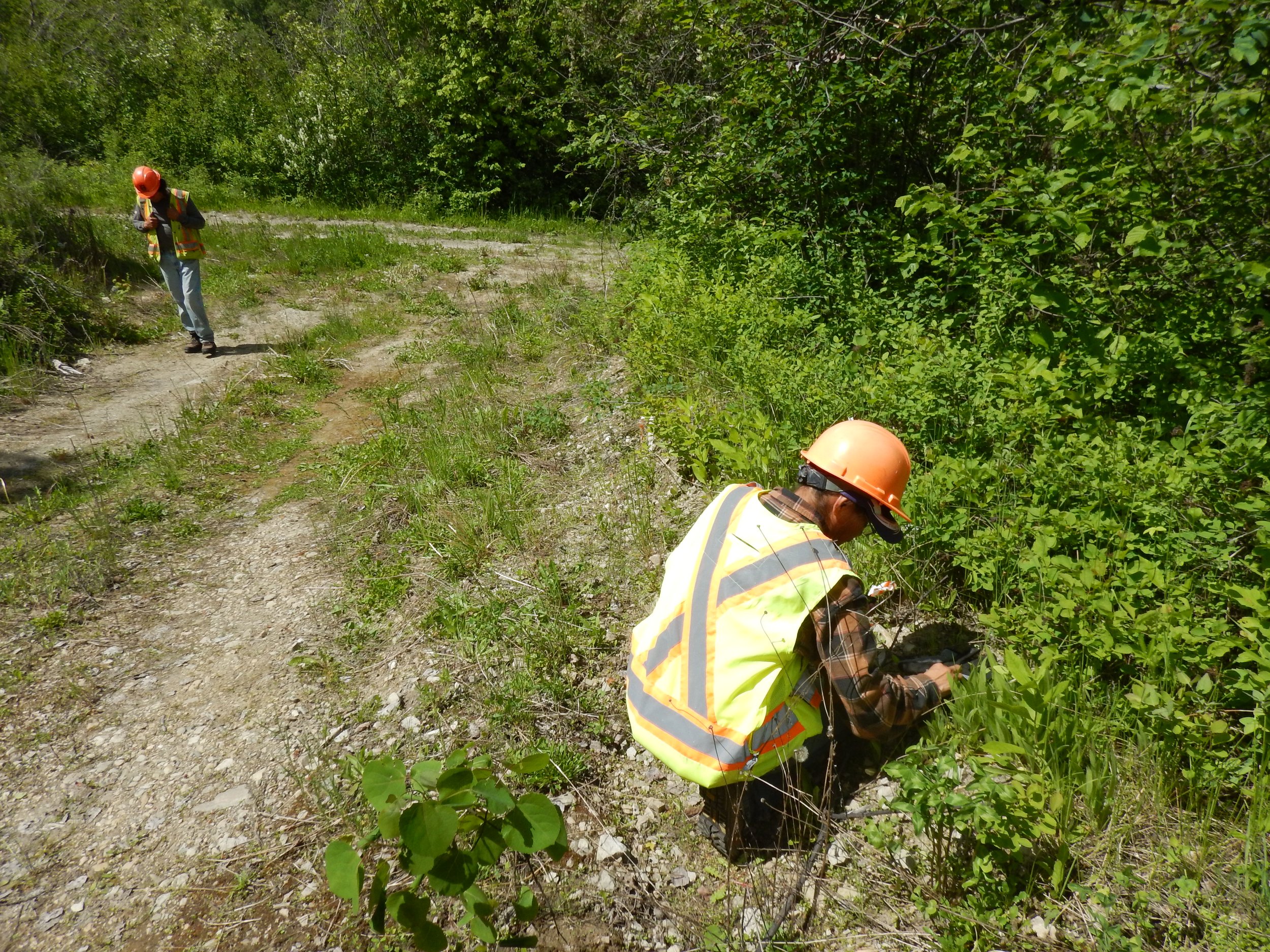
The next time you drive past a construction project and you see folks in hard hats and high-viz vests who look like they’re just standing around, you may in fact be witnessing the laser-like focus of a local CRM archaeologist, as he or she monitors the construction excavations going on around them.

A story that’s been written in stone

Not all research is planned. Not all discoveries come about by intent. Sometimes, a person is just in the right place at the right time.

For me, that place was a Kamloops area beach last week, walking with my dogs. The snow and ice had just melted away, revealing a single artifact on the sand: a complete spear point made more than 6 millennia ago.

It’s just a single artifact, but an object with the potential to tell us so much.

This artifact joins a small handful of other local sites known to date to what we call the “early period”, those few thousand years after the last Ice Age when the climate and landscape were shifting and settling into the world we now know. It’s a rare and tantalizing glimpse into a very ancient past.

The object is a distinctive style known as Old Cordilleran, and is typically found in sites dating from about 9,000 to about 6,000 years ago. Functionally, it’s what archaeologists call a “projectile point”, a group of tools that includes the tips of spears, darts, and arrows.

This style is believed to be a spear head, meaning it was attached to the end of a long handle, and used by thrusting, most likely in the hunting of large game. It’s long, blade-like edges could serve double duty as a butchering tool.

When the artifact was made—and lost—the environment here was warmer and drier than today, and the valleys around Kamloops would have been rolling savannah of scattered ponderosa pine and tall grasses, supporting large herds of elk and deer, with mountain sheep, moose and caribou passing through.

The tool is made of a black volcanic stone called dacite, likely sourced from the nearby Arrowstone Hills, where Secwépemc, Nlaka’pamux, St'át'imc and their ancestors have been mining the valuable toolstone since time out of mind.  

The artifact is rare—as are most things of that age—but not unexpected. The Kamloops area has been home to more than 500 generations of Secwepemc and their ancestors, and the evidence of their occupation is plentiful here. But a thing can be significant without being surprising.

Artifacts of this age, beauty and completeness are unusual, in part, because of unlawful collection. When people find objects like this, and keep them as collectible curiosities, the information they contain is lost to the rest of us. The archaeological record gets fragmented.

It can be helpful to imagine the archaeological record like an actual book, and artifacts as pages. When a page is removed, the rest of the story is harder to understand. Sometimes we don’t even know what’s missing.

If a collector had picked up this spearhead, taken it home as a prize, this page would be gone, and I wouldn’t have been able to tell you its story.

Collection of artifacts is illegal, and also deeply unethical. That object is part of cultural patrimony that—unless you are an Indigenous person in your home territory—probably doesn’t belong to you. 

If you happen upon an artifact, there is a way you can actually contribute to the record. Take a photo, take a waypoint using Google maps (which lets you share a location), or just note your location as carefully as possible, and bring your information to someone that can help record the site.

In Kamloops, the Secwepemc Museum can give direction, as can the BC Archaeology Branch in Victoria. And, as a Dig It reader, you know that our group of local archaeologists are here for you. Reach out and help us help you, and together we’ll learn from and protect the past.