A British Columbia archaeology primer

The 2017 British Columbia Archaeology Forum is being held in Kamloops on Saturday, November 18th.  This is an annual event that allows archaeologists, academics, First Nations, government representatives, and the interested public to come together and discuss current archaeological issues and research. The Forum is hosted by the Secwepemc Museum and Heritage Park and will be held at Moccasin Square Gardens at Tk’emlups te Secwepemc (Kamloops Indian Band). 

In anticipation of this event, I present the following BC Archaeology Primer.

Archaeology is the study of past human cultures through the analysis of the physical remains of those cultures.  But what do archaeologists in BC do?  And why? 

1.    An archaeological site is any location where these material cultural remains are identified.  Archaeological sites in BC range in size and complexity from a single discarded tool to the remains of entire villages.

2.    Archaeological sites are more common than you might think:  Almost 50,000 have been formally recorded in British Columbia.  These sites represent at least 14,000 years of First Nations history.

3.    The Kamloops area has been a focus of human habitation and activity for millennia.  There are more than 250 recorded archaeological sites within ten kilometers of the downtown core of Kamloops—and many more in the region.

4.    Archaeology involves a variety of approaches and techniques for investigating the past.  Many of these are borrowed from related fields, including anthropology, history, geology and ecology.

5.    Because First Nations people have lived here for so much longer than the rest of us, most archaeological research in BC is focused on First Nations cultural history.  But archaeology is also employed to study the non-aboriginal history of BC. For example, archaeological research has focused on gold rush sites, World War II Japanese internment camps, and early fish canneries.

6.    Archaeological sites in BC are legally protected by the Heritage Conservation Act.  It is overseen by the Archaeology Branch of the Ministry of Forests, Lands, Natural Resource Operations and Rural Development.  The Act legally protects archaeological sites from alterations of any kind. The provisions of the Act apply to both public and private land, and it is binding on government.

7.    The Heritage Conservation Act automatically protects most archaeological sites if they are known or can be inferred to pre-date AD 1846, or if they contain human remains or aboriginal rock art of historical or archaeological value, regardless of age.  The Act also protects shipwrecks or airplane wrecks that are two or more years old.  The Act can also protect archaeological sites through formal agreement with First Nations, or by their formal designation as Provincial heritage sites. 

8.    The Archaeology Branch maintains an inventory of recorded archaeological sites and issues and oversees a permitting process.  Archaeologists must obtain permits to conduct their fieldwork.  These permits define the goals and methods of our archaeological studies, and confirm which repository will ultimately store and curate the artifacts and samples we collect (No, we archaeologists don’t get to keep the artifacts!).  The Archaeology Branch provide a variety of information and guidance for developers and for the public on their website: for.gov.bc.ca/archaeology/index.htm.

9.    There are archaeologists affiliated with most universities and colleges in BC.  However, most archaeological research in BC is conducted not by academic archaeologists but by archaeologists employed in the field of Cultural Resource Management (CRM).  CRM archaeologists conduct applied research focussed on avoiding or mitigating the impacts of developments on archaeological sites.

10.  Archaeological and heritage sites are commonly addressed in provincial and federal Environmental Assessments.  The management of archaeological concerns is built into the planning processes in the forestry and mining industries and in the transportation sector.

11.  Interested members of the public are invited to join the Archaeological Society of British Columbia.  The ASBC has been educating British Columbians about archaeology since 1966!  Members receive The Midden, an illustrated journal that has long been a cornerstone of BC archaeology.  The ASBC’s website is  asbc.bc.ca/

12.  In Kamloops, the Secwepemc Museum and Heritage Park offers a variety of displays focussed on Secwepemc culture and history, including extensive archaeological displays, and several recreated traditional dwellings and food processing features.  Group interpretive tours are available.  More information is available at tkemlups.ca/museum-heritage-park/.

13.  The Kamloops Museum and Archives documents many aspects of the cultural history of our town and our region, including Secwepemc history and local archaeology.  Their website is kamloops.ca/museum/index.shtml.

14.  Archaeologists in British Columbia have their own professional association, the BC Association of Professional Archaeologists.  It currently has about 230 members.  CRM archaeologists who are Professional Members are entitled to call themselves Registered Professional Consulting Archaeologists.  The Association’s website is bcapa.ca/.

Indigenous oral history and archaeology

Much of the general knowledge of archeology often seems to be associated with excavation fieldwork. The preparation of the archeology project prior to fieldwork is making sure project objectives are defined, heritage permits are in place and safety plans are set up. It also means organizing a team and establishing the equipment for the field, such as shovels, trowels, sifters, tapes, global positioning system units and more, depending upon the type of project.

Yet once the fieldwork begins and something has been found, it is always exciting, especially when you find that 7,000-year-old artifact and wonder if you are the first person to touch something that was cleverly stored, accidently lost or purposely discarded.

However, the fieldwork only represents part of what we do. The other part is the interpretation of the field maps that locate all the shovel tests or evaluative units and defining the site and landforms on which they are found. It also involves looking at the environment they are found in and inventorying and analyzing the artifacts (cultural material) collected, including the documented features (i.e. hearths and depressions), which is the evidence of human activity.

How do we interpret all of this? Prior to the fieldwork, there is some background research completed to understand the local culture area, followed by a comprehensive investigation after the completion of the fieldwork.

Presenting the long-ago past includes a thorough understanding of the study area that comprises building on the work of others to include the paleo-ecology, geology, historical use of the area, archeology sites recorded in proximity to the project,  ethnographic studies (written from a non-Indigenous perspective) and, importantly, the language.

More recently, some archeologists have been including oral histories of the culture group in the study area as it does provide another source of evidence. Oral traditions provide information about the area, such as the environment or certain land formations, migration into certain areas  and some of the pictograph symbols. This is of great interest to the local and younger Indigenous peoples, as much of their culture was interrupted due to various practices imposed in the past. Therefore, archeology results and linking their oral histories connects them to their heritage and long-ago ancestors.

There have been some excellent studies completed in which the oral history provided by community members has augmented, corroborated or enhanced the information of the area, practices, events or meaning of artifacts. For instance, we assume designs found on various bone tools is artwork or a signature design, but we know from oral history that some of these designs were, in fact, markers used by an individual to keep  track of the number of items made in their lifetime.

In other cases, oral stories passed down through generations identified a flood or volcanic eruption that studies completed by Western knowledge also supported. But, more interestingly, the oral stories dated the tale to being more than 4,000 years old. There are many other examples; however, the important aspect is this kind of information brings together Indigenous and Western ways of interpreting the past.

Archaeological sites in alpine environments

This past summer, while camping in Wells Gray Provincial Park, I came across a broken stone projectile point in the alpine tundra. There it was, lying on the surface, tucked slightly into the mosses. I described this find to a colleague, who told me they had found another broken projectile point nearby. Busy spot, I thought, but what were people doing way up in the alpine?

As with much of B.C., archeological sites tend to be where archeologists look for them. Most archeological assessments are development-driven and it’s less common that large-scale archeological survey and assessment targets high alpine environments. High-elevation archeology has been the subject of at least three masters studies in B.C., all of which go into greater detail than presented in this column.

Archaeological-site_Wells-Gray-online.jpg

A Simon Fraser University study was conducted from 1986 to 1988 in alpine settings near Pavilion, on the east side of the Fraser River, within the traditional territories of the Ts’kw’aylaxw and Xaxli’p bands (Alexander, 1989). During this study, five archeological sites were identified in the alpine. These sites included a scatter of stone artifacts, a burial cairn and three sites with loosely stacked rock features that were identified by local First Nations informants as hunting blinds. Informants described how deer would be driven up gullies, where hunters waited behind hunting blinds. Ethnographic research conducted as part of the Pavilion-area study was consistent with the number and types of archeological sites identified in alpine settings.

The seasonal round of activities described by First Nations informants, and identified in the archeological record, indicates people accessed both animal and plant resources in the alpine periodically through the summer months. People would set up larger base camps in sub-alpine settings and travel into the alpine for shorter, specific hunting or gathering trips.This pattern is reflected in the archeological record by a greater number and diversity of archeological sites in montane parkland and montane forested settings, including sites with cultural depressions (roasting pits) and dense artifact scatters.

There are many other archeological sites recorded in Wells Gray Provincial Park, most during an inventory and assessment conducted in the late 1980s. Four of these sites were found in alpine settings near my find spot. Three of these sites are scatters of stone artifacts and one is a possible petroglyph. The artifact scatters are small and likely represent locations where hunters camped, waited for game or killed and butchered animals.

The setting where I found the broken projectile point is covered by small alpine lakes and, probably more importantly, dozens of marmot burrows. I can’t be sure people were specifically targeting marmots, but they are abundant in that setting. Evidence of plant-gathering activities is difficult to find. Most often, these activities did not include the manufacture or maintenance of stone tools at gathering sites, thus, no physical remains are left for archeologists to find.

I had the privilege of conducting a combined archeological inventory and traditional use study in alpine settings in northern B.C. several years ago. Like the Pavilion study described above, it was fascinating to see how stories shared by elders provided context and interpretation to the archeology we identified.

Past instalments of this column have taught us about the variety of archeological sites across the Southern Interior of B.C. Based on the number of sites on mountaintops, it looks as though archeology occurs up and down our part of the province, too.

Skeletons: What can we learn from human remains?

Human skeletal remains are a very direct, and substantial link to past human occupation in way that everyone can understand, and there is much to learn through osteological analysis, or the study of bones.   Everything from a basic inventory where we determine presence/absence of various elements, or bones, to DNA studies, to a variety of carbon-based tests, can answer a multitude of questions we may not have even known to ask.

Every osteological assessment begins with a straightforward, although not necessarily easy, exercise of conducting an inventory – a presence/absence of all the bones that should be present.   Based on this inventory, and by examining certain variables or ‘markers’ on the skeleton, an osteologist can often determine an individual’s sex, age at death, stature, if they suffered specific types of trauma and/or disease – and if those traumas or diseases occurred before, during, or after death.

Sometimes, analysis stops here.  But in other circumstances, further study is conducted.  While no means an exhaustive list, isotope analysis is commonly employed. Carbon 13, or C13, is a stable isotope utilized to determine the proportions of different types of plant material consumed. It can also aid in determining the consumption of marine (sea based) versus terrestrial (in-land based) food in a person’s diet. Carbon 14, or C14, is an unstable isotope used in a process commonly known as radio-carbon dating.  C14 is a radioactive isotope present in organic material, and it has a predictable half-life. By measuring the amount of C14 left in bone, and comparing that to the known rate of decay, we can determine approximately how many years ago an individual died. 

As personal example, I examined skulls for evidence of brain tumours from skeletal collections dating from Medieval and post-Medieval periods in England.  It’s not a disease that is commonly found, or searched for, in skeletal collections.  My research indicated that more than 10% of the large skeletal collections showed evidence of brain tumours, a relatively shocking number.  Keep in mind, these were not necessarily terminal, or even malignant, tumours.  But it provided an unexpected answer, and certainly raised more questions that could be important for medical considerations in today’s populations.

Ubeklaker 1978 Adult Skeleton.JPG

To bring it closer to home, there is an archaeological burial site east of Kamloops that some readers may be familiar with: Gore Creek Man.  This man’s remains were found eroding out of the creek bank several decades ago.  Through a series of studies we were able to learn a great deal both about this individual man, but also the wider group of First Nations people that lived in the Thompson valley at the time. 

Through inventory and analysis, we learned that Gore Creek man was in his late 20s or early 30s when he died, was approximately 5’6” tall, and that he likely perished in a mud slide or flash flood before coming to rest in the creek channel.  C13 studies told us that he had an almost totally terrestrial diet, although there were enough marine markers to indicate he had eaten sea-food at some point in his life – likely from spawning salmonid species in the river.  Perhaps most remarkably, C14 studies showed that Gore Creek man lived, and died, more than 8,000 years ago, an almost unfathomable number.  But it aligns with what First Nations people have told though oral histories; that they have lived here for time immemorial.

There is not enough space here to start a discussion about the ethics and cultural sensitivities surrounding the science of studying human remains, and there are as many opinions about what the ‘right’ thing to do is as there are individuals involved in the study of osteology.  Whatever the opinion however, there is indeed a great deal to be learned from our ancestors.


Archaeology Blankets the Valley

In the Secwepemc calendar, September is called Pesqelqlélten, or “Many Salmon Moon”. It refers to the vast numbers of sockeye salmon that run up the Fraser and Thompson watersheds in the fall, heading for natal lakes and streams. For thousands of years, September was a time when extended families came together at key spots to harvest this food that has been central to culture and survival.

One such location is just upstream from Kamloops, close to where the LaFarge cement plant sits today. In Secwepemctsin, the place is a called Cyew’kwe, roughly, “where people fish with scoop nets”. Here, more than 1,500 years ago, Secwepemc ancestors began to build weirs: massive, permanent fishing infrastructure that would serve their families for generation after generation.

Weirs, or fish fences, are built to funnel fish to be trapped. They’re found all over BC where waters are shallow and relatively slow, and fish are known to school, pool, gather. Locally, the town of Barriere derives its name from the weirs noted there by French-speaking fur traders in the 19th century.

The weir at Cyew’kwe was strategically positioned in a part of the flow of the South Thompson River preferred by salmon. The wide opening of its V-shaped design faces downstream, so that returning fish enter it and are channeled into a narrow opening, where fishers wait with spears, baskets or nets. When no more fish are needed (or no more can be processed fast enough), the fish can flow through, carrying on unimpeded. It's a brilliant system, a beautiful example of sustainable landscape modification.

The archaeological site here is more than a kilometre long, and consists of almost 1,400 individually sharpened stakes. They're mostly pine, a few of Douglas-fir and birch (all grow nearby today).  Radiocarbon dating of wood from different parts of the structure shows it was in use, and continually mended and maintained, for more than 1,500 years. While the earliest radiocarbon dates from the site are around 1,560 years, archaeologists and Secwepemc people believe it was built much earlier, the earliest stakes having decayed long ago.

LaFarge weir site JHammond.jpg

When the first stakes in this facility were sunk, the Secwepemc salmon industry was already wildly successful. For the preceding 3,000 years, technology and social systems formed around the unique blend of resources this landscape had to offer. Salmon, then as now, was an essential part of that existence.

The weir could provide all the food needed—and more—but the people turned that into an economic and cultural cornerstone.  Families were organized powerhouses, each fishing, curing and storing thousands of pounds of salmon every year. Surplus fish were stockpiled and traded in every direction, so this salmon wasn't only salmon: it became the cedar root and hemp and moosemeat and copper and abalone and buffalo hide traded by neighbouring nations. And later, iron and canvas, guns and glass.

Today, the evidence of intensive salmon processing at Cyew’kwe is spread across the exposed mudflats, along the shores, and up on the terraces above. At low water you can still make out the lines of wooden stakes pounded into the riverbed, the scattering of stone tools, and tons—quite literally—of hearth rocks spread along the shores.

It can sometimes be hard to articulate the depth of history, hard to express how Secwepemc people grew up hand in hand with this river. Here, it’s written on the land: the fish weirs, the processing stations, the pithomes that people returned to at night, bellies and caches full. Archaeology blankets the river valley, where families lived and worked together for millennia before contact. That's what time immemorial means.


Archaeobotany: Or How I Learned to Stop Worrying and Love Plants

The profession of field archaeology at first may seem exciting and adventurous to some, but in reality most of the time this job involves hiking seemingly endless kilometers across difficult terrain or digging an infinity of small, yet deep test pits into hard, hard ground. And it is an incredible job to have. As someone interested in stone tools and starting out in archaeology, after digging what felt like thousands of shovel tests without a single stone artifact to be found I grew bored. So I occupied myself with plants! Obviously, plants are abundant and an easy distraction while in the forest. More importantly, knowledge of plant species is a good skill for a field archaeologist to have as certain types of plants can provide information about soil conditions and drainage at a particular location (e.g., horsetail in wet areas) or whether an area has been recently disturbed (e.g., thistle, mullein). These are often referred to as indicator species.

Typically, the study of modern vegetation is associated with traditional use studies that aim to document aboriginal land use patterns. However, field archaeology can at times be an importance source of traditional use information, especially where associations between archaeological site types (such as cooking features), and modern vegetation become apparent. While not totally conclusive, it is interesting when it is possible to associate ancient cooking features with an existing patch of a traditionally economically important plant such arrow-leaf balsamroot or wild mint.

The unique semi-arid environment of the Interior is more amenable to the preservation of buried plant remains than in more temperate areas of B.C. While there is no doubt that plants were important economic resources during pre-contact times, plants are rarely found in archaeological contexts, as organic materials simply decay too fast. One of the most common indirect kinds of evidence for plant utilization in the Kamloops area are small, round cultural depressions, with blackened charcoal-stained soil and fire broken rocks: the remains of ancient earth ovens. Since many of the important edible root species had to be cooked prior to consuming, people developed the technology of hot rock cookery. This involved digging a pit in the ground, filling the bottom with hot rocks, layering the pit with tree boughs before adding the roots and finally covering with soil. The roots would then slowly roast underground for up to two days before being dug up again for consumption or for winter storage. Radiocarbon dates obtained from these cooking features provide point to the considerable antiquity of hot rock cookery in the southern interior, with sites in the Kamloops area dating to as early as 7,000 years ago. These cooking features are found all across the landscape in various settings, sometimes in clusters of several hundred or as an isolated occurrence.

While the use of earth ovens declined in the contact period, traditional use information and ethnobotanical studies document the continuing importance of a wide variety of plant species to the Secwepemc people. In my time hiking through the forests and grasslands in the surrounding area, I have come to recognize a few culturally important plants and have learned a little of their past and current uses. With beginner's knowledge of only a few of the traditionally important plant species, one can start to see the forest for what it once was: the grocery store, the pharmacy, and the hardware store all in one place.

Heritage for Healing, Heritage for All

I’d like to tell a story about the power of heritage to heal, to reconnect, and to rebalance.

Driving on the TransCanada Highway west of Kamloops, you’ll cross Durand Creek just above its mouth at Kamloops Lake in Savona. This is the traditional territory of Skeetchestn, a division of the Secwepemc Nation historically known as the Deadman’s Creek Band, or even farther back, the Bout-du-Lac Indians.

Today at this spot there's a mill, a highway, and railway. Skeetchestn histories tell us it was once a busy fishing station, one of many small villages occupied until the 1870s, when settler encroachment became intense here. By that time, gold rushers-turned-rancher and farmers had claimed the most productive lands and waters along the Thompson River and Kamloops Lake by 1880, in defiance of BC’s plan to set aside “lands reserved for Indians”.

Secwepemc people continued to use some of the land, now under title or lease, either by the grace of the owner or covertly, into the 1940s. Skeetchestn elders say they were ousted from Savona for real in 1950s, when the TransCanada Highway was built through here, and neighbouring properties were fenced and gated. Elder Elsie Hewitt recalled how promised Indigenous rights quickly lost out to private property rights and new landowners’ political power: “They’d always ask us, ‘why did we give up our rights?’ We had no choice, we were chased out. We were told we were trespassing.”

So generations passed, and alienation from this property strained the community’s connection to this place. Little was known about how people used to live here (obviously, theft of Indigenous languages and wretched epidemics didn't help with continuity of knowledge, which traditionally relied on oral record-keeping).

Last year, under the heat of the summer sun, Skeetchestn and Tk'emlups heritage crews went back to find that connection to ancestral use, using archaeology. I went too. The archaeological site we found had been disturbed by a century of uses—an orchard, a mill, an airstrip to name just a few—but traces remained.

We found a story’s worth of artifacts: tools made by ancestors of stone quarried locally at Arrowstone Hills, bone implements for fishing, and clues about the diet that once sustained Secwepemc families: bones of deer, elk, marmot, and salmon. Horse & cow too, from the early post-contact era. The artifacts tell us the site was occupied from 150 years back to at least 2,400 years ago.


The archaeology we did here wasn't groundbreaking. We found what we suspected we'd find, what the Elders said was there. More important was what it did for the people involved: it drew a direct line between today’s Skeetchestn fishers who work the lake nearby and their ancestors who did the same. It allowed the yucwmiʼnmen (caretakers) who found the site to exercise traditional heritage stewardship roles usurped by colonial rule. And for seme7 (whites), for whom oral history isn't concrete enough, or relevant, the archaeological finds were an exciting, accessible way to make past Indigenous occupation tangible.

Heritage is really about people, not things. When we find artifacts, we’re holding pieces of past lives, we’re revering a connection between people—all people, though all time. We can’t undo colonial damage, but a new kind of heritage stewardship can change the balance. Think about it, the next time you pass through here or somewhere like it: there is a past under there. It may or may not belong to you, but it has meaning and value for all of us.

Studying sediment for clues to the past

A small team of archaeologists and members of Secwepemc communities dig test pits in a hay field next to the Eagle River, east of Sicamous, under the July sun. Everyone is covered in the fine, powdery silt that sticks to their sweat dampened clothes as they dig carefully placed test pits, fill handheld shaker screens lined with 6 mm steel mesh, shake out the sediment, and examine what is left for artifacts and bones. Nearby an archaeologist hand cranks a soil auger, taking a sediment sample of deposits over two meters deep. She pulls the auger up hand over hand, careful to do it in a smooth motion so the loose sand does not run out the bottom of the auger bit. She holds the auger bit over a screen and gives it an expert shake. Rich, dark orange sediment followed by a thin black layer slide out onto the screen mesh.

“I’ve got a paleosol at two point five metres in the bottom of this shovel test!”

Everyone stops what they are doing and crowds around the screen, commenting on how well developed the soil is, and grumbling about how much more work they must do.

An important part of archaeology rarely found in local museums, stratigraphy (the study of sediment layers and soils laid down over time) can tell archaeologists many things about the past: what the landscape and climate looked like thousands of years ago, the relative age of artifacts or other cultural objects, and about the people who lived in this region. It also tells archaeologists how deep to dig.

In some places around Kamloops, archaeologists and Secwepemc community members have found stone tools over ten thousand years old, buried eight meters below the surface. Through careful recording and study of the layers of sediment laid down on top of these artifacts, archaeologists can understand how, over the millennia, sand, silt, and clay carried by lakes, rivers, wind, and landslides have covered up and modified the landscape.

In other places around Kamloops, artifacts of a similar age can be found right on, or right below, the surface. The archaeologists and Secwepemc people who find these artifacts can stand in the same spot as a person who lived thousands of years ago, look out onto the landscape, and wonder what it might have looked like back then.

A paleosol, staining created by acid and chemicals leaching into the sediment below from rotting leaf litter, tells archaeologists that an ancient ground surface covered with plants, shrubs, and trees once existed below the modern landscape; a surface that people might have once have hunted, fished, gathered, danced, and gamed on.

Under the surface of ancient pithouse or ‘Kekuli’ depressions (semi-subterranean dwellings common on the interior plateau, starting around 4500 years ago), archaeologists record a complex ‘layer cake’ of stratigraphy uncovered in an excavation, which archaeologists can sometimes reconstruct into a record of generations of its occupants. Some housepit depressions can have hundreds of layers of “cultural stratigraphy”, telling a vivid and detailed story.

As much information as the study of stratigraphy can offer to archaeologists, Secwepemc communities, and anyone interested in the deep past of what we now call British Columbia, the most valuable archaeological sites are those that are left intact, as the act of excavating and recording the stratigraphy of a site destroys it. The archaeological record is non-renewable and many sites have already been disturbed or destroyed by highways, railways, and housing developments; it behooves everyone to preserve what is left for future generations to study.


Exploring Cultural Depressions

Stone tools and other portable items left behind by people from the past make up a significant portion of archaeological research, as the last three installments of this column have done an excellent job of highlighting. The physical remains of past human activities are the focus of archaeological studies, which also include non-portable items. Archaeologists refer to the non-portable components of archaeological sites, such as hearths, trails, or structural remains, as “features”. 

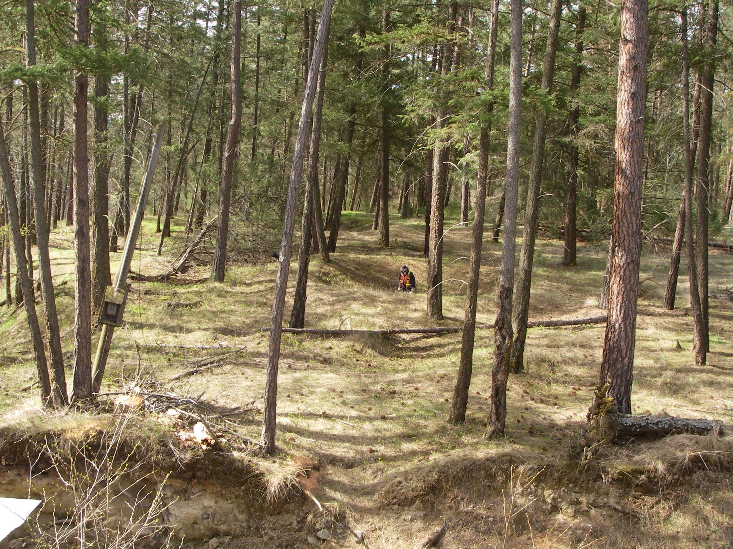
Walking along the lake and river shores in the interior we sometimes come across small and large depressions in the ground. These depressions provide evidence of past human occupation and archaeologists call these distinctive features “cultural depressions”. The function of a cultural depression is determined in part through the size and shape of the depression as well as the results of any archaeological testing. Common types of cultural depressions include the remains of past housing structures, storage facilities, or cooking locations.  

Dig It Image 3.jpg

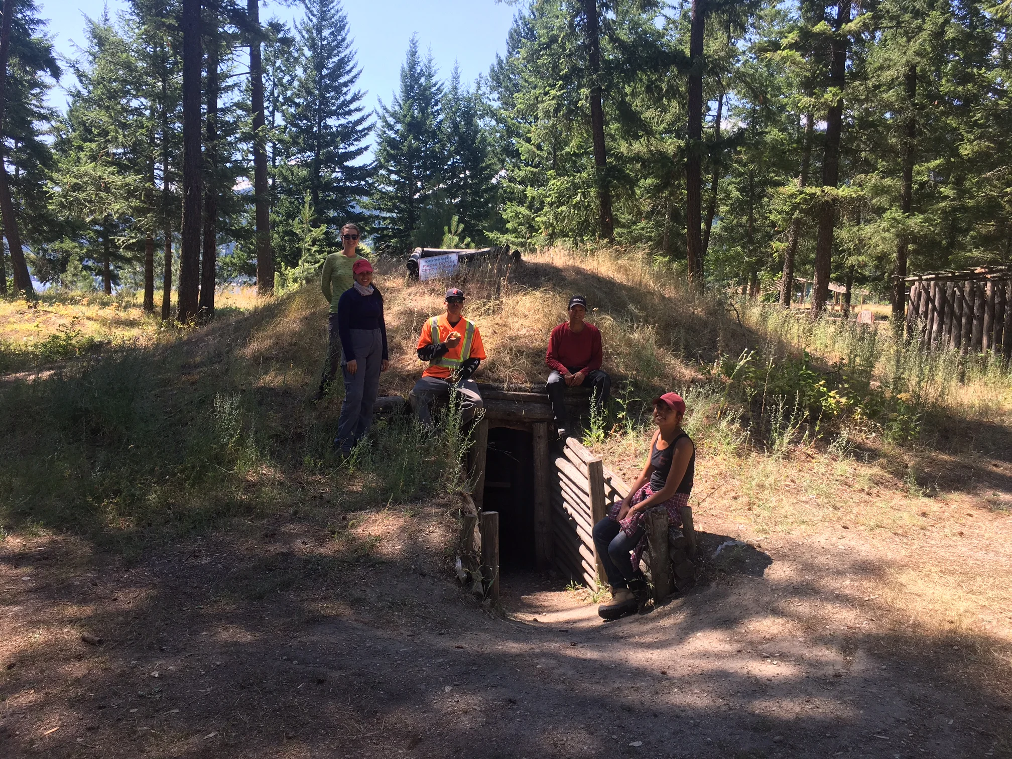
The larger depressions, ranging in size from 5 to 15 m or more in diameter, are typically the remains of housepits. These were semi-subterranean houses that were constructed by digging a pit and piling excavated sediments around the perimeter to form a rim. A timber frame was then assembled over the excavated pit and covered with a combination of woven mats, dry grasses, pine needles, bark, animal skins, and sod. This style of house was often occupied in the late fall through the winter and snow would accumulate on the surface adding extra insulation during the cold winter months.

Entrances to the housepits commonly consisted of a timber framed side entrance or an opening in the top centre of the house that acted as both a chimney and an entrance/exit using a ladder. Inside there would be sleeping platforms and benches around the perimeter and a hearth in the centre to provide warmth, light, and a place to cook. Several different styles of housepits have been recorded in BC’s interior representing regional differences and changes through time. Housepits were often used and re-used for multiple years. They would be abandoned in the summer in favour of more portable housing styles, such as tents, and then cleaned out and reoccupied the following autumn.

Smaller diameter depressions (1 to 3 m) are often the remains of earth ovens or storage pits. Earth ovens or roasting pits were used to cook various food items and often contain large quantities of cooking stones and burned rock. Storage or cache pits consisted of an excavated pit lined with woven mats, dried grasses, or tree boughs. Food items, for instance dried salmon or prepared roots, were then placed in the pits and reburied for consumption later in the winter. Storage pits were often located within or just outside housepit locations so that stored food could be accessed throughout the winter.

What typically remains of abandoned housepits in the present day is a sunken pit with a well-defined rim around the perimeter that formed when the house structure collapsed. These depressions may be easily identified in open grassland terrain, but in more forested areas cultural depressions might only be located when someone fortuitously stumbles into the feature.

Cultural depression sites measuring several hectares in size and containing hundreds of housepits, earth ovens, and/or storage pits have been recorded in the southern interior. Locally, you can visit reconstructed winter houses (or kekulis) at the Secwepemc Museum and Heritage Park in Kamloops and Quaaout Lodge in Squilax. Visiting the reconstructed houses is a great experience and well worth the trip. If you come across a depression during a hike and want to report its location or wish to learn more about cultural depressions, please contact a local archaeologist.

Dig It Image 1.JPG

Analyzing stories from the past

I regularly receive two responses about archeological items we recover.

"Cool, how old is it?" and "So, you just collect rocks and bones?"

While I most appreciate the enthusiasm of the former response, both provide an opportunity to discuss analyses we use to gain information from artifacts.

How old is it? The best-known method to determine the age of archeological materials is radiocarbon dating. Analyzing the decay and ratio of carbon isotopes in once-living materials such as animal bones from archeological sites gives us a date range, for example 4,750 years plus or minus 82 years.

When stone tools are found in association with the dated bone, the date can be applied to the tools. This is particularly useful for tools whose form changes through time, such as arrowheads and spear points. So, when archeologists say an arrowhead is about 2,400 years old, it is because arrowheads of that style have been found repeatedly in sites where associated organic materials have been radiocarbon dated.

What was it used for or on? Organic items -- wooden tools, baskets, food plants or animal hides -- that were the focus of past activities often don't preserve in archeological sites.

However, specialized laboratory analyses can identify residues left on artifacts to help determine on what or for what the tools were used. Protein (animal) and starch (plant) residues unseen by the naked eye can remain on stone tools for thousands of years.

For instance, proteins specific to large animals have been identified on the edges of small arrowheads, confirming which animals were hunted in an area. Further, it indicates the power and accuracy of bows did not require the use of large points for big game or that small points were only used on small game.

Similarly, a wide range of starch residues have been found on tools confirming that harvesting and processing plants for food, medicine and construction purposes was an important part of past people's activities, even though we rarely find remains of the plants themselves. In some cases, the analyses identify residues of plant and animal species no longer present, indicating the effects of environmental change or human influence.

Where did it come from?

First Nations trade networks were extensive in pre-European times. It is exciting to find non-local materials such as scallop shell, whale bone or obsidian in archeological sites. There are specialized analyses that can determine, specifically, where tool stone originated.

When the chemical compositions or "fingerprints" of recovered stone artifacts are identified, they may be matched to the documented "fingerprints" of source areas for valued tool stone (for example, obsidian from Glass Butte in central Oregon).

When we determine an artifact's origin is hundreds or thousands of winding kilometres along river systems or over mountain passes from where it was deposited, we see the artifact for more than its specific function.

We are able to reconstruct and appreciate the lengths to which people interacted within and between regions to gather what they needed to navigate their physical, social and spiritual environments. Archeology seeks to understand people's adaptations to the world around them by examining the materials they left behind.

However, it is important we recover artifacts from their original location to conduct many of these analyses and understand what they represent. Much like how a paragraph missing many of its words does not make sense, an archeological site with artifacts removed cannot be properly analyzed and interpreted.

This is why we promote notifying an archeologist of locations where you may have seen artifacts instead of collecting them.

Todd Paquin is an archeologist.

Analyzing stories from the past

I regularly receive two responses about archaeological items we recover.  “Cool, how old is it?” and “So, you just collect rocks and bones?”.  While I most appreciate the enthusiasm of the former response, both provide an opportunity to discuss analyses we use to gain information from artifacts.  

How old is it? The best-known method to determine the age of archaeological materials is radiocarbon dating.  Analysing the decay and ratio of carbon isotopes in once-living materials such as animal bones from archaeological sites gives us a date range (e.g., 4,750 years +/- 82 years).  When stone tools are found in association with the dated bone, the date can be applied to the tools.  This is particularly useful for tools whose form changes through time, such as arrowheads and spear points.  So, when archaeologists say that an arrowhead is approximately 2,400 years old, it is because arrowheads of that style have been found repeatedly in sites where associated organic materials have been radiocarbon dated.

What was it used for or on?  Organic items (e.g., wooden tools, baskets, food plants, animal hides) that were the focus of past activities often don’t preserve in archaeological sites.  However, specialized laboratory analyses can identify residues left on artifacts to help determine on what or for what the tools were used.  Protein (animal) and starch (plant) residues unseen by the naked eye can remain on stone tools for thousands of years.  For instance, proteins specific to large animals have been identified on the edges of small arrowheads, confirming which animals were hunted in an area.  Further, it indicates that the power and accuracy of bows did not require the use of large points for big game or that small points were only used on small game.  Similarly, a wide range of starch residues have been found on tools confirming that harvesting and processing plants for food, medicine, and construction purposes was an important part of past people’s activities even though we rarely find remains of the plants themselves.  In some cases, the analyses identify residues of plant and animal species no longer present, indicating the effects of environmental change or human influence.

Obsidian artifacts and tools.jpg

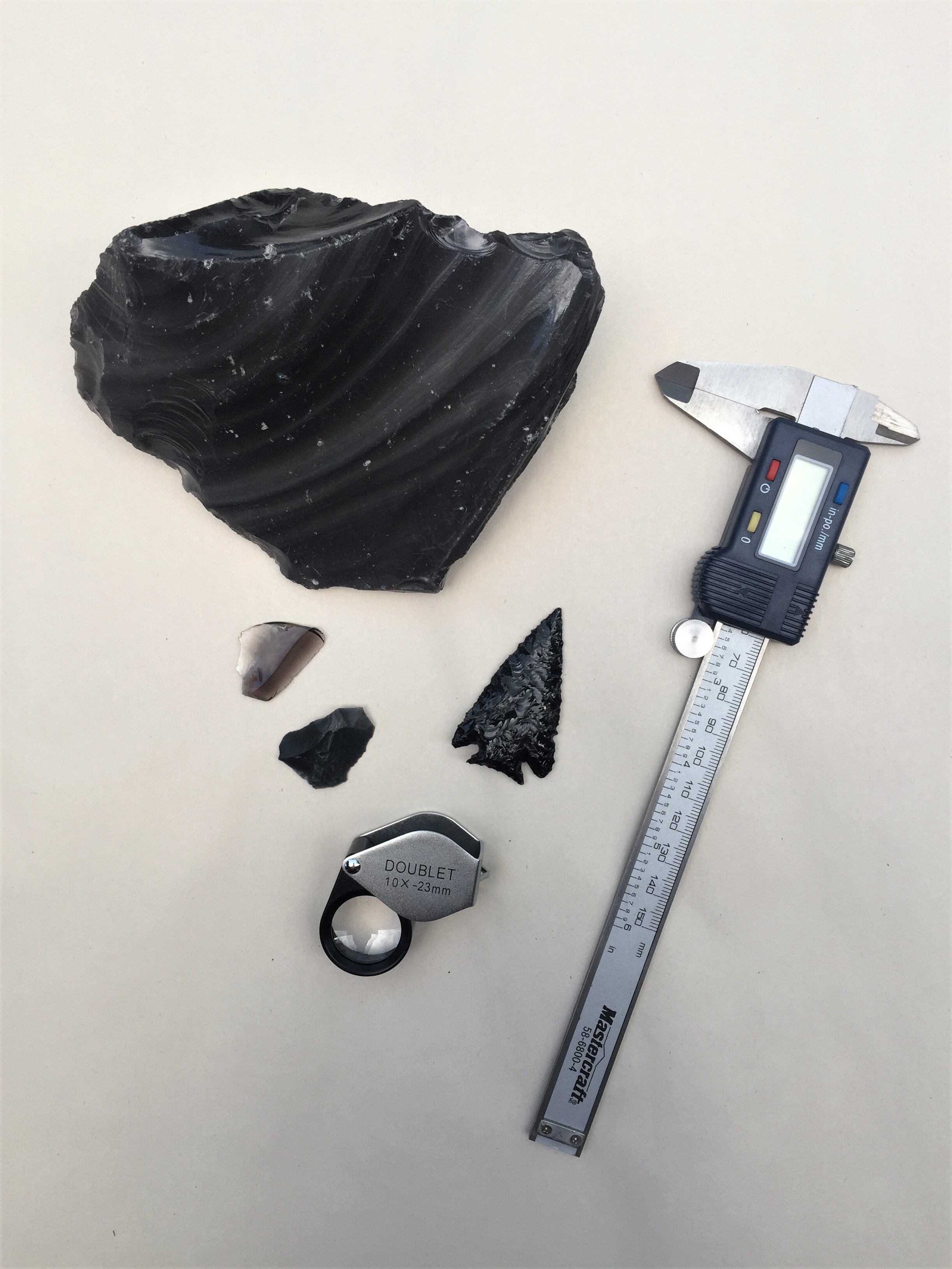
Where did it come from? First Nations trade networks were extensive in pre-European times. It is exciting to find non-local materials such as scallop shell, whale bone, or obsidian in archaeological sites. There are specialized analyses that can determine, specifically, where tool stone originated. When the chemical compositions or “fingerprints” of recovered stone artifacts are identified, they may be matched to the documented “fingerprints” of source areas for valued tool stone (e.g., obsidian from Glass Butte in central Oregon).  When we determine that an artifact’s origin is hundreds or thousands of winding kilometres along river systems or over mountain passes from where it was deposited, we see the artifact for more than its specific function. We are able to reconstruct and appreciate the lengths to which people interacted within and between regions to gather what they needed to navigate their physical, social, and spiritual environments. 

Archaeology seeks to understand people’s adaptations to the world around them by examining the materials they left behind.  However, it is important that we recover artifacts from their original location to conduct many of these analyses and understand what they represent.  Much like how a paragraph missing many of its words does not make sense, an archaeological site with artifacts removed cannot be properly analysed and interpreted.  This is why we promote notifying an archaeologist of locations where you may have seen artifacts instead of collecting them. 

Bone identification.jpg

And it stoned them to their souls

In our last column, Nola Markey and Brian Finlay discussed stone tools collected from the shores of Little Shuswap Lake. This collection included some tool types about which readers may already be familiar: arrowheads, spear points and scrapers. Why do archeologists seem preoccupied with stone tools?

Stone tools are ubiquitous in the archeological sites in our region. First Nations peoples made a great variety of tools and equipment out of wood, bark, tree roots, mammal bones and antlers and many other organic materials.

But many of the things people made in the past do not preserve well under most conditions. Commonly, organic artifacts decay in the ground, so what’s left for us to find? Stone tools. Archeologists rely on stone tools to understand the pre-contact life of First Nations in the Kamloops area and beyond. The study of stone tools has been a fundamental part of the archeology of the B.C. Interior for over a century.

Making tools from stone is difficult (I know, I’ve tried). You can’t make anything out of most kinds of stone (I’ve tried that, too). Only specific kinds of stone share the physical properties that allow them to be predictably shaped into usable tools.

First Nations peoples in our region have known for many thousands of years where to acquire the best tool stones. One especially important source is located near Cache Creek, in the aptly named Arrowstone Hills. Pebbles and cobbles of dacite, a fine-grained volcanic rock, were collected on a massive scale across an area of at least 100 square kilometres. Hand-dug pre-contact mining pits, still visible in parts of the site, testify to the importance and intensity of use of this resource. This prehistoric quarry was used for millennia.

One of the challenges in the regional trade in tool stones was their weight. To keep loads manageable, people with access to tool stone sources would complete the preliminary preparation and shaping of stones into what archeologists call “blanks,” creating lighter and standardized trade items. These could be manufactured into a variety of different tools by their eventual owner.

Archeologists have used a variety of techniques to match the artifacts they find to particular tool stone sources. The recent development of portable X-ray fluorescence devices has allowed archeologists to confirm the geochemical fingerprint of both tool stone sources and artifacts and has led to a renewed interest in this kind of study.

Archeological research shows the high-quality dacite tool stone collected and quarried from near Cache Creek was traded across the region and beyond — and this trade persisted over thousands of years. First Nations communities established an interconnected series of pedestrian trails and canoe routes that facilitated regional trade. These trade networks allowed access to important resources that were not locally available.

Regional trade and exchange helped maintain social connections forged through kinship and marriage. Recent archeological excavations near Vancouver confirmed that Cache Creek dacite was traded down the Thompson and Fraser rivers all the way to the coast 5,000 years ago.

So, if you discover stone tools while you enjoy the outdoors around Kamloops, please don’t collect them. Instead, consider that what you’ve found represents a very rare resource, a tool stone collected and carefully curated and traded across dozens or hundreds of kilometres.

All that before it was carefully crafted into the tools you’ve discovered.

Cultural Pride through Artifacts

by Nola Markey, Archaeologist and Brian Finlay, Skwlax Aboriginal Interest Department

Little Shuswap Lake Indian Band would like to express their appreciation to the Boyd Family who recently submitted an artifact collection to the community. The Boyd’s have lived along Little Shuswap Lake for just over 50 years and during this time found numerous stone tool artifacts near their property. Some of the tools included arrowheads and spear points, scrapers, utilized flakes, fishnet sinkers, and gaming pieces, made from a variety of materials such as chert, chalcedony and basalt.  To Indigenous groups, such artifacts are a significant part of their cultural identity and connection to their ancestors. These types of artifacts, uncovered at an archaeology site, are also important to archaeologists as they provide clues in explaining how people lived in the ancient and recent past.

Many artifacts are found accidentally. Furthermore, construction crews find artifacts when they are building roadways or digging up an area to lay foundations. Farmers find sites when they plow their fields or homeowners clearing a field to build a vegetable garden. Archaeologists will get telephone calls from people who stumble across an artifact or site while they were out hiking.  Of course, there is a darker history of purposely looting a site and selling artifacts, which is not permitted as artifacts are protected under provincial heritage legislation. Preserving artifacts and protecting sites is paramount to archaeologists and Indigenous communities.

Today, many Indigenous communities work closely with archaeologists to develop comprehensive heritage management processes. Some of these processes include developing their own cultural heritage policies, building their own artifact and research repositories, museums and cultural centres, including repatriating artifacts lost to museums from other countries. To Indigenous communities, these artifacts are not merely “things”, they provide a sense of pride and are a testament of the knowledge and achievements of their ancestors. There are stories linked to the places where artifacts are found, offering a sense of place called home or re-affirming their spiritual practices from the past to present.

Once again, Little Shuswap Lake Indian Band, a member of the Secwepemc Nation, would like to thank the Boyd family for taking good care of the artifacts over the years and are pleased that they will remain in their homelands. The artifact assemblage will be documented as the “Ann Boyd Collection” and they will be catalogued and safely stored. We recognize that the preservation and study of artifacts are important for the survival of our cultural identity, and we will use the artifacts for research, training and other educational purposes. We encourage others who have private collections to contact us. Little Shuswap is currently working on registering a repository with the province with a long-term goal of building a museum and cultural centre. The cultural centre will showcase our culture, skills, crafts, art, songs, dance, spirituality and more. It will also bring back the “spirit of hope and pride, and awaken the strength of our community.”

Historical Landscapes and the Buried Past

by Matt Begg

As archeologists, we study prehistoric peoples and cultures by analyzing the things they left behind.

Around here, that means taking a particular perspective of the landscape around us to figure out where we might find archeological sites.

Or, more simply put, to find where people have done stuff that would create things for us to find. We spend as much time thinking about the landscape around us as we do studying anything you might see in a museum.

Archeological sites might be defined places on our landscape where archeologists have found stuff, but each site represents a much wider use of the lands around them.

When we start to connect the dots between all of these archeological sites, we can take another perspective.

From this perspective, we see a continuous cultural landscape that has evolved over many thousands of years with the Secwepemc peoples, who have lived here since time immemorial, through the historic era in Kamloops with fur traders, gold prospectors, railroads and ranchers, and into modern times as our city continues to grow and evolve.

You don’t need to be an archeologist to see our landscape from this perspective. Have you ever looked around a landscape and just felt the history around you? We have some great places to do just that.

For example, I like to walk my dog in Kenna Cartwright Park in the evenings. There’s a viewpoint at the top of a hill I like to stop at, where I can see the city spread out below. From there, I can see the confluence of the Thompson rivers, where fur traders pulled up their canoes.

If I squint toward downtown, I can make out the old train station that is nearly a century old and the tracks that have carried people to and from this city since the late 1800s.

Across the river, I can see the Secwepemc Museum and Heritage Park, which includes a 2,000-year-old winter village. I also know where many of the other recorded prehistoric archeological sites are located and I can see dozens from this same viewpoint, including villages, campsites and hunting and fishing places.

Even if you don’t know these exact locations, you can be sure that, in the past, people occupied all the same places we use now.


Keep this cultural landscape perspective in mind when you replant your garden, level part of your yard for a new shed or even when you hike on the local trails. You may see evidence of this ancient cultural landscape.

It happens all the time, such as when I found a small scraping tool among the stones used to line my driveway, when I recognized the culturally modified tree that grew in my yard in Smithers and when I spotted a stone tool on a Kamloops hiking trail just last weekend.

If you spot these sorts of things when you’re out and about, consider yourself lucky and take a picture (but not the artifact).

Leave the site as you found it and call one of the local archeologists with your questions.

Water's Destructive Power

By Kim Christensen

Published 18 May 2017 in Kamloops This Week

The destructive power of water is a hot topic right now as we see municipalities throughout the province declaring states of emergency, including here in Kamloops, where unstable slopes are threatening many homes.

In my own neighbourhood, residents are mourning damage to their yards and gardens (and lamenting the loss of easy access to our local store) as raging creek waters have forged new paths with little regard for structures or roadways.

These flooding events also have the power to damage what remains of some of the area’s earliest First Nations village sites. 

Many of these early villages, which have become archeological sites, were built on the very banks of the waterways that are flooding today.

And they can be damaged in the same way that houses built on creek and river banks are impacted.

An example of this can be seen at an archeological site north of Kamloops, on the bank of the North Thompson River just downstream from the outlet of a large creek.

This particular site is made up of nearly 20 circular depressions of varying sizes; these depressions represent what remain of the village’s original pit-house structures, as well as cache (storage)   and roasting pits.

What is interesting about this site in particular is that it is located across the river from an oxbow channel.

When visiting, I wondered how the oxbow had formed and if that process had affected the archeological site.

A review of historic air photos revealed the river was still in its original channel in the mid-1940s and what is now the oxbow was the main channel at the time.

Air photos from the 1960s, however, revealed that within
the intervening 20 years, the river had pushed through the narrow strip of land and created a new river channel.

Digging deeper, I learned that in the late 1940s, during a year of especially heavy rain and flooding (sound familiar?), a small local dam had given way and an enormous flood of water came rushing down the creek bed, slamming into the river just upstream from this archeological site.

This, coupled with the otherwise unusually high flood year, was the force that pushed through the skinny strip of land and created the new river channel and oxbow we see today.

This event also swept away a portion of the archeological site, which appears to have stretched across the river.

Adding to this, the new river channel continues to erode into the bank and the remaining cultural depressions are being lost to the annual rise and fall of water levels.

When an archeological site is damaged, even by natural processes, the unfortunate reality is the loss of cultural heritage and scientific information.

So, as we continue to face ongoing episodes of heavy rain, I am concerned not only for our current villages and homes, but also
for the damage done to the region’s original village sites and the history and knowledge that will be lost with the archeological sites swept away in the floods.

Introducing Dig It: Learning about the ancient history beneath our feet

By Joanne Hammond

Published 5 May, 2017 in Kamloops This Week

If you stood on the beach at Riverside Park, on a spring day 2000 years ago, you’d probably see a lot that’s familiar: houses and boats, gardens and public spaces. You might look upstream and see, on the sandy shore on both sides, neat rows of beached canoes draped with reed mats to protect from sun damage. Behind them on the banks you'd see racks holding fishing gear, in various states of drying and repair, waiting for the next trip. And among it all, you'd see dogs and kids and moms and dads, families stretching in the sun after a long, cold winter.

Today, not a hint of that past is visible, but it's there still, underfoot. And under road, and park, and parking lot, and field. It’s our buried heritage. It’s the incredible archaeology of our region, and it is as much a part of Kamloops as the soil itself. In some places, it is the soil. 10,000 years of continuous occupation will do that to a place. How do we know? That’s what archaeology does! And we’re doing that right here in Kamloops.

Local archaeologists have worked for decades to understand the Kamloops that was built long before Canada began to form. Through the material culture, the stuff of peoples’ lives, archaeologist can piece together ancient stories written on the land. We look at Tk’emlups, and see Secwepemc families, and the neighbouring First Nations that came to visit and trade, that were the heart of this region for millennia. We see where Kamloops came from, and want to share that with you.

Now imagine that spring day again, but just 200 years ago: little would be different, but change was already here: over your shoulder were the first rough log buildings of Thompson's River Fort. You'd see a beach crowded with canoes piled with fur and fish and meat for sale. The fur trade here was just a few years old, already thriving on the centuries-old commercial trade routes that met at this hub of rivers and overland trails.

Let us take you back there, in this regular archaeology column where we’ll bring you stories of this region’s past. Every month in this space, we’ll exploring ideas of the past through the artifacts and sites that dot our region, and the people that today work to protect them. Stay tuned!